Tuesday 20 June 2023

Beinn Bhreac (Ullapool)

 Hill: Beinn Bhreac aka Meall Dubh (Speckled mountain)

Type: Fiona

Height: 667m

Three of us from ADRC set off to this, some might say, uninspiring hill amongst the giants. But other more knowledgeable people will be aware of the magnificent panorama available to those who do this on a good viewing day.

The hill also has two names, depending on which map/site you use, which does not help but only one is the true summit. On some maps/books etc it is known as Meall Dubh. But its correct title is Beinn Bhreac. You could start at Leckmelm and go over Meall Dubh first but we started from Inverlael and ignored Meall Dubh completely. We just called it Devils mountain.

Through the field of coos who had no interest in our presence whatsoever, fine with us.


Not exactly intimidating slopes, Bhreac ahead
Over the bridge and a slightly ascending track takes us to the only challenging bit of the day, find the hidden track. We did and it was a delight. In the shade it zigzagged steeply but on a fine track. We hit a main crossroads but kept going until we reached the deer fence. Good height was gained quickly without without trauma as we continued up an estate track contouring the landscape. Once again serenaded by male cuckoos.

Gordon ascending with the Fannichs behind
It was now time to hit the moor and cross the burn at its ford, not much water around. Then follow a slight deviation before just going for it and head across the moor aiming for where we think the top is. It is about 1.5km of fairly gentle ascent across the moor, meandering on the higher ground to miss the peat hags and other boggy sections but nothing troublesome. A nice surprise was a springing a Black Grouse, certainly not an every day bird.

Lochan found summit just behind

Deer antler marks the summit
Reached the top and realised that the small lochan we wanted to find was over to our right and the top of Beinn Bhreac just behind it. A nice surprise when we got there as the very small cairn had a deer antler as part of its structure.

Although the views were hazy the sightings were good enough for us but we could also imagine what it would be like on a clear blue sky day. Still we the Beinn Dearg hills, An Teallach, the Fannichs, the Assynt hills a bit grey but could be made out and lots more.


On our way back down we spotted some red deer hinds and had an identify the butterfly on the lower slopes.

Overall a good straightforward ramble, without stress and good crack.

PS: the Devils remark alludes to the ascent height.

Ascent: 666m

Distance: 14.9km

Time: 5.23

Wildlife: Black Grouse; Cuckoo (m+f) calling; Red deer; Skylark; meadow Pipit; Peacock butterfly; Grey Wagtail; Pearl Bordered Fritillary;


A cracker of a day and a double bag.....Beinn Ghoblar & Cnoc a'Bhaid-rallaich

Hill: Beinn Ghobhlach (Forked mountain) (635m) & Cnoc a’Bhaid-rallaich (544m)

Type: Fiona & Sub2k

The rest of the group were 


off Munro bagging but with a forecast of very hot weather I did not fancy an estimated 8-10 hour day so opted for my pair of hills. No doubt the Munro group would see a few other people but I expected far less and indeed saw nobody, total isolation, not such a bad thing.

Heading to the left of the crags

Across Little Loch Broom the Corbett Sail Mhor under cloud


I was not going the long way round via the western side of the hill which solo Graham/Fiona baggers might do but instead I left the path almost immediately, just after the deer fence, and took a diagonal/meandering ascent up the pathless slopes. It was very steep at times but surprisingly I did not feel too bad. It was a case of going so far, taking a look at the terrain ahead and pick a route and so on. Avoiding the crags was not difficult. An ascent of about 30 minutes of looking at the terrain in your face, find your next steps and keep going. I took the occasional breather to enjoy the sideways views, better than just looking at grass and stuff in front of my nose. In parts the bracken was already waist high but it was avoidable for the most part, maybe not so easy in a few weeks.

Ghobhlach ahead 
I reached the initial high point and could now see Beinn Ghobhlach ahead. But dilemma time. To go the traditional route meant losing about 90m of the gain or stick with the ridge and go longer before dropping.

I decided to go down and walk between the two lochs. Fairly dry but some sections needed careful attention and I can imagine it could be very different under wet conditions.

Looking back to lochans and Sail Mhor
The final section was no worse than before but actually felt a lot longer. In reality it was a bit of a slog and looking back it was now significantly higher than the earlier high point.

Summer Isles ahead


West ridge


Ben More Coigach
On the ridge a final rocky ascent leads to the summit and the views do not disappoint.

I walked along to the east ridge to enjoy the full spectacular of as good a 360deg perspective that you can get.

Sub2k directly over the lochan but I went well left of it
I had made good time so decided to take in the Sub2k. If the ground had been wetter I might have avoided this extension but although I had a clear view of the peat hagged terrain I decided the hard ground should be safe.

I spotted movement and it was a small herd of goats, but they did want to snapped. The male had superb horns but every time I raised my camera they disappeared over the horizon. I could only try a few times before giving up but I did get a long distance snap when down below.

Full extension to get the goats

Could be very different after a wet spell
The peat hag section was relatively good but a couple of times the ground looked iffy and when I put my walking pole in it went almost to the handle, my worst nightmare, sinking into a bog on a solo ramble. Thankfully I found more risk adverse crossings.

Little Loch Broom, Fannichs & An Teallach 

Ghobhlach from Cnoc

Snake or lizard rock?
A ‘straight line’ route took me up the 150m ascent to the top of Cnoc a’Bhaid-rallaich which turned out to be a fairly broad stoney section that you can walk along and take in the myriad of views. A cracking spot for a refreshment break.

Ullapool


Now time for the descent. The very steep and at times very dry grassy slopes were a straightforward but quite painful descent for me. My knee is complaining. I could see the metal vehicles at the walk start glistening in the sun below me so I knew roughly where I was heading.

A slow steady plod before I spotted the deer fence and then a choice of left or right. I chose left and followed a burn rake avoiding the heather back to the car.

An excellent ramble in conditions that turned very warm. Better my ramble and two bags than double that time for two Munros and dare I say it, possibly poorer views. And for me not another person to be seen, just me and nature on a beautiful day, my kind of ramble.

Ascent: 857m

Distance: 8.9km

Time: 4.25

Wildlife: Red Deer; Common Frog; Wild Goat; Orange tip (m+f); Common Lizard; Meadow Pipit; Hooded Crow;

Thursday 15 June 2023

Ton up as well as the number of clegs killed.....Tyndrum Corbett duo from Auch

Hill: Beinn a’Chaisteil (Hill of the Castle) (886m) & Beinn nam Fuaran (Hill of the Well) (806m)

Type: Corbett x2


I admit that I did not sleep too well last as I doubted the wisdom of this ramble. I booked accommodation at the last minute with a regular B&B I use, Inverardran House, in Crianlarich, as the forecast was for dry weather. It turned out to be not just dry but scorching and it was prolonged, unheard of in Scotland. Last night there were some thunderstorms that caused travel disruption and they were forecast to continue today from midday. Just about the time I would be traversing from Corbett 1 to 2. Would I be drenched, would I be hit by lightning, was I mad, possibility of all 3.

Alarm woke me from my disturbed sleep at 6am but I was determined so up, dressed and en route within 15 minutes. Traffic was light and I made better time than expected, actually 30 minutes too early for the Green Welly restaurant to open, no black pudding and fried egg roll to dry me out. So I went to the snack bar, a total rip off compared to the restaurant and far inferior food, avoid unless you must.

Drove to Auch and ready to go for 8.30, about an hour ahead of where I thought I would be. Just as I started off a call from the good lady. I immediately thought I had left something but nope just a courtesy call, suspicious!

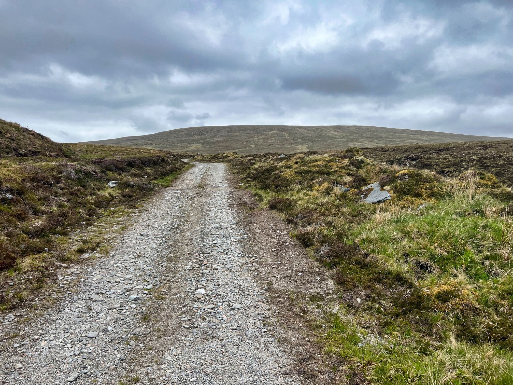
Bulk of Chaisteil dominates with Fuaran peeking out behind


Munro of Beinn Mhanach ahead I turned right and walked below it

On the climb views of Dorain left and Dothaidh right

Levelling out

Top in sight

From top looking back down Glen Lyon

I walked down past Auch farm wondering where the body of the cyclist had been hidden, two drunks will pay a heavy price but not as much as the cyclist.

My route starts with Beinn nam Fuaran which is the furthest away and is a good 90 minutes walk before I even start climbing. It is pleasant enough through the Auch glen with at least 3 river crossings, all fine in today's arid conditions but I can imagine it could be wet feet at other times. The heat was feeling quite oppressive hemmed in here in the glen and again I was questioning my decision making.

The slopes had looked steep and intimidating so it was with some relief that the gradient looked better when I finally left the track and started my ascent. Fools optimism.

From here it is about 400m of ascent which does not sound too bad but it is pathless, very steep, over rough terrain particularly at this time of the year when the grasses and bracken are flourishing. The last 100m is less steep but under that sun it did not feel like it. I met up with the old fence and followed it for the last section to the summit. A strong wind was blowing, great to be cooler but was it the precursor of the weather warning? The haze meant that even nearby hills were not great viewing but it was what it was, I was there. Onwards or not, you know the answer.

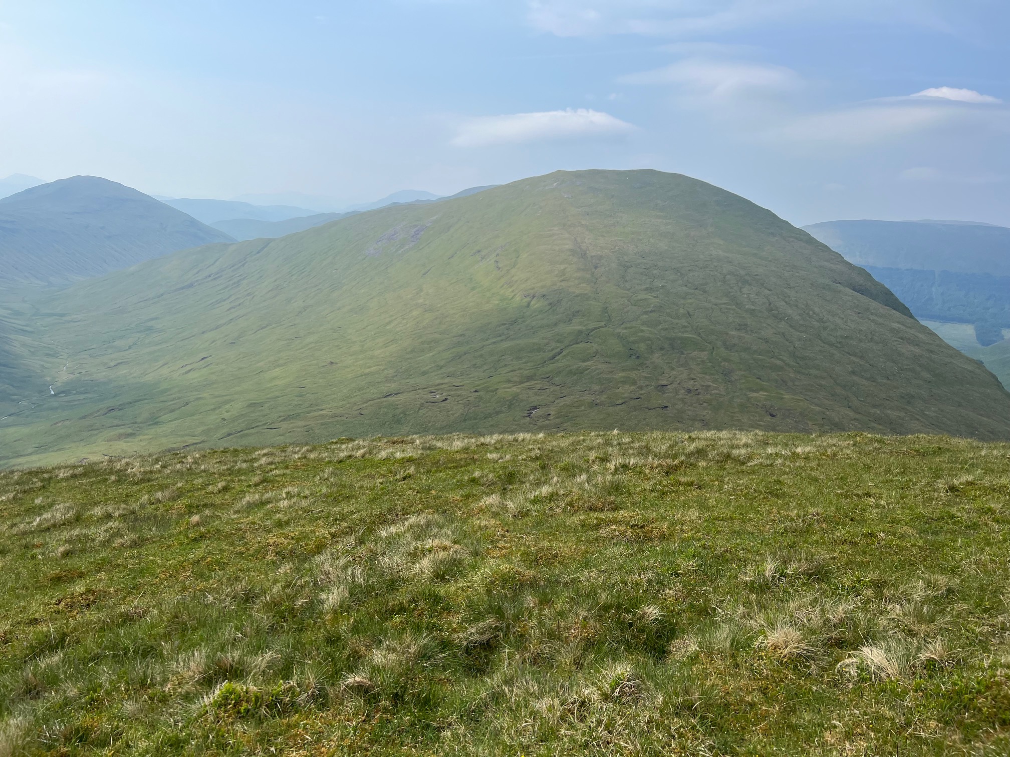
Chaisteil ahead from Fuaran

Follow the fence all the way

Looking back from summit to Fuaran

My car is up at the big tree plantation still a way to go

View over Beinn Chaorach and Crianlarich munros beyond

The 2nd Corbett of the day in sight. I knew there was a drop of about 260m but it felt much more and I was once again questioning my sanity for doing both. My knees were feeling the descent and as I dropped it was getting hotter and hotter and the ascent looked more daunting. Looking at the map I had descended

This is bog and peat hag territory but I had studied a line which seemed to avoid the worst of the hags and indeed it did under these dry conditions but still plenty of wet stuff to remind you of what might have been, but it I wont affect me as I do not intend to be back but you never know.

I had descended away from the hill to avoid the crags so it was ‘relief’ to head back towards the hill and start climbing again.

It is only a climb of circa 350m and on a good gradient so it should have been straightforward but turned out to be anything but for a few reasons. It was hot, hot, hot and my 3 litres of water which had seemed excessive weight at the start was going down rapido. The clegs were more numerous than on any walk I can remember, I lost count of how many I killed never mind the ones I swept off my clothing. One did succeed above my elbow and though my top. Throw in a couple of ticks and it was an ascent of constant concentration but not always on the terrain. Finally with 200m to go my legs were gubbed. I was walking in short sections before having to stop. I assume it was the heat along with 2 weeks since walking but I had exercised every day so most likely the heat. After about 15 seconds of rest the cleg attack forced me to move for the next short section.

With immense relief I reached the small cairn and Corbett 100 had been ascended. My reward a water bottle with a dodgy tablet for rehydration and a Turkish Delight bar, smaller than I remembered but the sugar hit was appreciated. Again hazy but good views.

SE towards Chaorach

Descending and looking at the long track walk back in the heat

The hill is far too steep and cragged to descend from the summit so a track heads SE away from where you want to be and does so for quite some time. By now I just wanted to get back to the car. But the rehydration stuff and the sugar had worked so feeling better. When I reached a lochan I decided to just head down the slopes. It was painful as my socks and boots were not cooperating despite being regular companions. The clegs were back on the attack throughout the descent and although I could see the track it never seemed to get closer. Until it did and I was there.

Of course on this hard packed estate track, under the beating sun it was back to hot, hot, too hot.

There are three building projects you pass, a lot of dosh is being spent here.

Hot and bothered the walk is over, the yellow alert has been cancelled and I am in need of a cool shower followed by an even colder beer.

I had not heard any trains on my ramble and at the finish discovered last nights thunderstorms had caused a landslide that had blocked the route, no trains running so tomorrows long looked forward day out not going to happen. Honestly this is Scotland but obviously under climate attack, not just the clegs then.

Memorable ramble mainly because it was the ton up, but it was too hot for enjoyment and as such I was the only idiot on the hills it seemed, if anybody else was there I did not spot them.

Ascent: 992m

Distance: 18.6km

Time: 6.07

Wildlife: Small Heath; Chimney Sweep; Raven; Meadow Pipit; Linnet; Chaffinch; Oystercatcher; Common Frog; Cuckoo; Wheatear;

Rough and tough beauty.....Quinag

Hill: Quinag…..Sail Gharbh (808m); Sail Ghorm (776m); Spidean Coinich (764m)

Type: Corbetts x3


We decided to do the route anti clockwise on the advice of one of our party but in retrospect I would stick to the clockwise route as described in Walkhighlands & SMC book. There is a good reason that most people recommend clockwise.


Lochan Bealach Cornaidh appears as we climb

Coffee break as our last Corbett comes out of the cloud

Sail Gharbh still in cloud but straightforward

Sail Gharbh
The forecast was for the best day of the week but as we headed up the very well renewed track it did not seem like that, the track all the good work by the John Muir trust. The low clouds added to the atmospheric conditions but as this was my top to-do ramble of the year I wanted blue skies and views.

A good walk up the track when unexpectedly Lochan Bealach Cornaidh appeared beside us. We had been on a gradual rise but that was soon to change as we began the very steep ascent to the ridge leading to our first Corbett of the day, Sail Gharbh. The final section is rocky with only a vague track. As we gained ground false top after false top appeared out of the cloud until the final peak was the real thing, good going just over 2 hours. The highest of our three Corbetts although I can assure you it did not feel like it. Cloud was coming and going so some great views alternating with misty cloud.

Kylesku bridge


Sail Ghorm long slow climb

In a Walkhighland report one walker went down here in error in bad weather luckily recovered after a major fright


Looked back and the rock formation looked like a rhino head to me, had lots of other suggestions

Liz on Sail Ghorm
Now some unwanted backtracking before we contoured our way round towards the 2nd Corbett of Sail Ghorm. On the way views over to Kylesku bridge opened up, a stunning combination of deep blue water and verdant greenery, so picturesque.

En route we reached the bealach with the projecting stone where some of the group had their pictures taken, a fine airy piece of rock. There are a few ups and downs alongside some stunning views, it really doesn't get much better than this.

There is a contouring track, narrow and eroding, with dangerously steep drops on our right side, not a place to slip, quite likely to be fatal.

Then a slightly tricky minor scrambling descent before the long walk to Sail Ghorm. It is a fine ridge walk and although only about 1.5km long it seemed a lot longer.

We passed the impressive rocky cleft with an almost vertical drop. You can find a walkers report on Walkhighlands who in bad weather who started to descend this, a frightening experience for him.

The cairn, which is on a wide grassy area, was reached with good views eastwards but the westerly views over the sea had too much cloud cover. Nevertheless through the breaks it was impressive as the blue water turned white where it was breaking over rocks. Lunch time but the wind had turned very cold so not as long spent as might have been.

Liz edging out

Formidable last Corbett lies ahead


Looking back Corbett 1 far right and Corbett 2 middle distant

Spidean Coinich

Descent
More backtracking this time the full distance before the scrambling section, much easier than descending.

A short walk, another climb, then time to take in the good views as the next section was for me the morale sapping stage.

This final section was the toughest by a long way for many reasons. At the end of a long walk you want as easy a finish as possible, this was anything but. The 3rd Corbett was the lowest in height but certainly not in blood, sweat and tears.

An ascent of about 120m would normally be good for a 3rd hill but not here. Then followed a descent of around 170m, all that height gain eroded and more and it was a crappy horrible steep descent with total concentration required. It felt like we were almost back down to the level of the lochan we passed on our wat to Corbett 1, not an inspirational feeling.

Now an ascent of 140m surely that was it, nope. Another 60m descent, I was getting well fed up of this roller coaster and wanted it over. Again another 120m of ascent and we were finally at Spidean Coinich, Corbett number 3. Walkhighlands describes the views are sensational and I would not disagree. All of Assynt & Sutherland was laid out before you with much, much more besides. By now we were in complete blue skies with only minimal cloud covering the odd top, so the long distance views were impressive, everything I hoped it would be.

All that remained was the initially very rocky, mainly pathless, tough descent. More or less continued all the way down.

We made good time and I was delighted to complete this iconic trio of Corbetts but no denying it was a tough walk. As stated earlier I would have preferred to get the roller coaster as a hard starter with an easier finish. Views at times out of this world, really as good as it gets,

Ascent: 1240m

Distance: 15.3km

Time: 7.06

Wildlife: Ring Ouzel; Skylark; meadow Pipit; Golden eagle (on way home); Common Green bottle fly;