Sunday 30 April 2017

Arran Coastal Way Sannox - Lochranza the high road

After Wednesdays leg from Brodick to Sannox I made a quick return to Arran to continue the ACW walk from Sannox to Lochranza. I had two choices today, weather permitting I was going to go up from Laggan cottage, do the sub 2000 Fionn Bhealach and drop down to Lochranza from there. Failing that I will just do the full coastal stretch. Matching the bus timetable is a further consideration.
Sannox stepping stones
I would have preferred the 8.20 sailing but for some reason it only sails Mon-Thurs so on the later 9.40 which brings some time pressure.  A nice smooth crossing once more and again an expensive Calmac breakfast roll and coffee and caught the bus to Sannox. Forecast mixed cloud, sun with showers.
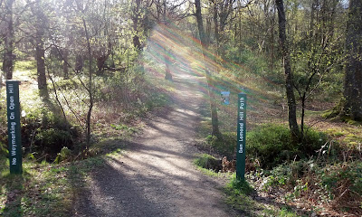
Picking up where I left off in South Sannox I crossed into the woods just opposite the Glen Sannox walk. Wrong entrance, a burn in the way. Next turn was correct with large  stepping stones, that’s better. On Wednesday I was bitten without seeing the beasties today it was both immediately, amazing at this time of year. I followed the trail round the bay and through some woods then reached another burn. There were stepping stones but looked slippy and I did not want wet feet this early so I followed the track back towards the road and then crossed a wooden bridge to head back down the other side.
I could hear a lot of barking and wondered what I was heading to. At the parking area a small travellers encampment had been set up. I counted 8 dogs, a mixture of whippets and pit bull types all going crazy but thankfully they were all chained up, they looked an evil lot. Not a person to be seen.
Sannox woods
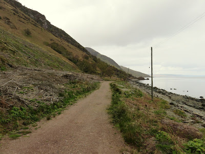
Through a large fence and onto a hard packed road which is followed for a few miles. Good sea views to distract from the other side. The navy navigation beacon is an obvious marker and the trail becomes a normal track with the fallen rocks the next marker.

The vista has opened out with big hills on the left and grand views over the Cumbraes and Argyll. It now feels properly remote, the only noise accompaniment is the calling of the birdlife. Thankfully enough of them to keep interested. Wheatear, rock pipit, common gulls, eider and mallards. Then, I hear my first cuckoo of the year and from now on until reaching Lochranza it was constant calling. Amazing, not one heard on Wednesday but it now sounds like the entire UK population is here.
View north near fallen rocks
There are frequent light showers on and off but the tops are just clear. As I negotiate around the fallen rocks I spot movement ahead, 2 walkers going in the same direction. The only people I have seen on the walk so far.
2nd beacon and way uphill?
I almost miss the other mile navigation beacon as it is inland whereas the 1st beacon was right on the coast. Looking at the background it looks like possibly an easier way up to the top, looks more straight forward on that grassy slope from here than my map suggests.

Heading towards the Millstone point just soak in the remoteness, the isolation and the scenery. I am now in line with the summit of Fionn Bhealach but of course from this level it cannot be seen. The Coire is impressive. However on a lower peak just ahead red deer hinds silhouettes on the skyline, the first of many that I will see today.
Laggan cottage
I catch up with the walkers who are having their lunch and sheltering at the cave, a pity as I wanted to look in this but did not want to disturb them. A quick chat, they were sticking to coastal route, then I was heading towards Laggan cottage, the white building standing out in the distance. Track is boggy in patches but generally good.
A pair of Northern divers are close by and a very large seals head appears, what a brute, only yards out, with what looks like a squid in its mouth.
Looking back towards Laggan cottage
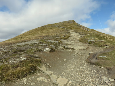
At the abandoned Laggan cottage decision time and its uphill. There is meant to be an obvious path but for a few minutes I just climb and then I spot a faint trail which seems to follow my maps trail so up I go. Relatively straight but as no obvious route keep checking the map. I reach a point about half way up where looking down on the abandoned Cock farm I can see a herd of deer grazing amid the ruins. Apparently over 100 people lived around here at one time, it would have been a harsh life.
I also see 4 walkers heading south on the coast, there is life. The path is now clearly defined, rocky but good walking. The views across the water impress so take the time to enjoy them.
Creag Ghlas Laggan
On the top the obvious track ( I think this known as the Postman’s track) continues towards Lochranza but the route to Fionn Bhealach is evidently a case of following the ridge, Creag Ghlas Laggan. The weather has changed quickly, clouds drop down, smirry rain and visibility reduced as well, it is bleak up here.  2 stags are close by staring, do the see me as a threat? Wherever you look there are pockets of red deer. I decide to leave Fionn for another day. The clouds have blown away but it is a chill wind.


The views over the northern Arran peaks are what this is all about. I might not be high but this is spectacular.

Walking down the track the distillery comes into view and looks so picturesque nestled below the hills. Groups of red deer are still all around. Obviously no cuckoos up top but as I get down to the village one calls in the trees beside the farm, cheerio, cheerio, it sings.
Distillery
Final descent gives a good view of the bay and castle.

The deer are so prominent that walking on the road that split’s the golf course this young stag was totally unconcerned about my presence, not just bunkers the hazard here.
30 minutes until the bus to into the distillery café for my hard earned coffee and cake. Plus I had to buy a bottle of port cask finished malt, the tourist pound gets spent. Remember, they say one tourist pound goes around 13 times. I will enjoy a tipple tonight.
Distance was 9.72 miles taking 3 hours 40min. Ascent just over 500 metres. I will have to complete the coast section later but I do recommend this.
Saturday 29 April 2017

Forth & Clyde Union Canal Falkirk - Linlithgow

I am absolutely delighted to have finished my last leg of this long distance trail. I have been lax in getting to it but this morning I woke early, Mrs was away, and decided to get it done. 45 minutes after deciding I was on my way to catch my first train of the day, yes I did shower. 
An hour and a half later I was at Falkirk High railway station which is right on the canal, ideal for my start, except it was raining, this was not on any weather app.
Tunnel entrance
Turn left at the canal and you are immediately and into arguably the most interesting part of the walk. Ahead of you is the ‘Falkirk tunnel’, 630 metres of a narrow, dark walk with water dripping and dropping all around, particularly today with the rain on. It was the longest canal tunnel built as the landowner did not want to see it from the house. 

The canal, millennium funding, is lit and the lights create some amazing images and reflections in the water. The sound of dripping water, the darkness how atmospheric and interesting is this? What a brilliant start. About half way along I spot someone looking into the tunnel at the far end but they never appeared and when I exited no sign of them and no exit path!!

The terrain is typical suburban canal side walking and not a lot to note except some suburban roe deer feeding in daylight, 2 bucks and a doe. They were on alert, watching me closely, but still rare to see so open in daylight.

Then just ahead I spot a barge heading this way, yippee. My winter strolls saw none of them, are they not what the canal is all about. Indeed 3 went by on the walk, and I even overtook one at Polmont, I know they go slowly but that is ridiculous.
Prison walls
Soon you reach Polmont and not so free are the prisoners of Polmont young offenders prison. Some of the top floor barred windows overlook the big Tesco store (easy for stocking up on refreshments), I wonder if the prisoners want to see every day activity. 
Now away from Polmont there is more open country and it is a pleasant walk. Many more cyclists around today and interesting how few warn you when coming up behind, as a cyclist myself this is not good enough.

I watch a heron which was one of the fearless ones. Although across the water they usually fly away when a human nears but not this one. It wasn’t even hunting maybe enjoying an earlier meal.

Next I come across a barge docking area, smoke puffing out a couple of them, heating will be required if you are living on them and then reach the Avon viaduct, which is apparently the longest and tallest in Scotland. The views looking down were impressive, the River Avon in flow, a picture perfect mixed wood and views across to the huge railway viaduct. 


Almost in Linlithgow now and I come across a rather barren rocky field full of cows, almost non existent grazing and most of the cows lying around. Then I realised that they mostly looked pregnant and then spotted a calf lying beside its mother. I thought the calf was dead and only through the binoculars could I see an ear flicker weakly, very newly born I assume.  I thought I was going to see a birth as the next cow's rear faced me and a calf started to emerge but the cow then lay down on its side breathing heavily and the calf disappeared back inside, not yet time. Many more of the cows seemed ready to deliver. I always assumed a farmer would be on hand to aid calving but not in this case. I cannot make judgement as I do not have the knowledge but this field & herd just did not leave me with a good feeling.

On a more positive note Linlithgow golf club is across the water. I have fond memories as I was a member here for three years and the 17th hole in particular was a favourite, A par 3 played from high up towards the canal with a big drop off. Many a ball of mine ran down that slope into the water. Good memories.

Almost there and the amount of housing has increased substantially since I lived there many years ago. I now get a good view of Linlithgow Palace, family have been christened and married in there. It was not deliberate but on reflection this was the most apt place to end this long trail, excellent memories and reflections of both the journey and my own history.
Despite the more optimistic forecast today was a cold easterly wind and a few light showers. Distance was 9.39 miles in 3 hours.
A superb walk that I would encourage anyone to do.
Now that celebratory beer.


Thursday 27 April 2017

Arran Coastal Way Brodick - Sannox, red deer, golden eagle & bitey things


The Arran coastal way is my next long walking route. I originally planned this as a winter exercise but the times of both buses and ferries combined with daylight hours meant a change of plan was needed to enjoy the experience. However, public transport on Arran is still an issue for anyone like me, planning to do this in day stages, hopping across every other week. I thought that more buses would run to connect with the increased summer ferries but not so, plan ahead.
This had a minor impact on today’s walk by changing the walk to start in Sannox. There is not a lot to do in Sannox if hanging about for a bus so a return to Brodick to kill time was more appealing so the route was reversed.
Casteal Abhail
A smooth ferry crossing, nourished with a Calmac bacon & egg roll, straight onto a bus which 20 minutes later dropped us off at Sannox, in the sunshine. A beautiful spot, great views of the coast and the imposing hills behind. I think that I am looking at Casteal Abhail to my right and Cioch na h’Oighe on my left (happy to be corrected), both look mightily imposing. The ramblers are soon climbing Goatfell via the scramble up Cioch but might be too much for my lack of heights. Mrs B with me today so no great exertions.
Sannox Bay
For 2.5 miles it is a lovely scenic coastal road walk heading south aiming for the other side of Corrie. It is a road walk and although traffic is light there are still a few going quickly so stay alert. There is plenty to keep you interested both at sea and inland. Great northern black throated diver spotted out on the water, delighted with that as don‘t see many of them. 
Long boat on right
Small harbours and inlets, lovely houses. There is a small coffee shop and hotel at Corrie if required. The replica long boat at Corrie looks intriguing I’m sure it goes out to sea but with whom?. 
Corrie
Whilst standing at the spot in the snap below, looking inland some movement caught my eye, a golden eagle was spotted circling at the peak ( I think it's the Rosa pinnacle), binos confirmed this was the case. 

A minute or so criss crossing the hillside then up and away and off to the interior, bingo. Also at this little harbour black guillemot appear to be almost tame and not the least spooked by us walking close by. Rock pipit aplenty. Gannets and their amazing dives wonder what fish they are catching.
Just after Corrie there are two inland options, as well as the option of just walking the coastal road but the Way route is inland. First option for the active walkers you can take the high route via North Goatfell.  
Or, as with Mrs B in tow follow the Merkland wood trail which twists its way through the woods for about 3.5 miles. There is reasonable height gain but all in all a bit of a trudge for 2 miles. There has been a heavy tractor or something which has gouged up parts of the trail, muddy but passable. Occasionally a gap in the trees gives you a view of the sea. Hundreds of tadpoles in the drying up pools, I hope they grow up soon, as well as deer prints in the soft mud at times so you might get lucky.  Also in the still air we saw nothing but felt small bites and a later count I had 5 little lumps on my head. I thought it was way too early for insect repellent.
For a spell the wood has been cleared giving good views over Brodick, Holy Isle with a particularly good view of the pointed hill of Mullach Mor and not least a ferry arriving. Sad part is we knew that it would have to make a return trip before we were boarding, that’s island life.

The route is now downhill until a new hard packed route built for heavy machinery, not walkers and cyclists, has to be followed for about half a mile. Then through the woods again to join up with Goatfell track. Just look at the deep shades of green some of these trees are, if you painted them people would say you don’t see trees that colour. 
Great northern diver nice spotted feathers
When watching the Highland cows I spotted movement outlined on a hilltop, a walker. Binos out but not a walker it was a red deer hind and with the binos I sighted another half dozen grazing. Delighted with that.
At this point you can visit Brodick castle, a National Trust property, but it is not our thing.
Popped into the Arran brewery and bought some bottles that I do not see in the shops at home and then continued on to Brodick. A stop for coffee and cake as too early for the ferry. Interestingly I heard an interview last week from an Arran spokesman who said that every pound spent on the island by tourists was recirculated 13 times, an impressive figure that shouts out loud that tourism does pay.
Black Guilemot
A final walk alongside the golf course and then the beach and into Brodick. Still too early, rain appearing so had to shelter and have a cold pint of Joker IPA in the Douglas to finish the day, not driving later!!
I reckon that this is potentially the least significant leg of the walk but we enjoyed it. The distance was 8.27 miles (13.31Km) as we idled along for 3 and a half hours but if in a hurry you could knock 45-60 minutes off that. The maximum height was 536 feet (163m) but with the ups and downs it was 994 feet (303m) of ascent.

Sunday 23 April 2017

Ben Lomond a tourist hill but still a worthy walk

With the weather improving (ha-ha) it has been an opportunity to get some bigger hills under my belt. Last night the weather forecast indicated a clear morning, possibly clouding up later. So I was away from the house for 7.15am for my 60 odd mile drive to Ben Lomond, today’s objective. This is a Munro category hill with a height of 974 metres, my biggest climb of the year.
The hill is probably the 2nd most popular after Ben Nevis so the car park at Rowardennan had a few cars parked up already but by 8.20 I was on my way. £3 parking charge but at least the loos are free.
I stop at the info board which has a QR mobile phone code scanner app which amongst other things lists the 32 main peaks you can see from the summit. Great idea but sods law it would not connect to my phone.

Head through the visitor block, basic loos available, and compared to last weeks Corbett the climbing starts immediately. A couple of sections of wooded area and then you break out onto the moor.
At the 1st gate a cyclist is coming down the rocky path, he shouted that the weather was good up top, had he been there or just cycling the West Highland Way track, intriguing as I breathed heavily? Within 10 minutes jacket off it seems warm, well I was sweating already.


The well constructed path reminds me of Goatfell, large step up boulders which I know my thighs will tell me about tomorrow.
In these conditions the track is easy to follow and with the clear air you get good views of the early walkers making their way up.
As always I breath harder in the early stages improving once I get my 2nd wind. I pass some early starters on the climb even with my stops for snaps and taking in the view. Enjoy not endure is important. For me head down, small steps keep going.


Once the flatter stretch is reached there are good views of the Cobbler and other Arrochar hills as well as the Ben ahead. The walking is now less stressful but you are still climbing.
Some runners are coming towards me as they descend, not even in my heyday could I run up these.


The northerly wind is now being felt so jacket back on and also time for nourishment. I can see the winding trail on the final third and pleased that I am getting there and feeling within reason ok. Looking west there is a weather front engulfing tops which I am presuming are around Tyndrum. Hope it misses me.


A bit more heavy breathing and lots of sweat but the final section is good and the summit is achieved. I had not looked at my GPS gear on the way up and I was surprised the ascent had taken only 2 hours 12 minutes, delighted that it was quicker than I expected. Near the top I note that on a bad weather day the drops into the eastern corrie, on your right off the path as you ascend, could be deadly. But the crags are mightily impressive.


Up top on a day like this the views are simply breathtaking, Scotland at its absolute best, but what I could have done with that app to name all of these hills. A few I know or can guess but not 32. Still take it all in and enjoy. For the full 360 degrees there is something interesting to look at not the least Loch Lomond and its islands.


But not for long as the cold wind means sudden pain in my fingers, gloves on and time for the descent. Today it is by the same route as I am doing the Ptarmigan descent in a couple of months, save that experience for then.
On the way down the hill is getting busier and busier and surprise, surprise the dress sense of some bewilders. Not just their clothes but the footwear. There will be some very cold and sore walkers if they get to the top.


There quite a few Japanese around, at least active and not sitting on a bus, but where do they go at night, you see them during the day but night?
Enjoyed the descent and back at a now full car park, cars cruising waiting for a space, maybe also someone giving them their ticket.


A great day but quicker than expected, distance walked 8.02 miles which took me 4 hours 19 minutes. The runners probably did it in a quarter of the time. Height climbed 3081 ft or 939 metres.

Monday 17 April 2017

Carn an Fhreiceadain the hill of hares, grouse and wind

After yesterdays little runt success today was the turn of its big brother, big runt, otherwise known as the Corbett ‘ Carn an Fhreiceadain, the Watchers (lookout) cairn standing at 878 metres. The met office forecast was consistent for this week, rain by 1pm. Initially when I woke it was grey and gloomy but by the time I had my toast & cuppa it had brightened up enough to be optimistic so off to Kingussie.
From my research and yesterdays observations I knew that there was an estate grouse track basically up and down the route. Fairly straightforward walking and little navigation required.

As I arrived at the car park I saw 2 guys walking away up the hill but never saw them again so they were not on my route, plenty of other options. Exactly on 9am I started walking by crossing the Gynack burn and following the road to the golf course and then into a pleasant tree lined section with the crystal clear water in the burn running fast on my left, I thought I might taste some that later, more of.
Walkhighlands route guide said to turn right and not cross a wooden bridge at the estate. As I approached a wooden bridge I could see a big house through the trees so off to the right I went following a clear track which was just before the bridge. At the side of the track was a large digger carrying out excavation work. After 10 minutes I had my doubts about this, the track was not going as I thought. Map out, wrong bridge, back down to bridge and about 300 yards later a 2nd wooden bridge!!

There are some route choices for you, straight up the west route to the Carn and return or take a circuit to include Beinn Bhreac going west to east or vice versa. The latter was my choice so I took the right turn and up the clear path, soon coming to a deer fence which I thought I was going to need to climb it as the latch would not open but eventually I got there.
Now out on the open moorland the track meanders and rises gently, my kind of walking. Plenty of sheep about and a few beautifully coloured male pheasants honking away. There are already good views across to the Cairngorms and on your left Creag Dhubh is the imposing hill.

Making good time I catch a glimpse of a sheep down a gulley, disappearing behind a mound, but something didn’t seem right and when I next spotted it, indeed I was wrong, it was a pair of mountain hares with most of their winter coat. Many more were to be seen today and some remained almost within touching distance. I wouldn’t have thought they see many people maybe its just that. I took a nice close up shot, checked the camera to find a message ‘no sd card’. Curses, amateur hour, I had left it in the laptop when transferring yesterdays snaps. Luckily mobile camera but no close ups.
The other prominent species were the plentiful red grouse. Again some remained so close it was unreal. Others did their normal behaviour and burst out from the gorse beside the track with the explosion of noise that gives the heart a flutter.


The path moves quite a bit eastwards of the Carn but when it turns back I soon spot the Green Bothy in the distance, something to focus on. The gradient is starting to increase, I knew the easy stuff couldn’t last, and it ramps it up from here to Beinn Bhreac. The expanding views are great but looking back an ominous black & solid weather front is coming this way, Newtonmore disappearing. So on with rain gear, needed anyway as the very strong winds were pretty chilly.


I reach Beinn Bhreac to a disappointingly small cairn, maybe as it has no classification of its own walkers just go on by. Still spend a minute taking in the views, remote countryside indeed.


I turn into the wind and head to trig point which is some distance away, the path twisting and turning, dropping down before climbing again, I didn’t need that. Thankfully the weather front has blown through to my east missing me but giving the cairngorm tops a new dusting of snow, my lucky day? Snow is still lightly holding on up here, clinging to the heather.


I stop at the trig and small cairn to take in the views which even with today’s weather are good. The Monadhliath mountain range is one huge area of remoteness. Newtonmore hills not too far away. I can also see a range of snow topped mountains way to the west which I assume will be the Fort William/Mamores area.


On the summit this is a large expanse of flat land, if it were not for the estate grouse track navigation could be an issue in inclement weather.
From the trig, going west there is a much more impressive stack so off I go to explore.  Not sure why it is there but it is very well constructed and the views are excellent.


But it is too cold to hang around so I follow the track downwards. No doubt this western side seems to be a steeper gradient. Views still great I take a break for food in a sheltered area looking down onto another bothy. The grouse shooters are well looked after on this estate.


Almost over and I now meet my only other walker of the day. We stop and chat for a couple of minutes, she is young and foreign and looking a bit underdressed for the weather, I hope the weather stayed good for her.
Down here there are a number of areas where the heather has given way.
Almost there and I see that the big digger is now well into the bank on the other side of the bridge. Later, when going past the golf course, the previously clear water is now silt brown, if the burn was a fishing water and Sepa informed I suspect digger man would be in trouble.

Back at the car I check the stats. Time taken 4 hours 24 minutes. Distance walked 11.46 miles and climbing was 665 metres. Happy with all that a good day and a beer awaits.