Sunday 30 October 2022

A hot day on Arran.....Cir Mhor

 Hill: Cir Mhor (The great comb)

Type: Corbett

Height: 798m

Another day to get excited about. It was to be my 1st trip to Arran since Covid, almost 3 years has passed, unbelievable. But maybe I wasn't as excited when my alarm went off as I was going for the first ferry. But I sure was by the time I was on board and had my traditional CalMac breakfast roll.

The objective today was Cir Mhor, known as the Matterhorn of Arran, no arguments from me.

We were going through Glen Rosa but there are no buses to the String Road that tie up with this ferry. The other bus driver said she would stop as close as she could but she forgot about us, thankfully not much of an overshoot so a short walk back.

It was a hot morning even this early.


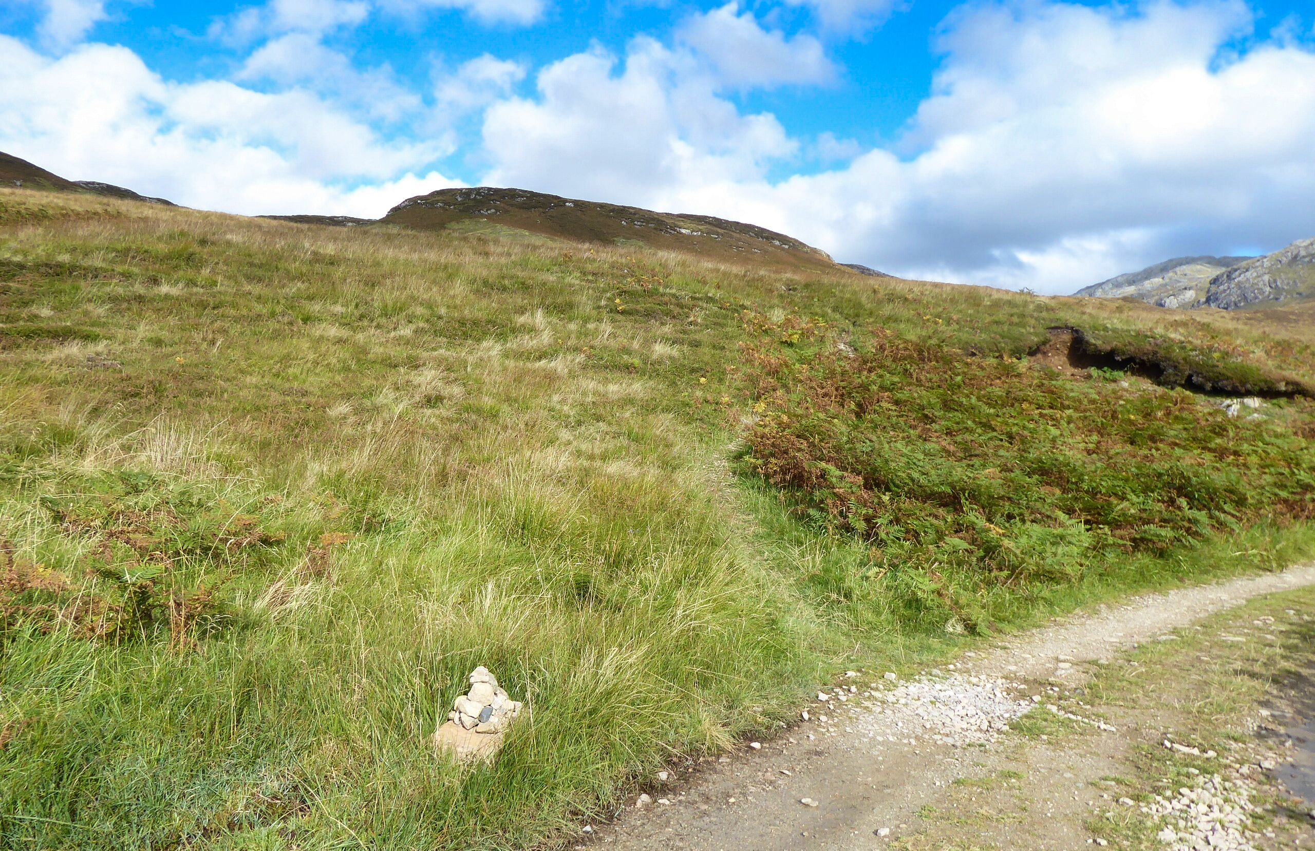
Anticipation builds as the hills are spotted ahead as we enter Glen Rosa. The walk through Glen Rosa was different. The foliage was long and so overgrown the path could not be seen at times. Lots of ski style shuffling feeling for obstacles. But the worse was the insect life. Lots of minor bites and a couple of cleg ones. One of them was 3 bites through my shirt on my back right at my rucksack. At first I thought it was just a twisted strap but nope, real bites.

So it was relief to reach the junction and start the climb proper.


That's a proper pointed peak of a mountain

Cir Mhor was looking magnificent, a grey fortress with a stunning peak against a clear blue sky what a sight.

When we reached the corrie a cooling breeze was very welcome, I had been feeling it in that heat.

Looking over to Loch Tanna, Beinn bharrain & Meall nan Damh

Up the short zig zag track and the north and west of Arran is your magnificent vista.

Lost the correct track going through the boulders and thought we had found it but it was heading for An Caisteal. So a direct line up through the grass and boulders and came across the track.


It is an interesting climb and the latter section requires hands on minor scrambling before the top is reached.

The ridge to 3 Beinns

Glen Sannox and Witches Step on left

Goatfell Glen rosa side

At the top is a small area for about 4 people to sit and take in the view. The views are amazing looking over to the Witches Step. Glen Sannox far below with the blue waters of the Firth beyond. Goatfell of course dominates and looking down Glen Rosa both the Holy Isle and Ailsa Craig can be seen in the haze.

Glen Rosa with Ho;y Isle in background

One final look back at a stunning mountain

We followed the same route back. Grateful that the breeze was now lower which made the walk through Glen Rosa much more pleasant. It is still a long haul but the beasties were hiding.

Common Darter

Dark Green Fritillary
One of the frustrations is the non buses to meet the extra summer sailings a disgrace for a tourist island. So the long walk back to Brodick and we missed the ferry by 10 minutes. Time to hang about and take in the scenery.

A cracking walk on a beautiful day.


Ascent: 878m

Distance: 20.5

Time: 7.01

Wildlife: Common Darter; Meadow Pipit; Scotch Argus; Dark Green Fritillary;

Sunday 23 October 2022

A choo choo train to Leum Ulliem

 Hill: Leum Ullien (Williams Leap)

Type: Corbett

Height: 906m

Once again the weather forecast made grim reading, high winds, heavy rain and cold, but for once this summer it was wrong in one major factor. It was definitely not summer so a tick in the cold box. It was very windy on the tops and ridge. But the predicted heavy rain was only a light drizzle for a short time, result.

Peak of Leum Ulliem
Always exciting to start a walk with a train journey and the one to the remote Corrour station did not disappoint. Major confusion about which door to disembark as the on train announcement differed from the on train conductor shouting instructions. All got off safely.

Beinn na Lap behind


Leum Ulliem's peak

The walk decision was to go anti clockwise. A good estate track takes you up on a gently climbing gradient. As it was a short walk we extended it by continuing on the track up to the subsidiary top of Beinn a’ Bhric (only about 30m lower than the main top) where there is a large cairn and despite the greyness of the day some fantastic views. 

The ridge and the top does not look pointed from here


Grey Corries

Dog photo bombs train snap

Buachaille Etive Mor & Beag
As we climbed the Grey Corries were the most prominent but from up here there were additional spectacles, Rannoch Moor and the glistening pools of water but more stunning were the fantastic view of the 2 Bookles along with the Aonoch Eagach ridge.


Schiehallion

We now had an additional descent and reascent of about 80 metres over rough ground before we found the original track. We then followed for a short distance before cutting off and heading up the grassy slopes. 

Before long it flattened out and the large cairn was in sight. It has a narrow shelter for a couple of people. There were a few more of these structures on the flanks of Bhric. There is no grouse shooting here so I assume they are for stalkers use.

The views from here are good but not as good as Bhric. A different view of Rannoch Moor and the local Corrour Munros, the Alder range and the ones from Fersit all showing well. Many more in the distance including Ben Lawers and the pointed Schiehallion.


Corrour Station
Time to descend the ridge which had a faint track coming and going but I suspect we were a little too far SE and maybe missed a better track. It was quite rough at times, some deep pools to leap so it was with relief we came across the main track but almost at the end.

Time for a venison burger and a pint in the station restaurant. What a size of a burger, one to remember for the future.

So a good walk in great surroundings, not a bad day out at all.

Ascent:649m

Distance: 10.85km

Wildlife: Red Deer; Meadow Pipit; Common Frog

Saturday 22 October 2022

Spartleton

 Hill: Spartleton

Type: Sub2k

Height: 468m

The weather forecast was for the first good day for ages, so I escaped for a morning and headed for Spartleton Hill. Described by Walkhighlands as a rounded dome in the Lammermuir Hills.

It is surprising that so quickly can the city of Edinburgh be left behind. When I reached Gifford the moorland beyond was a fabulous burnt orange in the early morning light. The sheep were in a belligerent mood, on three occasions one stood right in the middle of the road forcing me to stop before moving. Had to laugh.

I started from the Whiteadder Reservoir small parking area just on the east side of the dam on the north side of the road. The reservoir water was picture perfect flat calm only broken by the ripples of the plentiful rising fish and the wake of the swimming geese. The only sound was the honking of the geese. An ideal start to a walk.


The water has pretty much dried up on this side and as I walked alongside the water a snipe flew out of the vegetation at the side wings rapidly beating.

My descent track coming down from the trees


First view of Spartleton


Sheep guarding castle

Three route options but I was going for a direct approach along the track to reach the remains of Gamelshiel Castle, really a small towerhouse, with a large round sheep fank adjacent. The two walls are all that remain of the 14th century tower house which once stood here, today guarded by a single sheep. The thickness of the remaining walls gives some indication of its strength, and it is believed to have had a vaulted cellar at ground level.

After the castle I took an immediate left turn, crossed the Hall Burn and head up a path on the far side. Starting to blow now, how easily conditioning lost.

I followed the narrow path heading up to a gate that I could see. If you wanted to rough it head straight up the rough moorland. The amount of red grouse flushed was impressive, abundance hear.

Reached the gate in the fence to be greeted with the views over the large wind farm which covers it eastern flanks.

Taking the easy way I simply followed the track to the summit. Blue skies but a chilling cold wind had me pulling my beanie out of my pocket, wimp.

Gun butts everywhere, looking south

Bad picture all round, my shadow and the turbines
A huge cairn for a Sub2k and trig point is an excellent viewpoint if you try to not look at the Crystal Rig windfarm. Silence was disturbed by a quad bike, the farmer with two dogs on board rounding up his well scattered flock.

Today was excellent visibility, looking over the turbines the Fife coast was in the distance. The spikes of the Pentlands were distant but impressive. Looking south over the shooting but it was a lot of moorland with a couple of small peaks sticking up.

Heading for trees on the left
As I descended I could hear a skein of geese above me, but could I see them, nope. Their underwings clearly brilliantly camouflaged against the sky. The noise slowly drifted away.

Pheasant rearing cages all birds gone
From the summit I returned to the fence and gate. I followed the upward route for a while but instead of taking the castle turn I continued straight on heading for a copse of trees which eventually meets up with the ancient Herring Road. ‘At the height of the herring boom in the 18th and 19th centuries this route would have been followed by fishwives carrying heavy creels of herring to markets in Lauder from Dunbar on the coast. It was also used by people who would buy a winter's supply of salted herring to provide food for the cold months’.

View back to the reservoir
A pair of meadow pipits were doing a high speed coordinated mating/bonding session. The fast-twisting manoeuvrers were a delight to watch.

Then headed back to the car flushing another snipe, I assume the same one from earlier as very close to the earlier spot.

Overall, a short but excellent ramble, just what I wanted out of this morning.

Ascent: 243m

Distance: 5.2km

Time: 1.36

Wildlife: Meadow Pipit; Geese; Red Grouse; Pheasant; Snipe;

Friday 21 October 2022

Remote Glas Bheinn.....The hill of the ticks

Hill: Glas Bheinn (Grey Hill)

Type: Corbett

Height: 776m

Feeling better today so decided on a bigger test. I was thinking about Quinag but not really in that shape so opted for its singular neighbour, Glas Bheinn. I knew this was a 6-hour ramble today, but the forecast was the best day of the trip so made use of it.

Two options for this hill and I opted for the longer, less direct route. I parked at the car park near the Inchnadamph Hotel. My jinx is still with me as my GPS did not have this walk in its memory. I knew I had set it up last night but no idea what happened. Mmm decision time. The hills were shrouded in cloud but were forecast to lift. I did have my OS map and compass, with the route highlighted so old school today, off I went.

After the hostel I bumped into a couple of walkers staring at a map. Are you heading to the Munros they asked? Nope, we looked at their map and got them right and to be sure I walked the track with them to their cut off. But because we were talking, I missed my cut off into the hills indicated by a very small cairn.

This is a Corbett, not an almighty Munro so no motorway size tracks here. I was expecting a small wooden post as this is also a section of the Cape Wrath trail. It has a reputation as an extreme challenge so maybe markers don't go with it.

Gate to nowhere
The non-obvious path now became a recognised one and had me puffing as I climbed to reach the old gate to nowhere, by this time I was sweating back style, where had this heat come from, jacket and hat off.

The only sound was the gurgling of the river as I ploughed on climbing all the time.

I reached a small shelter with a wooden bench, room for two but a good view of a waterfall, more about this shelter later.

After about an hours walking I got my first view of my target the ridge still in cloud.

More ups and downs on the rocky/stony/boggy narrow track but at least someone had put some work into it. But this is real isolation, a very remote piece of our land.

Eventually the path descended via a very boggy section to reach the outflow of the larger Loch Fleodach Coire. This was the bit I was unsure about, if the river was in spate turn back time. Although the stepping-stones were slippery and some of them submerged it was passable.

Green lochan
After crossing the outflow where was the path? I walked along the very boggy edge of the loch to meet another burn crossing, then another!! Some trampled grass indicated a path, yippee. But it was going up away from where I wanted to be albeit I knew from my map that it would turn around higher up. Looking at the terrain a direct route to the base of the hill was clear but unpredictable. Being on my own I stuck to the path for now. With the ups and downs there is a lot more ascent than the hill height suggests.

Heading for grassy rake mid left
Now another decision as my map was now differing from the Walkhighlands description which thankfully I had downloaded as text on my phone. I had to take a much longer walk than expected to the base of the hill, crossing some very wet and boggy sections.

Turning from grass to boulder scree

A few of these hiding in the grassy bog
I knew this was now a series of elevations to the plateau. Sticking to grassy sections as much as I could I reached an open grassy area surprising some hinds but were they bothered, nope.

1st of a few sightings
The next two lifts were awkward boulder/scree sections. Now I was into proper Assynt Corbett tops terrain.

Finally a plateau was reached but no sign of the top. I had seen what I thought was the top cairn but just a line of sight one. Easier walking with areas of grass and stones but aware of how close to the drops I was.

Then I spotted it over the plateau at 10 o’clock so a different angle to the one I was on, yes I had not been looking at the map. With relief the big cairn and shelter was reached. Decent views but not the best I have had on these hills, not a patch on Breabag for instance. Looking back the clouds were romping towards me so I wasn't hanging about.

Quinag

Looking back along the plateau

Canisp & Suilven

Glad to be off the scree. More deer on the grass

Inchnadamph looks close but still a few hours away
The views over to Quinag showed its tops still covered in cloud. Nice views out to sea and the stony landscape close by. As I was self-navigating I wanted to get away from the steep drops before the cloud covered me. Big plateaus can be awkward to navigate for my skillset.

Heading back to the stepping stones, Conival's peak just in shot


Snap doesn't do waterfall justice, the noise was spectacular and soothing
Got back down, over the moor and across the stones safely and climbed back to the shelter for my sandwich. I sat on the grass listening to the waterfall tumble down from its great height, genuine tranquillity. A wilderness all to myself. Just as I finished my sandwich, I noticed a tick crawling up my arm. I killed it but noticed another on my underarm. As it was despatched, I saw one on my jacket sleeve and another on my rucksack. Despatched those two then headed off at a pace with still at least another hours walking. On the descent I felt something on my neck and scalp, three more times, each a tick was killed but now every itch or whatever had me paranoid.

Almost back. Took this on the ascent as loved the sky.
Was I glad to get back to the car and go through all clothing and gear but no more ticks found. Thankfully likewise back in the shower.


Overall, ticks aside, a superb long-distance ramble. Certainly not one to be walked in poor weather unless absolutely sure of your outdoor skills. This is genuinely one very remote place. I was solo in more ways than one, not another person spotted. But it is a while since I had the buzz of solo walking in a remote environment. Certainly not a feeling I get in group walking or even with just one other. This being alive buzz only comes from solo walking. You really can get Scotland to yourself.

As I looked over at Quinag it was heavily covered in very dark clouds, I made the right choice.

Ascent: 900m

Distance: 18.1km

Time: 5.38

Wildlife: Chaffinch; Meadow Pipit; Red Deer (hinds); Raven (heard); Buzzard; Scotch Argus; Red Admiral;