Showing posts with label Laggan. Show all posts

Friday, 4 July 2025

I could have done without that descent.....Beinn a' Chaorainn & Beinn Teallach

Hill: Beinn a’ Chaorainn (Hill of the Rowan)(1052m) & Beinn Teallach (Forge Hill)(915m)

Type: Munro x2


Beautiful clear blue skies yet again for an unplanned last minute ramble where I ended up bagging a couple of new Munros. I was in the area to do a couple of bike hikes but this opportunity appeared and I had a free day so went for it.

A group of us from Ayr OIR met up at Roughburn for a 9am start. Easy to find, just along the road, west of the Creag Meagaidh circuit. 

You could go up here but far better to keep walking for another 5 minutes

A pleasant walk through some woods, chatting away and listening to the spring birdsong brought us to the deforested area. A sideways walk along to where we would start the ascent of the 1st Munro. Some boggy sections of ATV track was encountered before we probably made a slight error and followed a track left instead of staying on the direct track. 

On off ATV tracks helped

It didn't make a lot of difference but we did end up in a newly tree planted section, lots of holes in the ground so awkward walking so pleased to get to the deer fence. 

Where is that deer fence? 1st top peaking up top left.

We were slightly lower than the planned route but found a gate in the deer fence rather than the going over the style mentioned in walk reports. 

However, it wasn't too far away and as we wandered upwards we came across the path from the style. Path you might think, where did this come from as the description says pathless?

Looking back to the deer fence & the Fiona Creag Dhubh

The slog

But a faint path there was which helped morale as we climbed onwards and upwards, onwards and upwards, you get the picture. I was pleasantly surprised at the gradient which was better than I expected but nevertheless it was a relentless ascent without respite.

More elevated view back including Grey Corries and the two westerly Fersit Munros

Looking back the views were stunning. I needed plenty of short stops stops as the sweat was running the sun lotion into my eyes, very painful. Plus with rubbing my eyes so often I was irritating my recent operation which brought on a different pain, the joys.

The final section is a boulder/grass combo which meant frequently losing and regaining the track.

Creag Meadaigh Munros 

Levelling off and across the boulder strewn top we reached the first summit and cairn but this is about 10 metres lower than the middle top. Spectacular views over the Creag Meagaidh hills. Nice to see what they looked like as they were mainly in cloud when I climbed them. 


Loch Treig surrounded by the Fersit Munros Corrour beyond from South top

Turning around the waters of Loch Treig was shimmering in the bright sunlight, Corrour behind. All the big mountains in view Fersit, Grey Corries & Fort William giants.

True summit on the right then follow the ridge round on the left

View from summit back to top 1 (South)

The going underfoot had improved as we headed to the real summit and again took in more of the superb views.

Ridge walk, some of our group arriving at 3rd top (North)

A lovely contouring ridge walk leads to the third summit. Sadly deaths have occurred on this section with snow crevasses not being strong enough to hold the walkers from a long and fatal descent.


Today was different, a few clinging snow patches which did not affect us so we enjoyed it taking in a superb view of the tiny halfway lochan.

View over to lumpy & bumpy Beinn Teallach

As we walked the ridge we also had a good view across to the 2nd Munro of the ramble, Beinn Teallach. Once it was the highest Corbett, now the lowest Munro, promotion or how the mighty fall. From like afar this looked very different to Munros in this area, much more the rough and rugged type associated with our local Dumfries & Galloway hills.

I had felt really good on the ascent, pleased with my stamina and legs but the toughest section was still to come.

After the main ridge we had a slightly downhill contouring grassy section before the full on descent began heading steeply to the glen of the Allt a' Chaorainn. It is always slightly demotivating when descending knowing an ascent was coming next. But this descent was over 400m, a huge descent. A grassy boulder crusted hillside. We were constantly zig zagging to keep on the grassy sections.

Beinn Teallach was always in view getting higher and steeper the more we descended. As said if any hill could be transported to our local Dumfries & Galloway hills and not look out of place it was this one. No smooth parts just like a toads skin, a few grassy rakes and covered with small craggy sections.

Closer view of lochan also seen in above photo

The climb was just over 300 metres, the short steep sections were really punishing my legs. Lactate issues kicking in. Tracks found and lost. Constantly readjusting and that bloody top never seemed to be in sight.

Poor snap but final climb more Munro like now

View from summit to 2nd top

But finally a faint boulder trail climbed to a cairn which as soon as I arrived I spotted another one across the way where our two fastest walkers already were. But the guide says this first cairn is the Munro top although we do head over to the other one as it is said to have the best views, not that any of the views today have been shabby.

On the way down, good track for much of it

Glad to be on the homeward stretch even though that is still a long way off. Again grassy, stony up top, more wet and boggy as we descend. But the descent was hot, hot, hot. The dry spell meant the possible daunting river crossing was a breeze. My water bottle was filled in the cold fast running water, delightful, I needed it to revive me.

A cracking walk in beautiful conditions with great views throughout.

For me a walk of two halves. The 1st really good because we largely kept going and that suited my style. The 2nd half was much tougher. We had a few breaks, the big descent and then the uphill climb where I found myself in my mental ‘can/must do’ territory. But really getting to old for that.

Despite that a well worthwhile ramble in good company.


Ascent: 1208m

Distance: 17.6km

Time: 8.21

Wildlife: Chaffinch; Buzzard; Skylark; Meadow Pipit; Mountain Hare; Raven;

Sunday, 13 October 2024

A cold and muddy ramble.....Gael Charn (Monadhliath)

Hill: Geal Charn (Monadhliath) (White Hill)

Type: Munro

Height: 925


The big question is 'how do you tell when it is summer in Scotland'? Going by this year that is a very hard one to answer.

I had missed out on bagging this hill a few times but today was the opportunity to rectify that. The drive from Laggan to Garva Bridge has to be one of my favourites.


The water levels on the Spey, as viewed from General Wades bridge, looked on the low side considering the amount of rain that we have had. I know that the nearby Spey dam regulates water flow so looking at these levels I assume it is in this direction.

Arriving at the parking area it is empty. On previous occasions it has been full of campervans as well as walkers cars. This is ‘summer’, the schools are on holiday, it is one of the easier Munros, the forecast is okay, very surprised.

Everyone who has read a report on this hill will know it is a mudfest and after the recent rains it did not disappoint.


Path would get a lot muddier

This will be a fairly short report as not a lot happened on this ramble. It is a very straightforward walk along a distinct trail, it is a Munro after all. Very boggy as I followed it alongside the burn before making a detour. At one point I lost the track but knew it was not far away. Found it just before I had to cross it. The only distraction was a small group of four stags, not at all bothered with me.


Luckily, despite the recent rain, it was a straightforward burn crossing unlike recent stressful ones.

I had been feeling a bit chesty on the early stages but thankfully I was breathing okay as I started the final climb to the plateau. The wind was much stronger and colder, so much so that I had to put on a winter hat, unreal.


Although not a difficult section this seemed a long slow slog interrupted by a Ptarmigan who like the stags seemed not at all bothered by me. But they never do I love them.

Once I reached the plateau the weather was full on. The wind had increased but the telling factor was the temperature, I reckon the feel like wind effect was sub zero, at least my hands were telling me that was so.


The huge cairn appeared on the horizon, not the nicest walking across the boulders and I was happy to get there.

Hiding from the winds I took in the views which were monochrome but with the cold air the distance that could be seen was extensive and far further than should be the case for this time of year.


Ben Nevis in distance

Ben Alder range

The nearest hills were obviously Alder hills, Creag Meadaidh and onwards to Ben Nevis. But looking south I was sure I was looking at the Killin hills and SW the Glencoe mountains. Along with the Cairngorms to the north quite a viewpoint. But is was so cold I was not hanging about.


Creag Meadaidh & Laggan hills beyond

Track back to the parking area

On the descent I met a family who were the only other walkers on the hill today, as said earlier very strange for this time of the year.

About half an hour out the wind died and the temperatures soared. Of course I cursed that I was over dressed, zips opened, but it literally only lasted 15 minutes before it was windy and cold again, unreal.

Overall it was a good ramble. Despite my chestiness I was surprised to see that I had made such good time. Maybe one day it will be summer gear to enjoy.

Ascent: 651m

Distance: 13.4km

Time: 4.22

Wildlife: Ptarmigan; Meadow Pipit; Red Deer; Mountain Hare;

Sunday, 8 September 2024

Three Munros, nae views, a grey day.....Creag Meadaidh circuit

Hill: Carn Liath (1006m) (Grey Hill); Stob Poite Coire Ardair (1054m) (Peak of the pot of the high corrie); Creag Meadaidh (1128m) (Bogland Rock)

Type: Munro x 3


When I was compiling my original list of 100 Munros this circuit was on that list but for whatever reason was not part of the completed 100. Having achieved my target I was ticking off some of those hills that were on the original list. Now it is not about numbers but rather about walking hills that I really want to do.

Last night when I looked at the forecast I considered aborting as it was to be fog and very poor visibility from low levels covering all day. But this morning it hag changed to fog at higher levels and mist from lunchtime onward. Okay lets do it. Apologies not many snaps as the conditions up top were grey and more grey.

The parking area was already pretty full when I met up with my walking buddies. Some I knew including Gillian from my hometown and other groups walking companion. From here the cloud level looked to be around the 700m level, fingers crossed that it would rise. Nobody was late so a prompt start.


Clouds still lower than I hoped

We decided to go clockwise and get the biggest out of the way first which meant ascending the scree/boulder field rather than the more awkward descent.


Beautiful setting for the Lochan a Choire

A gentle rising gradient took about an hour to reach the Lochan a’ Choire and the mightily impressive rock cliffs of Coire Ardair. These are huge and considered to be the 2nd best winter climbing routes in Scotland, 2nd only to Ben Nevis. A privilege to see them close up.


Looks a lot flatter in the snap than it did on the day

Next was the awkward section up through the scree and boulders to the bealach ‘The Window’. On off track and lots of hands on light scrambling up the steep slopes. The weather had not improved but rather deteriorated so outer layers donned in the drizzle and cloud.


Looking above wild landscape

Across the plateau and the final climb to Creag Meadaidh, we had not followed the track in the photo

From the bealach it is another steep section to get to the plateau. Thankfully it was softer grass up top and about 1.5km of flat walking to the summit, bypassing the false cairn which is bigger than the real one. A short steep slope and Creag Meadaidh was reached. Munro number 1 and just over 3 hours.


Back to the bealach and you can see back to the lochan

Reversed back along the plateau, the descent to the bealach seemed longer and steeper for some reason. Then the short stiff pull up to the 2nd Munro of Stob Poite Coire Ardair. That did not seem to long and included a food break.


Now it was an undulating plateau walk to number three. The feel good factor of ticking of number 2 so quickly kind of diminished as there was just over 4km to walk along the plateau. Typical of a high plateau it was a mixture of grass and boulder sections making for easier and tougher walking. Not so good for good pacing.


Starting final descent towards Loch Laggan

On the descent a view back across to the lochan higher ground still in the clouds

Finally we were there with a brief weather window to see back to ‘The Window’ but overall a very disappointing viewing day.

For me the hardest part of the walk was this descent. It was steep and a knee was beginning to hurt. The track became a narrow muddy gloop fest and one heel slip left me with a nice covering of black dirty peat mud but at least I had kept on my over trousers so my main gear was protected for the car journey, others were not so fortunate.

Near the bottom it became a well constructed stone section which was great but no kinder on my knees.

Overall I was pleased that I did the circuit and if I had been bagging for the 100 I would have taken the day and its weather conditions. But, as these are now ‘for me’ trips, the lack of views were disappointing, but that is just another part of this crap Scottish summer.

Ascent: 1248m

Distance: 22.48

Time: 8.06

Wildlife: Common Frog; Hooded crow; House Martins;


Thursday, 8 August 2024

A rough wee ramble.....Creag na Doire Dubhie

Hill: Creag na Doire Dubhie

Type: Sub2k

Height: 571m


My intention had been to get a higher hill on my to-do list out of the way today but the weather forecast had turned brutal for this time of the year. Instead of the hoped for blue skies and higher temperatures the reality was the opposite. A months worth of rain was predicted bringing with it flash flooding, this was not helpful at all as one of my optional Munros had a river crossing, would I get across or even worse would I get back over on the descent? Throw in cloud level at around 600m with very poor visibility on the upper hill plus the bad weather included 40-50mph gusts up top, rethink required.

However, I did have a back, this Sub2k which I had intended to do tomorrow on my way home.


View of summit from parking area

I had this slotted in for completing last month but weather snubbed that again. I was within 5 minutes of the parking area with the rain at its heaviest of the morning. I was thinking that I was going to be sitting in the car for a while but just as I reversed into the spot the rain went off, finally a good omen perhaps.

I was starting at the normal point of the Halfway house bridge, room for about 4 cars if parked nicely.


Headed down the track beside the burn and found my first obstacle of the expected burn to cross but not the fallen tree over the track, easily bypassed.

Soon reached the end of the trees and the gate onto the open moorland where the small ridge with the large cairn was clearly in view.


Left to Loch Caoldair but right for me

There was a good track until I reached a Y junction, slightly beyond Loch Glas-choire which lies on your right.


Looking back to Loch Glas-choire

Took the now narrow right fork which although it does not look much it does continue up to the corner of the deer fence.


There was a faint ATV track going over the hump in front of me but I elected to follow the fence to its next junction. Some deer tracks but mainly heather bashing, poorer walking, sometimes on a steep incline but I did make it to the fence corner where the gate was lying on the ground, not me guv!


All off route from now on through the boggy ground, quite deep heather growth and lots of new growth bracken breaking through. As always pick your own line and keep climbing. And as always there were a few minor false tops before the flat area is reached with the large cairn nearby.


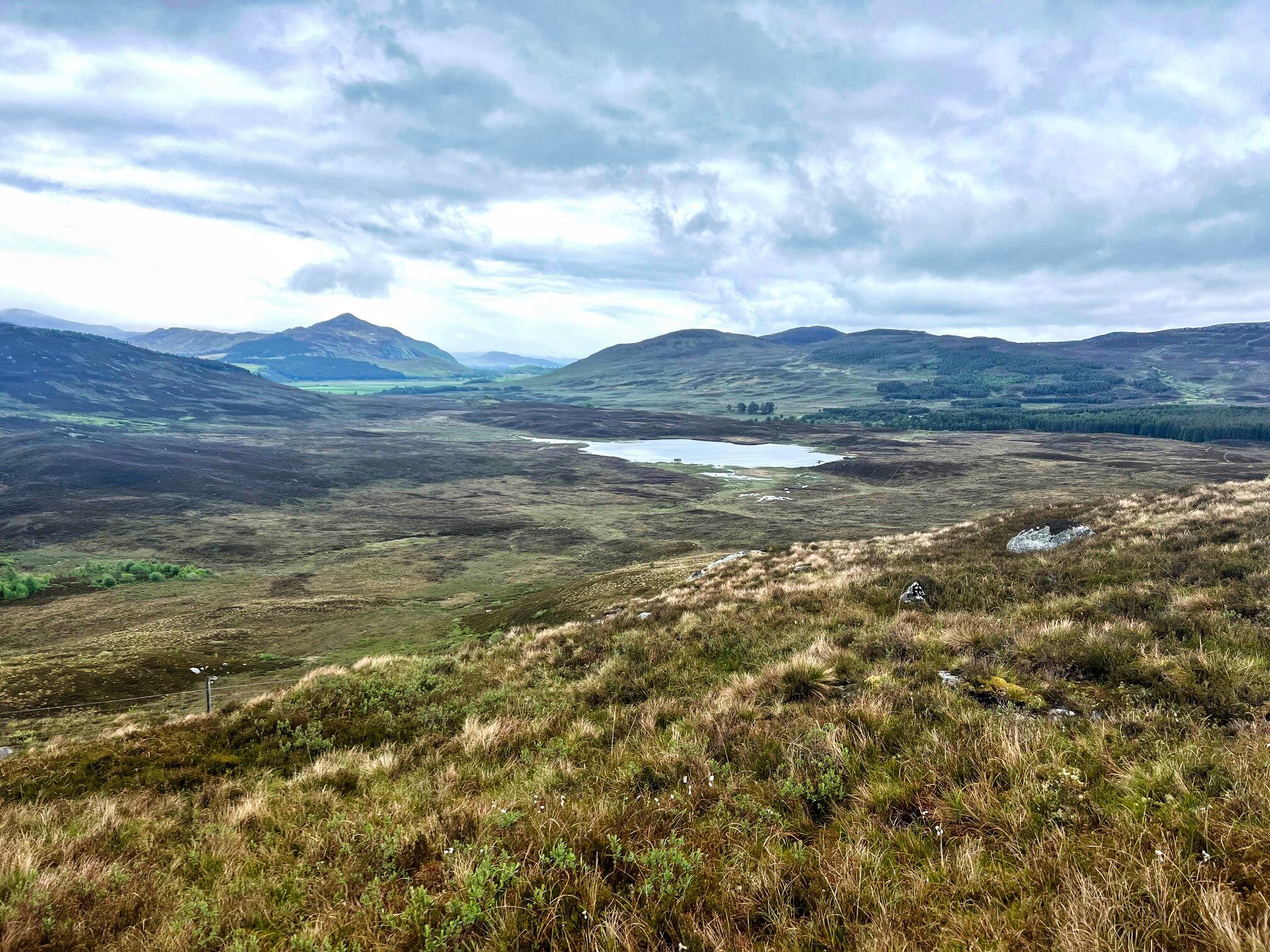
View North to Creag Dubh

Although there had been a few spots of rain I was dry and despite the low clouds and the greyness the views were not too bad at all. An hour to the top which was what I anticipated.


Rough ground ahead

From here I could see another track on the other side of the loch. The ground between me and a small very bright green patch at the start of the track looked rather rough. I assumed the green to be sphagnum moss. As I had plenty of time I decided to make it a circular route.


Green patch with track beyond

I took a line to aim for but it turned out to be far worse than the ascent route. Although the contours looked similar it felt much steeper and the terrain was just awful. Very steep wet ground, laced with heather and boulders with a bottom layer of bracken. In a months time when that bracken has grown forget it. It was only 15mins of descent but not at all pleasant.


Finally I was on the flatter heather where I headed towards the deer fence intending to follow it round to the track. Glad I did head towards it as I stumbled along a track which took me all the way to green area better than following the deer fence. The track was odd being there, it was as if a small digger had dragged its bucket along behind it clearing a strip between the heather. Whatever the reason I was glad of it, saved a lot of heather bashing.

Reached the green bit which was not moss but a small perfect fertile grassy area, looking around everything else is moorland, why did this patch develop, nature can be wonderful.

The track I wanted was only about 50m away but the deer fence was now a double one, why? I thought I was going to have to climb but I wandered down a bit and found an old iron gate, job done.

Then it was just a case of following the winding track back to the road keeping an eye out as there were big droppings, coos around, but never saw them.


Common Heath

A short road walk to find another car parked up, not the only person with a plan B today.

Another new hill bagged, a decent bit of dry fresh air, so not entirely a wasted trip. A fine wee hill with the advantage of a high start, perfect.

Ascent: 309m

Distance: 6.49

Time: 2.15

Wildlife: Meadow Pipit; Willow Warbler: Chaffinch; Stonechat; Barnacle Geese; Common Heath,