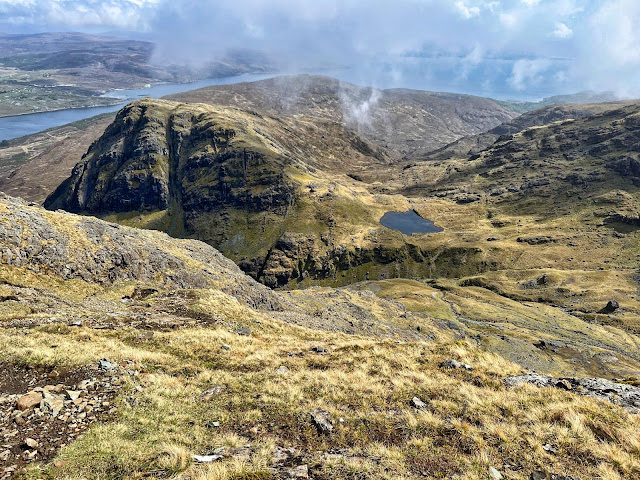
Hill: Blabheinn (Blaven) (Blue Mountain)
Type: Munro
Height: 928m
Walkhighlands describes Blaven as having one of the best viewpoints imaginable so it would be rude to do a walking trip and not include it, what could go wrong, well the weather for one. It is separate from the main Cuillin hills and some rate it as the finest peak on Skye.
We delayed our start to take advantage of the clear conditions as forecast by the Met Office.
A pleasant walk from the car park with the mountain in sight in all its magnificence. Looking at some of the scree slopes I was thinking that if I need to go up that I will be turning back. I was thinking of the Walkhighlands description ‘Good path at first, but later the going becomes very rough, with loose stones, a scree gully, and some very mild scrambling’. Okay bring it on and it did.
A narrow but good condition track brought us to the waterfalls of the Allt na Dunaiche carrying a bit more water than I expected so good viewing of cascading water.
A couple of burn crossings, these could be challenging after heavier rainfall, but even at this level I still managed to get a wet foot in the second burn. Gordon was struggling with his leg so left us at this point.
Once across it was a newly renovated but still very rocky track. We were now in the gloom and would continue that way right to the summit. It was a steady climb with good ascent gained quickly.
First route objective was a failure as we missed the sharp right turn at Fionna-choire but in fairness so did the 4 guys in front and the couple coming behind. Soon the scenario of us all, standing in the gloom, barely able to see each other, looking at gps etc, where do we go from here? As it turned out we found another track, obviously a lot miss the inconspicuous non extant track. This proved fine as it merged with the other one further up the hill.
Maybe at times it is just as well that you cannot see what's in front of you. We did have the benefit of hindsight looking back in clear air. A lot less intimidating when you are on the way down.
But in this moment in time we were on the way up and we reached the narrow stone scree gully. This was a long steep gully, it really should have a name to remember it by. It is the right hand branch of Great Gully which divides the main summit from its south top. There is no path. Clamber from side to side as you think best holding onto the rock edges to pull and steady yourself as the stuff under your feet constantly gives way and creating potential big boulder slides to endanger people behind you as well as listening out for some coming down your way from the walkers above. It was interesting to say the least.
Once above this gully we were back on the path but it was time for a short break to let body and mind recover.
 |
| Do not turn right at the cairn at the Great Pow |
The path is quite good until the small cairn is reached. A large boulder forces an awkward scramble, particularly for short legs. As we pondered how to get over it I spotted a figure in the gloom scrambling up a steep face just ahead, surely that was not the route? Starting to feel iffy. I got over the boulder and left Liz whilst I explored ahead just to make sure we could go forward. Luckily the other person was either an expert scrambler or just an idiot.
Reassured Liz got over the boulder obstacle which only left a short walk led to the top where about a dozen people were sitting around hoping the clouds would lift.
We sat around for a while, had some refreshments but sadly they didn't lift so back down we went.
 |
| Views starting to appear |
Around about the lower small cairn the clouds lifted enough at lower levels to get good views of the descent but looking back the summit remained covered.
 |
| Top of the stone/scree gully |
 |
| Liz negotiating the last major obstacle |
Both the boulder and the scree chute were easier on the descent than feared although great care still required. It was a descent of full concentration all the way to the burn.
 |
| Red Cuillins appear |
Superb views of the small lochan and further down views through to some of the Red Cuillins.
 |
| Track still looks a long way down from here |
 |
| The trees are the finish point |
Still a ramble to remember although more of an adventure than a ramble. At least the views on the descent provided some reward for the effort.
Ascent: 948m
Distance: 9.8km
Time: 5.45
Wildlife: Cuckoo (heard); Meadow Pipit; Willow Warbler; Skylark; Great tit;


No comments:
Post a Comment