Hill: Rubers Law
Type: Sub2k
Height: 424m

Rubers Law is a volcanic plug in the Borders and as a stand alone hill it is also another Iron Age hill fort. Seem to have visited quite a few hill forts around the country recently.
According to Wikipedia it was also a Roman Signal station. A Roman signal station on the hilltop may be inferred from the presence of many Roman dressed sandstone blocks on the hill, many decorated with a diamond pattern. The same pattern was found on stones at the Roman site of Castlecary on the Antonine Wall.
From my original plan I had intended to do this hill the following day but I had made good time so I reckoned I could get up and down before darkness.
Parking is in the small village of Denholm. It has a traditional village green as its centrepiece which is quaint, I cannot remember the last time I saw one like this. I followed the Walkhighlands route going anti-clockwise although I was not intending to do the full circuit.


 |
| First view of the hill |
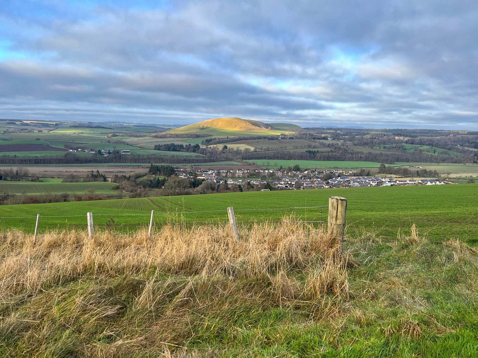
 |
| Looking back a shaft of sunlight catches the Minto hills (another pair of volcanic plugs) and in the foreground the village of Denholm |
There were a couple of stretches of woodland walking through an attractive native forest of mainly old Scotch Pine. Another small patch still hanging on in the Borders.
The track is mainly good going, bit boggy in places but it was going to get a whole lot worse.

 |
| Finally a sign |
 |
| Out of the trees the angle meant the hill had disappeared |
 |
| Over the brow and the coos and the trig come into view |
I am respectful of cattle, not scared to walk through them but where possible I will give them a wide berth. These did not look like a pedigree breed, more of a typical hill cow. If they live on the hill all year round they are more feral than tame and can be unpredictable.
However, I decided to keep going upwards and reassess later, maybe they would have moved on.
The ‘path’ was now a quagmire of wet, deep mud and boggy stuff churned up by this herd. Throw in lots of droppings and you get the picture, not very pleasant with no way to avoid it.
 |
| Surrounding the trig |
 |
| Got close but at the top of the gully I could not see anymore |
Nearing the top I spotted a rough grassy track on my left, seemingly unused by the cattle, which I hoped would take me round them. It took me to the top and I managed to get almost level pegging with the height of the trig, which I could just see about 50 metres away. But the low winter sun that I was walking into was so blinding that I could not safely see. I could make out shapes of cows ahead of me but whether they were grazing or watching me I could not tell.
So, being on my own, I backed off to let my eyesight come back. Out of the glare I could see that one cow had followed me but was stationary, just looking. I could also see that if I got past it there were no others between me and the trig but 3 or 4 were just behind. However, I decided that on my own with darkness not far off it was not worth the risk. But I am bagging it on the basis that I was more or less at the summit height and was just a feartie today lol.
 |
| Freezing fog and Moffat hills |
Decision made I was able to now breathe more easily, take in the view and take some snaps. Excellent views particularly to the west where the freezing fog still lingered and I believe that is some Moffat hills peaking out.

 |
| Golden hour light |

I enjoyed the walk back and although the light was fading I got back to the car in time. Not the highest hill but one I will remember for a long time.
Some additional historical notes:
In the 17th century Alexander Peden may have preached to a conventicle of Covenanters from a chasm in the cliffs on Rubers Law which is known as Peden's Pulpit.[3][6] The restoration of King Charles II of Scotland in 1660 was followed by an attempt to impose Episcopal polity upon the Church of Scotland. The Covenanters were those who vigorously sought to maintain the Kirk's Presbyterian polity. Ministers ejected from the Kirk, like Peden, preached to illegal conventicles of their followers in the open air between 1660 and 1688.
On Easter Day in 2000 another open-air service of worship was held on the summit of Rubers Law. People from Bedrule, Denholm and Minto churches met there to commemorate both the two thousandth anniversary of the birth of Jesus Christ, and earlier Christians who had worshipped in that place. The event is recorded by a metal plate fixed to the summit rocks of the hill. Bedrule church holds a service of worship on Rubers Law each Easter Day.
Ascent: 368m
Distance: 7.3km
Time: 2.28
Wildlife: Treecreeper; Coal Tit; Goldcrest: Blue Tit; Great Tit; Siskin; Jay; Wren; Chaffinch


