Friday, 6 January 2017

River Ayr Way Sorn - Stair

River Ayr Sorn
Happy New Year and the first major ramble of 2017 that merits a post.
There is no such thing as a bad walk. There are circumstances that might affect the walk but being outdoors is king. I know you can sense a BUT. Today's walk was a good one, a lovely crisp winters day, great scenery, some wildlife, a nice pint at the end, BUT the walk title is a bit of a misnomer. The long distance path is called the River Ayr Way, so you might think it does just that BUT as mentioned in my Stair-Ayr blog it digresses from the river for nearly half the walk. Still, I really enjoyed it as you will read AND I encourage you to do this, or at least the river sections.
I had two travel options, I could have got public transport but that would have involved 3 buses, would have taken 2 and a half hours hours, and with a tight turnaround at each stage it was not worth the risk of a traffic delay, missed bus, no walk. So onto my second option, Mrs B got up early and drove me to Sorn. Only 35 minutes and winter daylight time saved.
Sorn Bridge, Kirk, Graveyard
The car was showing -2 degrees at Sorn it was a cracking winters day. The light was magnificent,so good I took a snap upriver. I began the walk in the 'Main' street, probably called something else and walked west and crossed the old single track bridge across the River Ayr. The first 4 miles or so of river walk are quite something. The bridge (around 400 years old) stands opposite Sorn Kirk and its ancient graveyard, with some very interesting and old headstones if you have time to look.
A good track
Up the hill and quickly off road with good views of Sorn castle and another large marquee in its grounds, more weddings? Quickly thereafter the path descends to the river where you follow a good path to Catrine. It has been a cold night as you can see from the icicles in the branches just above the river.
Blurred icicles
At this time of the day the sense of isolation and tranquility is paramount. Only the sound of running water, birds calling in the trees and top notch unspoilt scenery, this is what it is all about.
Tranquil River Ayr
About 2 miles on you reach Catrine with the old industrial mill water driving weirs and holding ponds plus the newly constructed salmon ladder, great to see.
You depart from the river and aim to find the town square, it doesn't quite meet my expectations of a square to me, but, I ask a local and the burn crossing at 'Bridge St' is just ahead of me. Turn right and along the river we go, next destination, the new A76 Howford road bridge. Catrine is the last stop for food and drinks unless you want a longer detour to Mauchline later on. I get a brief sighting of a grey wagtail happily making its way along the opposite bank.
Salmon pass Catrine
Walk under the A76 bridge avoid the more obvious left track and go down towards the river to cross the Old Howford Bridge (built 1750 wow getting on for 300 years, solid construction) and head up the track. Sadly, not for the only time on this walk, fly tippers have dumped their domestic rubbish at the trackside, scum.
A left turn across a small field leads you into a ravine with magnificent compressed rock formations that make you think about the forces of nature that created these layers. I read that there are prehistoric cup and ring marks as well as modern graffiti. I think I see some possible examples but really an expert eye is required.
Rock layers
Now you have the equally magnificent, of the modern variety, Ballochmyle Railway viaduct (a train went over so still in use), which has as its claim to fame the longest masonry railway arch in the UK. The path is still in good condition but going up and down regularly so stretching the leg muscles.
Ballochmyle Viaduct
Enjoy the sounds of the running water as shortly the walk now leaves the river and for almost 4 miles is an inland countryside stroll. In parts it is public tarmac road, no pavements, take care particularly near Failford. It is also miles of fenced pathway, meaning direction is no issue and no livestock either is disturbed by you or vice versa. Some people complain about this herding but I will go for it as it keeps you safe. But why could it not be incorporated on the riverside that the landowners won't let you walk. I can only imagine it is fishing rights but I could be wrong. However, it does not keep you safe from growling angry dogs running free and well away from owner, at times some sort of spray as a safeguard would be welcome, probably illegal, and not even a sorry from the owners.
Herded in cannot get lost
At the hamlet of Failford I fancied a pint and a sandwich but the Inn was closed. Back to the emergency rations. A left turn takes you down into a stretch, known as the Ayr Gorge Woodland and a stunning section it is. It is managed by the Scottish Wildlife Trust and a good job they are doing. Good walking and informative information boards. The river is cut into the gorge which has colourful sandstone rock formations, a reminder that Scotland was once attached to Africa, our geology is based on sand and this is a spectacular reminder.
Sandstone gorge Failford
A little later I was aware of my backside feeling colder than usual. Investigation found a very wet rucksack bottom, I had put my water bottle in the rucksack upside down, obviously with the top not sealed, a wet rucksack and lower jacket. Thankfully not far to go as nothing left to drink.
The gorge has several sets of steps both giving regular ascending and descending, a bit of breathing blowing, not such a good fitness sign. There are super views at times of the river meandering way down below when walking these upper sections.
A final climb breaks you out of the woods and back into open countryside. Then back down to the river for a short stretch until you reach the detour (a stile leading to a short field crossing) at Daldorch farm. Apparently a couple of landslips further on near Stair have rendered this river section impassable. Now it is about 3/4 of a mile away from the river on tarmac and a final section on a twisty busy road so take care.
Detour at farm ahead
Finally I called the good lady for my lift. I deliberately left this until late on so that I could have a pint of real ale in the impressive Stair Inn, well I had earned it.
12.52 miles in total taking 4 and a half hours with just over 1000 ft of climbing. A fine walk on a fine day in beautiful Ayrshire countryside the vast majority never see. Enjoy.

Friday, 30 December 2016

River Ayr Way Stair - Ayr


This was to be my last outing for 2016, desperately needed to shake off the Xmas inertia and too much food and drink. I didn't want to travel too far so opted for the first leg of this long distance route, a new one for me. The River Ayr walk breaks down nicely into 3 similar stretches.
Today I began my walk at Stair, a lift required as the nearest public transport bus stop at least 2 miles away and headed in the direction of the sea. It is a walk that follows the river about 2/3rds of the way and disappointingly off river for about a third, presumably landowner difficulties the reason for leaving the confines of the river. 
River Ayr near Stair
With the prospects of a good weather forecast to keep me happy I left the hamlet of Stair and headed through a deserted farm track and soon along the riverbank. The first couple of miles is a straightforward and pleasant countryside river walk. A carpet of dead and decaying leaves gives for soft walking. 

The river alternating between fast and calm water with mergansers and dippers for company. On the right, up in the woods, you get sight of Enterkine house hotel, with a large marquee erected, wedding time I presume.
You now catch sight of the very impressive Enterkine rail viaduct built in 1872. It was originally built to transport coal from the pits as well as the Ayr to Cumnock passenger trains, and I believe an occasional goods train still crosses, but I have never seen one. Once under the viaduct the next bridge, Gadgirth, is in sight ( there are quite a few bridges on this walk). Across the water it looks like someone is doing work in the wood, I noticed it was up for sale, a wooden structure has been started, fisherman's stuff maybe?
Enterkine Viaduct
Cross the road at the bridge and keeping to the same bank follow the river towards Annbank. This is a tranquil stretch but there a warning sign at the bridge indicating a dangerous path ahead! It is slightly open flanked at times, eroded and muddy in patches but not sure why dangerous. I presume someone has had an accident and Health & Safety got involved.
Now upon reaching Annbank, a mining village, you take the first diversion from the river. The route I am using (via Walk Highlands) leads through the village and on the very outskirts there should have been a sharp turn left heading back to the river at an old nursery. I missed this (maybe it has gone) and walked the road for half a mile before rejoining at the next bridge. I had not brought an OS map just using my notes, wrong again. 4g did work but did not show this old mill and showed me joining the river if I kept walking. In Annbank there is a small store if you want to buy some provisions, indeed the last one until Ayr.
1st fallen tree
Go over the Tarholm bridge and you have now crossed to the other bank. The next warning sign I encounter is a 'no access to anyone due to giant hogweed'. I am not turning back so on I go and soon hit the boggiest, gloopiest, muddiest section with no option but to get through it. A couple of fallen trees make it even more interesting. Glad I had put on my gaiters.
Wallace's seat
I am rather warm now, indeed sweating, so my middle layer goes in the rucksack. A mixture of warmer weather and effort. I stop at Wallace's view which is okay but seen better. An MTBiker comes towards me, the only person I have seen so far. Good luck to him with that stuff up ahead.
The track rises above the river, pleasant if routine forestry stuff. I can see Auchincruive estate buildings on the other bank. The guide indicates crossing a stile and go across a field but I choose to head down via the river. On a good low river day you can follow this lower track to Oswald bridge but it could be dangerous in high running water. To stay true to my guide I rejoined the field and wished I had not. It was clear horses or cattle roamed here (none visible but recent droppings were in evidence), their hooves creating many deep holes in the grass, not great walking. Plus, the upper plank of the stile crossing has been removed making for a very awkward clamber over a high barbed wire fence. I am sure a few folk would not make this.
Green winter crop.

After crossing Oswald Bridge the next couple of miles takes you well away from the river, passing the college then following a straight cycle route to the A77. It is initially muddy but soon becomes tarmac. This is small homestead land, plenty of horses, kennels etc. But, I did get a close view of a yellowhammer, a rare sight to me these days.
Underpass at A77
At the A77 go down under the road and the river is followed once again. This is now the outskirts of Ayr so expect plenty of dog walkers and just a lot more people. Cross the new bridge at Craigie campus and follow this bank into the historic town of Ayr. Quite a few more bridges on this stretch but don't cross until the very last one which is the end of the walk. This now gives you views of the open sea directly ahead as well as newish residential properties. A short walk down either bank takes you to the docks if you take northern bank or the beach area if you take the southerly one towards the newish flats, Head into the town proper for food, drink or transport homewards.

Not a great day for wildlife but the sightings included: buzzards, heron, mergansers, goosanders, mallards, woodpecker, and all the common woodland birds and of course the yellowhammer.

I enjoyed the walk, a fine day out, just over 4 hours of effort and 11.5 miles. The other two stretches will be completed next month.
It has been a good outdoor year so have a good one and here's to 2017's rambles.

Postscript:

I was disappointed at missing the turn at Annbank so I returned today to complete the walk and it was a good decision. The stretch I missed was just over a mile and a half almost wholly alongside the river. The water is an anglers dream with alternating calm pools and running water. This enhanced the environment as the tranquil surroundings are either calm with only birdsong to break the silence or the roar of fast running water even when the drops are minimal.

At one point I came across this tree covered in Xmas baubles. No idea what the reason for these is.
Little Egret
Then further on I caught sight of a white bird in the river. Got the binos out and I was both delighted and stunned to have seen this Little Egret. I have seen these abroad but to my fading memory not in Scotland, a great surprise. I only got a brief camera shot at distance so apologies for the quality.
So really glad I made the effort, one of the best stretches of the walk. An extra 1.5 miles.

Saturday, 3 December 2016

Forth & Clyde Union Canal Ratho - Linthgow


It was a cracking December winter day, ideal for a low level walk. Being in the vicinity of Edinburgh I opted to walk another stage of the Forth & Union canal, my second. In a previous post I walked from Ratho into the start of the canal in Fountainbridge, Edinburgh. This time I am heading west so it is Ratho to Linlithgow.

There were a few people around the barges but by and large a quiet place this morning. The walk is mainly a tree lined wooded environment, easy flat walking. Just out of Ratho the opposite bank is lined with wooden cutout cartoon figures (see snap of Peppa Pig). This continues for over a mile and provides excellent diversion trying to name them all. Must have been 30 plus of them. If you have not had kids or grandkids forget it. These continue until Santa's grotto or is it a castle? I assume that one of the canal boats operates a kids/Santa trip but good fun for walking adults as well.
Peppa

Santa's grotto
After about 3 miles the canal takes a right turn and in front of you is the Almond viaduct which crosses the River Avon which from up here is a long way down. Good site for a bungee jump if you are brave enough. The viaduct gives great views down to the river. If you wish there is a walk diversion down into the country park.
River Almond

Typical woodland stretch
There is still regular aircraft noise and now that the woods are gone for a while and the M8 is also in sight and sound. Broxburn can be seen as well as the red coloured bings, a familiar site to anyone travelling here. I did not realise today's walk goes right past these bings. Also in the distance the tops of the new Forth bridges are in view.
Broxburn bings
Soon the walk goes under the M8 and Broxburn approaches. This is not the prettiest of places with a few surly dogs having to be avoided as well as their owners.
Having survived the walk is quite quickly alongside one of these bings (these are oil shale spoil tips), it seemed quite far away not long ago. I remember in the past these being used by motocross riders, no sign of that today, no doubt health and safety has scuppered that.
Back into open countryside and Winchburgh is reached. Flocks of redwing and fieldfare keep me company as they gorge on the red berries. Just before Winchburgh, on my right there is a small castle like structure and it looks like a golf course beside it, need to look this up. A small canal works depot is located here, Port Buchan I think. They look after the stretch from bridges 19-40. On the path side there is a picturesque graveyard, if you have got to be buried this looks as nice a place as any.

Back into wooded territory again I spot a couple of cyclists heading my way. I expected to see more today but only 4 in total. Indeed it was only a few dog walkers around as well. It is in next years plans to be cycling the full canal but only after I have completed this walk. Suddenly, in this wooded stretch, the temperature drops significantly and zips are pulled up. 

Once again the trees are gone and it is open countryside to to Linlithgow. However in the distance I can see two columns of 'whatever' rising in the distance, Grangemouth no doubt. Also on my right across in Fife another huge column rises, this time flattening out as the hot stuff meets the cold atmosphere. This time the petrochemical site at Mossmorran is no doubt the culprit.
Grangemouth pollution
The town of Linlithgow is in view, a lot more modern housing than when I lived here many years ago. Another historic town, Mary Queen of Scots and all that, but more of Linlithgow's history when I do the next leg.
My walk finished at the train station and as luck would have it one is due in 5 minutes.
The distance recorded at 13.47 miles taking just over 4 hours. 
I was not expecting a great deal of wildlife but pleasantly surprised. Non everyday close sightings included: water vole; grey squirrel; great spotted woodpecker; long tailed tits; fieldfare; sparrowhawk; buzzard; redwing.
Niddrie Castle

PS the castle at Winchburgh is Niddrie castle with a significant history so look it up and it does have a golf course of the same name.

Sunday, 6 November 2016

Speyside Way Aviemore - Grantown


You will notice that I have incorporated 3 stages of the Speyside Way into this blog posting. I actually walked the Aviemore - Boat of Garten on one trip and the other two another day but all 3 can fit into a reasonably fit persons walking day or split them into 3 whatever you want.
View over golf course to Lairig Gruh
Starting at the railway station cross over the railway bridge, stop and admire the view south and of the station itself, and take the back road to Dalfaber (follow the cycle path signs if required). At the next road crossing head towards the golf course and that is you. The towns orbital path can be used as well to get to the golf course.
Watch out for bikers
The initial stages meanders past the golf course and through a natural wood to explore if you wish. The path to B of G is a busy MTB cycle route so take care they can be on you before you realise.
The terrain opens out with good views of the Cairngorms and the steam train might pass close by. Follow the good path until you reach a fork, the right hand takes you straight into B of G, the left is woodland trails used by the bikers eventually bringing you to B of G if you take the correct turns. I took the woodland trail, it added about a couple of miles but no views to interest me.
When you break out of the forest there is about half a mile of new and old, mostly very large, houses to admire if you win the lottery.

At B of G there is a cafe, shop and hotel if you want to get refreshments or even the bus or train back to Aviemore. 
If not turn left and follow the main road following the signs to the RSPB Osprey centre. Cross the River Spey, pause and look for salmon if it is the season, then there is a short stretch of road walking before entering woodland again and then into the forest proper at the T junction.
Typical track
The next couple of miles through the forest is a bit boring but plod on. If the right time of year you might want to take a slight detour to the RSPB Osprey centre, but for us they had already flown the nest back to Africa. Look up the tops for Scottish crossbills.
When I broke out of the forest the track had one of these frustrating signs pointing in a half direction. The track looked most used so I went left but of course I should have gone straight on upwards following the tree line. I had my doubts but I had walked another couple of miles before I was sure an error had been made. This mistake either meant a road section for a couple of miles or a similar about turn distance. I was under time pressure to meet someone in Grantown so just walked on via the road.
Bob Dylan where are you?
Nethy bridge is a typical highland hamlet, a mix of very old and new property. I had picked up a Speyside Way sign but there were no more to be seen going through through the village and to this day do not know where the route went. I knew I should now be walking the old railway line. I walked in the right direction going past the golf course and realised I should be somewhere down to my left hand side. Incidentally, I was told that Bob Dylan purchased a house somewhere near this golf course but no sight or even sound of him today. The detour did have its good points as I saw the golf course, look out for the short par 3 that is played across the Tomintoul road, quite unique in my golfing experience. Also I came across the beautiful Abernethy Old Kirk and its war memorial graveyard, very historic and interesting to spend some time here. 

I considered diverting across a couple of fields but too many cattle in them so no go. About a mile further on I spotted an opportunity and followed a farm track downwards which thankfully led me onto the Way again, very happy to be back on track. There are signs promoting the good work of the local farm in assisting wildlife to flourish, good on you.
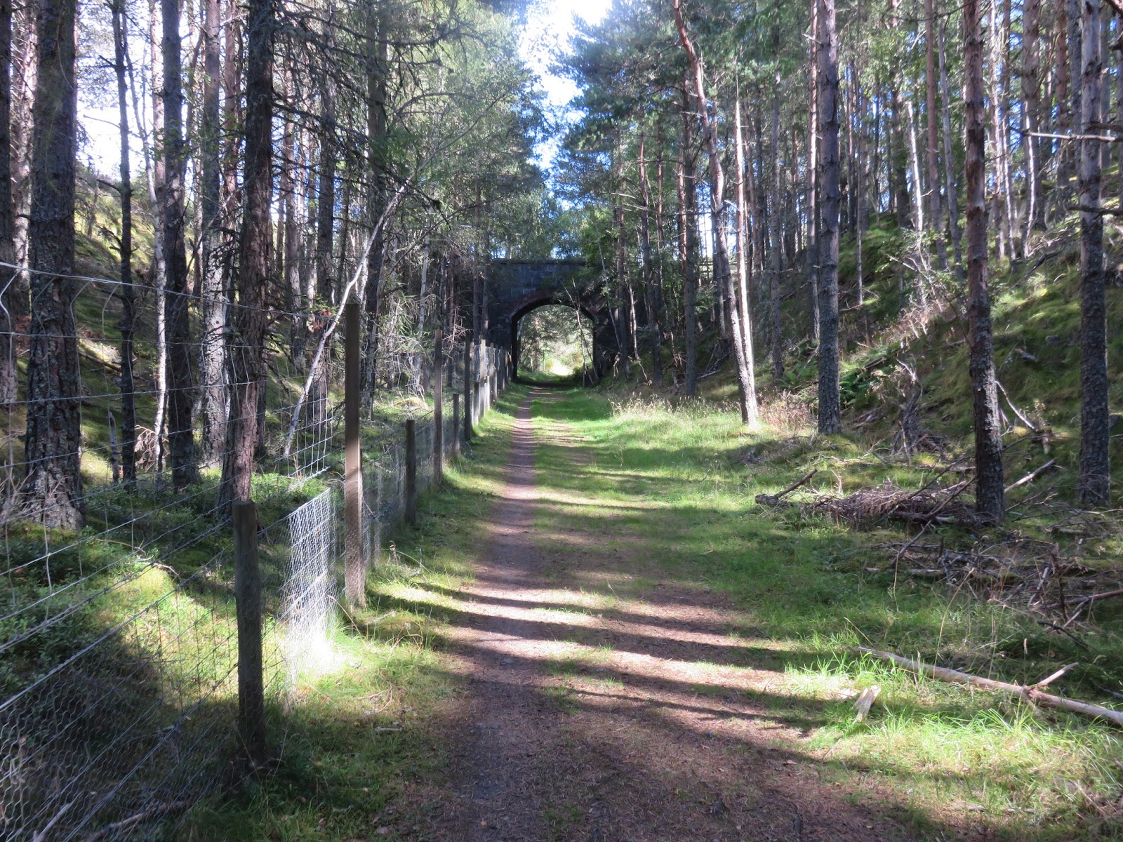
Old Railway section
This section is straight forward flat walking along the old railway line, going through farm land but no animal blockages. Through some woods a huge brown and sandy coloured buzzard suddenly and silently takes flight moving away from me. Then the River Spey appears into view with 3 salmon anglers trying their luck or should I say skill.
Buzzard appeared here
This stretch is a bit more interesting with interchanging wood and open views. 
Finally I cross the mighty Spey and take the woodland walk to Grantown.
Overall an easy and interesting walk. Total mileage for the 3 sections was around 17 miles, 6 for the Aviemore - B of G, then 11 for the B of G - Grantown on Spey.
Salmon Angler on the Spey

River Spey


Sunday, 23 October 2016

Forth & Clyde Union Canal Ratho - Lochrin Basin


After my hill efforts yesterday I decided on a low level walk today. My walking plans for next year included walking the full length of the Forth & Clyde canal which runs from Bowling near Dumbarton across the central belt to Edinburgh. However, as I was staying close to Ratho I took this opportunity to walk the 1st stage, albeit in reverse, from the walks normal Edinburgh start to Ratho. It is much easier to get transport connections from the city centre rather than Ratho, hence my choice of direction.
Fixed housing and flexible boat housing
I have not been in Ratho for years so was surprised by the new housing as well as the canal boats. A pleasant and popular pub/restaurant located here.
Ratho
You are straight onto the canal path and this stretch for about 3 and a half miles is through pleasant countryside particularly so as the trees were entering their Autumn colours phase. However, it is also a fairly noisy stretch as you are close to the main Glasgow motorway and Edinburgh airport, so just try and block the constant drone out. 

The canal is popular with holiday barges but I thought that the season would be past but I did see 4 on the move today. Friendly waves from 3 of them but one grumpy bearded guy stared straight ahead, probably an English tourist.
Bird spotting included kingfishers, moorhens, buzzards and umpteen small tit/finch flocks.
First boat cruises towards me
Be aware the canal is very popular with cyclists and there were plenty around today and some of them obviously do not like walkers.

The canal crosses over the Edinburgh road bypass and now you enter a more industrial and and somewhat grimmer area including the housing schemes of Wester Hailes.
Wester Hailes housing block
However there was much more people activity on this stretch. More people using the canal path, walkers and locals, some with early morning beer cans in hand. A group were getting some canoe coaching. A bird spotter tells me what he has seen today. Another group of young kids getting kitted out. Rowing boats were many: singles, doubles and even a four man crew. They presumably must up oars if another boat comes the opposite direction as the canal is rather narrow and extremely murky should anyone fall in.
Looking down to Water of Leith and railway
When the canal goes over the Water of Leith the environment changes again, parks and more affluent suburbs along with Boroughmuir rugby ground and sport complex. 

 Another rowing club hut, at least the 3rd, sits on the far bank with this poster of dedication to the Olympian, David Florence (3 Olympic Silver medals), one of its members.
As more people are around I reflect that I have heard more Polish voices today than English speakers, interesting sign of the times.

Then I come to today's walk conclusion. More modern housing built around the canal. Boats moored and this impressive lift bridge.
It is strange to then walk through a passageway to now be at Fountainbridge in the heart of the city of Edinburgh. A 5 minute stroll to Princes Street. Just brilliant and I know where I am going for a pint of Edinburgh brewings award winning Paolozzi before I get the bus home.
A really enjoyable and varied low level walk of 8.1 miles with enough diversity to keep your interest for the full walk.
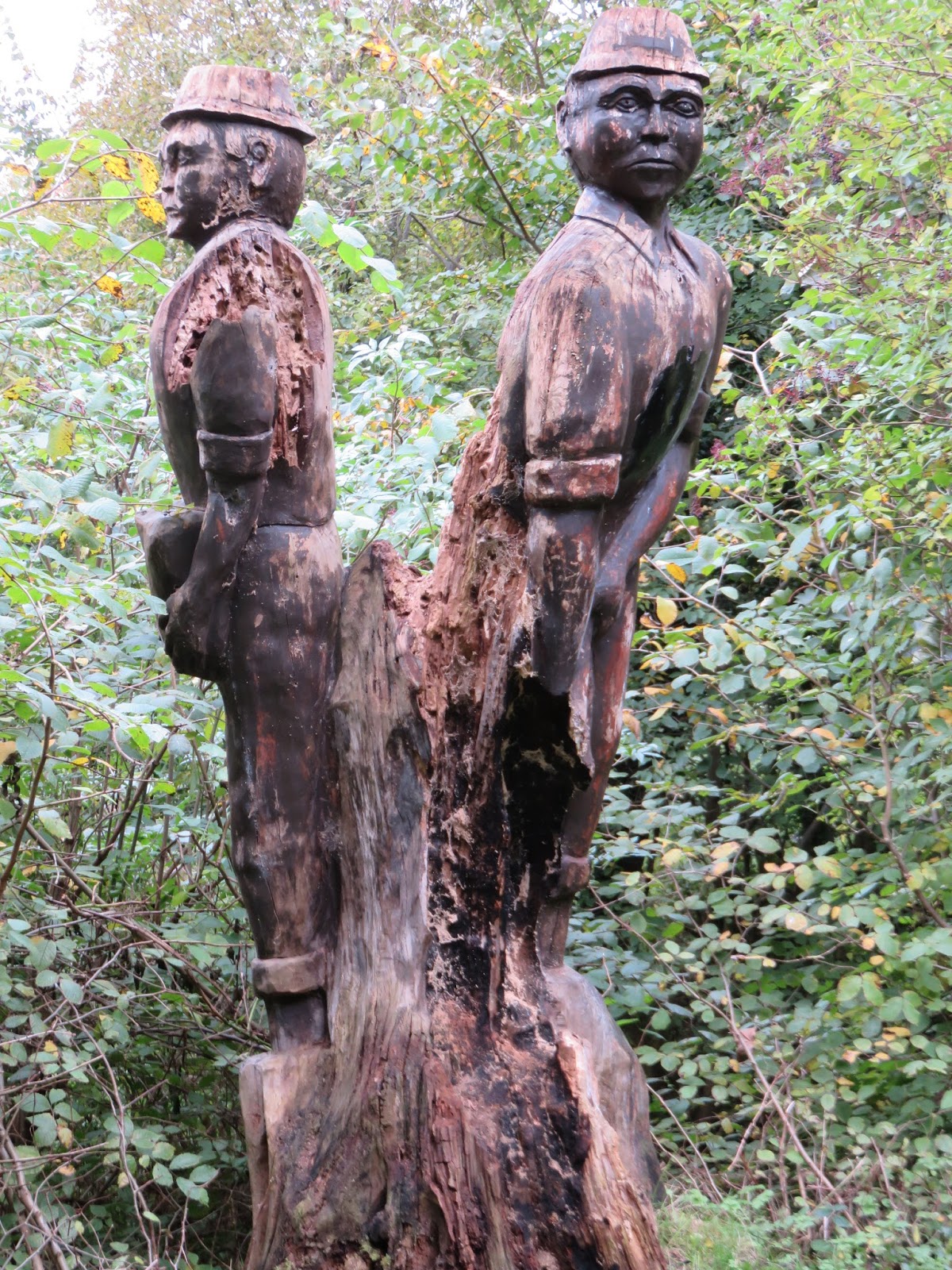
Not sure what this carving depicts, miners, canal labourers?