Showing posts with label Bridge of Orchy. Show all posts

Sunday, 20 July 2025

Top views but only after a long, long walk in.....Beinn Mhanach

Hill: Beinn Mhanach (Hill of the Monk)

Type: Munro

Height: 953m


Another stunning blue sky morning without a cloud in the sky, which in this part of the world, usually means cold and it was, very.

Another Plan B day, very high winds forecast so changed my plan. I had this down on my planner as a Bike/hike route due to the length of hard packed track that had to be walked. But I did not have my bike with me but too good an opportunity to miss.

I parked up at the scrape on the main road to Bridge of Orchy beside the entrance to the Auch estate and as I changed it was clear but chilly.

My target in the distance, mighty Beinn Dorain on the left

I walked down the private road to the Auch estate where in the morning light I could see my target. To be fair I could see quite a few Munros & Corbetts nearby but none of these were mine. Look carefully and that one way in the distance is where I am heading. 5 miles each way to the base of the hill and back, a long walk hence the original bike/hike plan.

Train crossing the viaduct Beinn Mhanach the right of the two hills

All the construction works at Auch look complete, a lot of dosh has been spent here. Farm buildings and modern housing. Reading later another foreign landowner.

Ruined cottage of Duncan Ban MacIntyre ahead. Beinn a' Chuirn on right

I entered Auch Glen and was immediately out of the sun mainly due to the great bulk of the Corbett Beinn a’ Chaisteil. The wind was blowing through the glen so jacket on as well, it would be an hour before the sun warmed me again.

The Allt Kinglass river is crossed 4 times and was higher than I expected. Pushing a heavy Emtb would probably have involved wet feet but would have been worth it.


Auch Glen is a nice glen hemmed in by big hills but it is kind of same old, just me and the sheep. As well as the view ahead which was not shabby.

Beinn an Dothaidh left centre & Beinn Achaladair right

On my hike in an estate vehicle drove past me, a lift might not have been turned down but it was not offered.

Left side of burn for me

Finally after just under two hours I reached the base of the hill beside the weir.

Now the hard work really begins. A direct ascent of 480m if you take it head on. There is no standard route up the hill and according to the reports that I read no path, a free for all up unrelenting steep grassy slopes. But that is not quite true, more of which later.

Looking at the map I had decided that I would ascend via the left hand side of the Allt a’ Chuirn burn all the way to the top. More the SMC route than Walkhighlands. This actually proved a good choice. Steep it was, huffing and puffing I was but looking at the slopes on the right hand side they looked steeper.

The going was pretty good mainly short grass and moss, not the tussocks I recall from climbing the Corbett across the way. But there was still a lot of huffing and puffing and short pauses.

Crossed the burn then headed up to the top

The only issue with my route was that it was forcing me away from the summit but I wanted to get to the top of the burn before heading for the hill. From this approach I could see that the Walkhighlands route is more direct and much steeper. I had also spotted a fence on the other side which I decided I would use for my descent.

Finally flattens off as cairn comes into view

Once I crossed the burn I had an easier walking gradient to the plateau and then onto the cairn. 1hour 35m, I don't think the direct route would have been much quicker but would have been undoubtedly harder.

Ben Nevis through the gap

Beinn a' Chreachain looking impressive

View South

View West

Although there was a haze the 360deg views were magnificent. It is mainly a stand alone hill albeit surrounded by its nearby cluster of Munros & Corbetts. But look beyond these and there is much to see, peaks everywhere including Ben Nevis, Ben Alder and much much more. Pictures do not do it justice. Although it was cool with a strong breeze it was not the 40mph forecast by the Met office this morning. A fine spot for view finding.

I headed off to find the broken fence which I followed back to the track. Yes it was more direct but also very steep. There is a faint path which was also very damp and slippery in patches. I met a couple coming up the fence path and also spotted 3 walkers on my right, just proving there is no one route.

Auch Glen flanked on left by the Corbetts Beinn nam Fuaran & Beinn a' Chaisteil. On right Beinn Dorain.

On the descent I was looking over to the Corbetts I climbed last year. The ascent, particularly of the 2nd one, on an extremely hot day, with clegs constantly buzzing around the knackered me, unforgettable.

Surprised at how much water was still flowing down the weir

Back to today’s hill and my right knee was very pleased when I reached the estate path at the weir, descending can be a touch painful these days.

All that was left was the long walk back to the car.

Compared to my inward walk it was now very warm in the glen. I had to use the burn to fill my water bottle, normally not an issue but there was a lot of green algy on the rocks which made me pause. But needs must as I was getting overheated, my tummy will tell me tomorrow if that was a wrong move.

After my knees being glad to meet the track it was the turn of my feet to be happy chappies getting to the car. Long hard packed trails and hard walking boots are not particularly compatible.

5 stags came out of the trees must be a hole in the fence

Overall the view was more than worth the effort, a good ramble under blue skies. A short hill walk but a long walk in and out.

Ascent: 831m

Distance: 20.8km

Wildlife: Woodpecker; Meadow Pipit; Buzzard; Red Deer; Raven; Wheatear; Chaffinch; Peewit;

Wednesday, 13 September 2023

Quite a viewpoint.....Meall Tairbh

Hill: Meall Tairbh (Hill of the bull)

Type: Fiona

Height: 665m

I had been unable to get out early in the week so was determined to take advantage of the one good weather day of the week available to me. An issue for me is that I am running out of new bagging hills within a comfortable day trip. Unless I visit my to-do, but I don't really want to do, list. Today was such a day. Last night was spent over maps and walk reports before I selected Meall Tairbh. There are a number of reasons why hills are on my ‘I don’t really want to do list’ and Meall Tairbh had nothing to do with the bull in its name but everything to do with the terrain. It has a reputation on its lower flanks, which is about half the walk, to have serious boggy sections. In my deliberations I reckoned that the mostly dry spring may have made it more doable.

I set off from home to time my arrival at the Green Welly with its restaurant opening and was spot on, normal unhealthy black pudding & fried egg roll scoffed with moans of appreciation, just as well it was quiet.

Inveroran Hotel and some WHW walkers
There was a lot of unexpected cloud around and indeed as I changed some drops of rain hit me. Rain gear taken out of the box in the boot and into the rucksack, hopefully not required. After my recent cleg onslaught in nearby hills I decided to wear long trousers today. A wise tactic, find out later.

For my ramble it really was a walk of two halves, a lower and upper section roughly of equal lengths. I was doing a straight up and down whereas another option is a circuit including Ben Inverveigh.


Passing clouds constantly changed landscape
The SMC book describes the bottom section as lush and boggy which in simple terms that's what it was. There is no one track for all on this hill. There was a mixture of very faint ATV tracks, along with deer trails but for the most part waddle through the long grass prodding sections very carefully as the bogs can be deep. Indeed the nearby Fiona has warnings of seriously dangerous bogs. I am sure some of these sections could be around here as well.

Still, got my big boy pants on I headed for the highest point following the best lines that I could work out. There was a strong breeze which was keeping the buzzing stuff away.

1st of the ramps, Ben Lui behind

Poor snap of Small Heath
After about an hour I came to the flatter section which was a constant tease. It is just over 2k but although it looks flat, it is a gradual rising ridge with about 250m of ascent before the top is reached. There are stony outcrops ahead on a regular basis that had the idiot in me constantly saying that's it, but of course it wasn't. I reckon there are about 5 of these long distance ramps. There are still sections of bog and peat hags so I was sticking to the highest ground when I could even if that was not the most direct.


Deer have a drinking hole
On the 2nd ramp I spotted 6 red deer hinds. The wind was in my favour but it was clear that they had spotted me but allowed me to get quite close before scampering. I reckon this lot are regular visitors at the Inveroran Hotel feeding slots and as such were less afraid of humans.

Lui range behind Orchy Corbetts

Fiona of Beinn Suide on left with Starav hills behind
The views from the top were really good, much better than I expected. There is a full 360deg panorama taking in the Orchy group, Lui group, some Etive hills, Black Mount and more.

Panorama from Etive hills left to Black Mount right

Black Mount range
Worth going over to the far rocks where the views open up into Glen Orchy. From here the descent and reascent to the ridge of Ben Inverleigh did not look too bad but without someone else to prod me on I did not have the motivation so a return by the same route.

Orchy Munros

Orchy & Tyndrum Corbetts
This was no hardship as I had great views of the Black Mount Munros, Loch Tulla and the Orchy Munros what's not to like.

Loch Tulla

Hotel now in view

On the descent I was able to better see the drier ground and even found a good deer trail which lasted longer than expected, of course heading to the hotel, just like me. I returned a bit closer to the tree plantation before finding another faint ATV track which took me back to the hotel. Coming off the main ridge the breeze disappeared and the buzzing stuff were back out to play and I was the only other person in the playground.

Drinker moth
On my way down I spotted a large yellow insect move in the grasses. Delighted to find it was a Drinker moth, female I think, my 1st ever sighting so a real bonus. I was also distracted on a regular basis by very loud vibrations in the grasses which were the large and noisy Golden ringed dragonflies.

Gold ringed dragonfly

One minor nip through my top but I reached the car unscathed. Changed into hot weather clothing, including shorts. Lifted my bag into the car and immediate pain at the back of my leg, you got it, a bloody cleg and it was a good tearing bite, it was very painful.

Apart from that it was a better than expected ramble. Drier terrain and excellent views, no more rain and no bull. Need to go back to that list again and reclassify a few of them.

Ascent: 529m

Distance: 9.9km

Time: 3.34

Wildlife: Golden ringed dragonfly; Meadow Pipit; Small Heath; Wheatear; Drinker moth; Chimney Sweep moth; Goldcrest; Blue tit; Coal tit; Redstart; Chaffinch;

Sunday, 3 April 2022

First Corbett and red deer of the year.....Beinn Mhic Mhonaid

Hill: Beinn Mhic Mhonaid (Mountain of the son of the moor)

Type: Corbett:

Height: 796m


A frosty morning with blue skies was an excellent start to the day. The Eas Urchaidh falls on the River Orchy were roaring spectacularly. This flood of water was also my concern would all the water crossings further up be possible to negotiate? Looking at the map I counted 5 but could be more.


First view

Ascent heading for the small tops
It is a very long walk in through the forest and in reality quite boring. There are some beautiful traditional trees but much more modern pine plantations. Occasionally there was a pleasant clearing giving some views, but alongside deer fences spoilt it a little. The wood seemed devoid of life, the occasional angry tit calling somewhere but really quiet, so weird. So it was a long plod taking just over an hour before the open countryside was reached. All burns crossed safely but the last one in the woods could be a significant obstacle if running higher.


From the shielings there is a faint track to follow for about a third of the ascent. There was a downside. Tracks attract water and at these temperatures the water had iced so I ended up walking through the tussocks preferable to constantly slipping.


About half way up I managed to lift my head and I spotted a red deer herd on the ridge, nice sight. Obviously they hadn't heard all the noises I was making as they stayed for some time.

Lui hills

Summit

Dalmally hills

Looking east to Rannoch moor Orchy hills on right

The ascent was really just a constant plod up the grassy slopes before the summit plateau was reached. Bitterly cold but superb 360 degree views. Well worth the effort. Which ever way I looked snow speckled Munro tops surrounded me. Dalmally hills. Black Mouth hills. Orchy hills. Lui hills and many many more.

Descent aiming for corner pines, the long ridge of the Graham Beinn Donachain behind


Back down the same way. Ben Lui looked majestically alpine as clouds came and went leaving more snow on its flanks. That would be a a dodgy descent today.


Beard lichen Usnea filipendula

Still despite the barren forest there was a few interesting trees and it was a worthwhile ramble on a lovely day.

Ascent: 846m

Distance: 14.5km

Time: 4.36

Wildlife: Red deer; Blue Tit; 


Monday, 27 December 2021

West Highland Way.....Bridge of Orchy - Inveroran

Walk: West Highland Way

Section: Bridge of Orchy - Inveroran

Ascent: 255m

The weather was still poor with the result that I had to abandon plan A as I could not ford the first river crossing without danger to life, aye mine. Plus, there were at least another two crossings further on. I suspected that water height would be a problem so plan B in operation. This was to complete the short section of the WHW I missed from a few weeks back. 

A straightforward walk with light rain at the start. The weather had eased slightly as I made the short climb through the woods but the wind was full on when I left the trees for the open moor.

At the high point the skies were more blue than grey giving superb views of the Black Mount hills as well as Loch Tulla.

I decided to stick with the road for a circular route. Some superb views of the Orchy hills as well as the swollen River Orchy taking the overflow from Loch Tulla rushing down the glen. Before long the weather changed and great rainbow shots.

A lot of weather crammed in to a short ramble, some great views and atmospheric snaps as well.

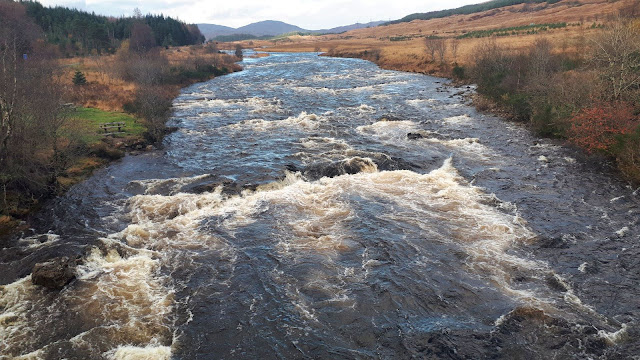
From Bridge of Orchy looking north. Fast flowing River Orchy middle section today. Ideal for paddlers but none seen.


Nice view into Coire an Dotaidh

No more trees, just rain for now

Looking east to Loch Tulla

Highest point a substantial cairn

Stob Ghabar

Blue sky = Blue water of Loch Tulla


At this point blue skies over Beinn Dorain & Beinn an Dotaidh

Ten minutes later grey skies looking to Beinn Odhar


Who doesn't like an old stone bridge?


And to end blue skies/grey skies = a fantastic rainbow, most vibrant I have seen for ages, the snap does not do it justice
Distance: 8.7km

Time: 2.11

Wildlife: Chaffinch; Meadow Pipit; Great Tit; Goldeneye; Hooded Crow