Sunday, 16 October 2022

A cold summers day for a Pubil Corbett double

Hill: Meall Buidhe (907m) (Yellow rounded hill) & Sron a’ Choire Chnapanaich (837m) (The nose of the knobbly corrie)

Type: Corbetts

A return to one of my favourite glens but is this summer I asked myself as I stood at the end of Glen Lyon with the wind howling, the clouds grey, smirry rain and it was cold.

Start from houses
The double Corbett circuit seemed less attractive at this moment. Nevertheless hardy souls we are and off we went doing an anti clockwise circuit following the Cicerone route and not WH or SMC, highly recommended apart from the longer lochside walk at the end.

Up through the Pubil estate following an estate track until we reached the small hydro dam, the coos were aplenty but they ran away, yipee. Avoiding the numerous large pats was harder than avoiding them.


We initially stayed lower down, heading across the moor, wet and boggy at times, small hags, typical upland moor before, cutting up to the ridge to find the iron fence poles. After that it was a straightforward walk to the 1st summit of Sron, under 2 hours good going. The number of frogs around today was unreal. 


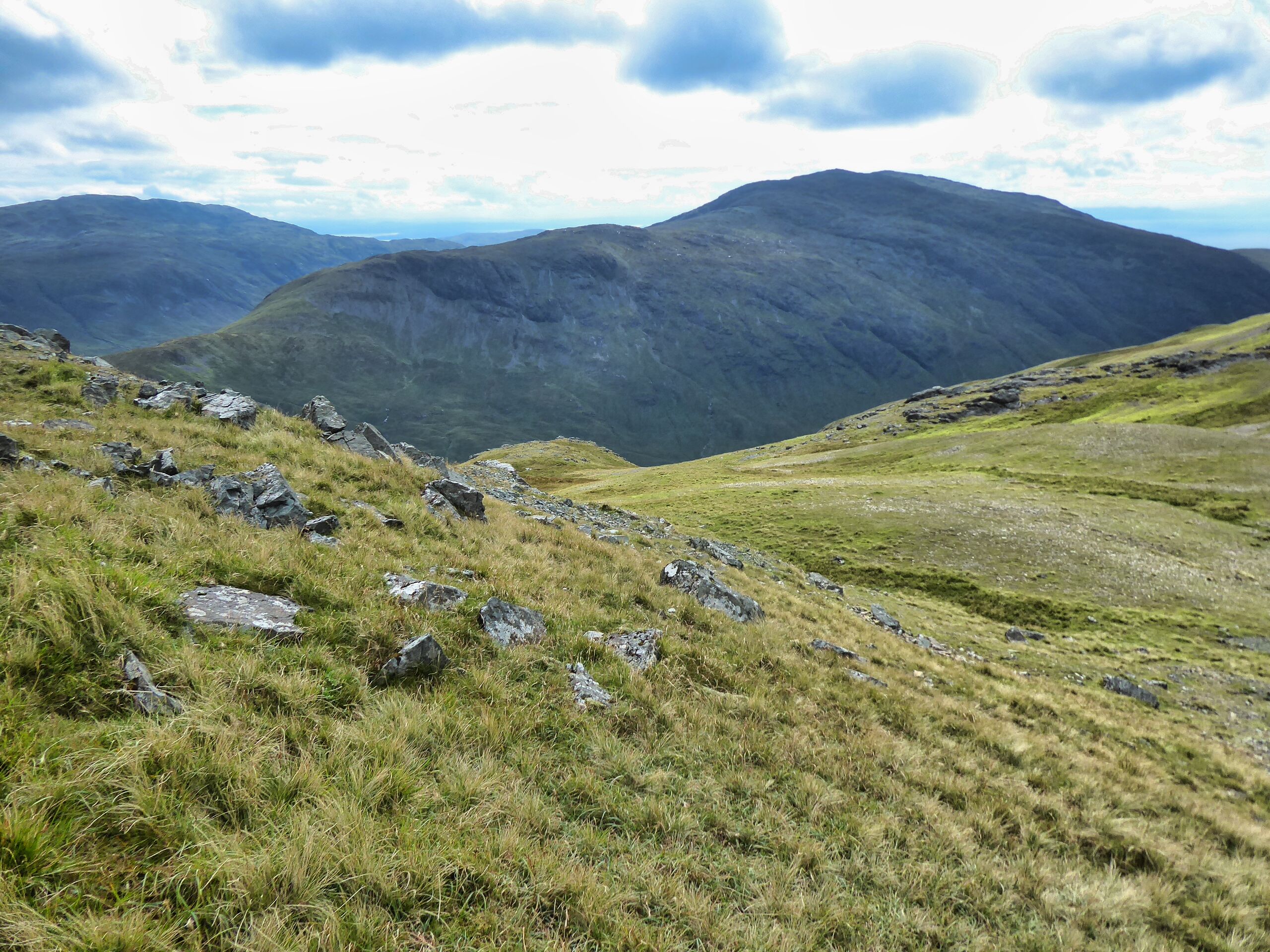
Good views down over the very low reservoir of Loch an Daimh. There is a big drop but you are not aware of it.

Heading for burn and then up to the bealach
The next section to the 2nd Corbett was to be the most awkward and as such the hardest. A steep descent to find the burn, peat hags to be avoided.

Then followed the burn upwards before peeling off to head for the ridge to find the next set of old fence posts. The contouring and rubbish terrain was hard work.

At the old posts there was a faint track, amazing how much easier the going is when the ground is flattened to a track, I was not complaining.

The next top is visible on our left but we are following the poles and taking a circular route before heading directly for the obvious cairn. Once again big is not always best as the true cairn is the smaller one further on. 

Summit plateau

Not the true top even though the cairn is miles bigger
It was pretty cold, almost freezing but the couple of Spaniards with us thought our weather was great compared to the oppressive summer heat they are used to. Surely there is a compromise to be found.

Our route now differs from the other routes as we headed due south down the steep grassy slopes. Stopping on same slopes for food and to enjoy great views over Loch Lyon and the impressive Coire Eoghannan, got to be some deer in there.

Found the required gate
Next a burn crossing before through the open gate in the deer fence. There is a very faint ATV track to follow through the newish plantation but beware there were a lot of hidden holes where trees had not been planted, care required.

Long walk back to the dam
Finally, we reached the loch and the long walk back to the cars with one steep climb to finish that I would rather not have had.

Overall, an excellent ramble in good company but some heat please.

Ascent: 1026m

Distance: 16.9

Time: 6.09

Wildlife: Common Frog; Small Heath Butterfly; Chimney Sweeper moth; Hare; Red Deer (hinds); Golden Eagle: Raven.


Wednesday, 12 October 2022

A Mull Graham the easy way.....Cruach Choireadail

 Hill: Cruach Choireadail (Corrie of the meadow)

Type: Graham

Height: 618m

Weather has been awful during this short family holiday, but I took advantage of a short morning to escape for a higher ramble.

This hill is normally done as a duo but no time for that today so an up and down ascent. As a single it is normally recommended as a very steep direct ascent for about an hour of pain. Not for me that level of exertion. I had driven past this before and noticed an ATV track that looked an opportunity. A look at the map and I could use this to get up to a high ridge and tackle the hill from there.

The ridge from the start but I am going the other way

From the road the boggy track can be seen climbing away from the target

There is parking for two cars maximum at the track to a mast in Glen More. I walked down past the mast and there was the ATV track on the right. It is not the best feeling to be walking away from your target at the start of the walk but that's what I did. The track meanders up the hill, very boggy at times, even becomes a parallel track at times but overall, a lot better than the deep grass and bracken alongside. That insect bite last month has taken its toll with not a lot of exercise since then. As such I was huffing and puffing away and felt decidedly not good early on but pleased that as I climbed, I was improving.

The ATV track does have off shoots, but I ignored them and continued all the way to the ridge.

Possible to cut across from here

Going that bit higher better walking

Small herd of red deer hinds in the distance
From here it was good walking along the ridge. It added more ascent and descent but worth it for the generally better underfoot conditions. There are excellent views of big hills all around, Mull has many steep beasts rising from sea level. Great views down glens back to numerous lochs.

Undulating ridge walk then the grassy scree climb up Cruachan Beag. I was surprised how good I was feeling long may it continue.


A last short drop and then the final ascent up to the top. An hour 34m so pleased by that. The easier long way around was not really that much longer and a lot less strenuous.

Ben More on right

Graham of Sgurr Dearg peak on the left

Raven comes for a scrounge

Rum Cuillins in distance

A disappointingly small cairn greeted me, but the views did not disappoint. It had been a grey day with the odd blue patch. The close view is dominated by another Graham, Ben Buie. Further afield Ben More with Loch na Kean shimmering light blue, very nice. In the distance the peaks of Skye, Rum and the Cruachan Argyll hills.

The wind was now gathering strength. A storm was due in the afternoon, but these winds heralded the early front.

Back along the ridge to the bulge in middle of snap

Ben Buie

I returned the same way once again enjoying the ridge before descending back via the ATV track looking at the impressive/imposing ascent ridge of Ben Buie. One for my next visit, maybe!!


Ascent: 614m

Distance: 8.7km

Time: 3.01

Wildlife: Meadow Pipit; Raven; Red deer.

Sunday, 9 October 2022

The Big Hill dwarfed by giants delivers.....Meall Mor Glencoe

 Hill: Meall Mor (Glencoe) (Big Hill)

Type: Graham

Height: 676m

View from visitor centre
There are so many times when I driven north through Glencoe and at the far end looked at this hill and thought the views should be good. Not just good they were great. How incongruous to call a hill 'Big Hill' when it is surrounded by giants. Our ancestors certainly had a sense of humour or just knew what they were talking about. 

Black trail

There are many ways to tackle the hill and/or depending on whether you are also including the other Graham of Sgorr a' Choise (it looks a spectacular hill which I have added to my to do list). There is an option to go directly up from the visitor centre but unless you are super fit, forget it.


Pap of Glencoe

Speckled Wood
Solo hit for me today so I parked at the Glencoe visitor centre watching hordes of tourists descend from their buses heading into the centre. This caused me to mentally debate whether I should pay the £4 parking fee when all these people were here for free. Being a good citizen I reluctantly paid up so under a dark cloud I headed for the appropriately named black forest trail which after a short ascent through woods becomes the blue trail. This is now a major highway, a wide stone forestry road (I presume) and in reality a bit of a zig zag trudge through the trees. Plenty of butterflies. On the lower section they were all Speckled Woods sunning themselves on the road. Higher up it became all Scotch Argus never staying still but numerous. The odd Large White appeared. 

I turned off forestry road here

Heading for corner of trees

I had noticed on the map a track which seemed to cut the road so I exited right onto a boggy, grassy, but evident track. It was now humid and the beasties were rising from the grasses en masse not a good idea. But some nice plants.

Marsh Grass of Parnassus
I re-joined the road but almost immediately left it by crossing over and heading for the corner of the trees not too far away. Mistake number two. The terrain was deforested and was a death trap. What should have been 5 minutes was a good uncomfortable 15 minutes. Every step had to be evaluated as plenty of hidden holes and boggy traps. The wood lying was now dried out and in danger of snapping plunging me down and potentially lacerating my leg. Was I glad to get over to find a boggy but open ATV track. If I had kept on the road for another couple of minutes!!

Found grass highway. Summit dark line top left

I followed the ATV track to a deer fence where the track became a faint line, god only knows where the ATV track had gone. It was steeply up the fence to reach a metal gate. The consolation was great views over Sgorr Dhearg which brought back memories and glad I wasn't doing that again.

Steep climb. Mast below with Grey Corries beyond

Sgorr a' Choise left and Sgorr Dearg right
Through the gate and now the faint track had disappeared. A steep never ending rough grassy slope was next. One of those angles you always thought you were getting there but seemingly never did. Finally a couple of large boulders was the plateau. Stunning views over Sgorr a' Choise looks a mightily impressive ridge. It was an immediate 'must do'.

A track!!

Top is on the ridge
The next section had a faint path but my eyes were not on it but instead on the huge mountains of Glencoe which filled my close vision.

A curve round to the ridge and the cairn and more very special views. The full 360 degrees did not disappoint.

Aoneach Eogach left and Bidean nam Bian

Dominated by Bidean nam Bian, that brought back good memories but also sad thoughts for the guy from Killie who died on it earlier this year. Across from it the Pap and the Aonach Eogach ridge in full profile.


Beyond the Pap the Grey Corries live up to their name but the top of The Ben is not unsurprisingly in cloud.


Another turn, looking back and over to Ardgour via the Ballachulish bridge and Loch Leven.

Finally back down to Loch Etive and the nearby hills. Yip quite a viewpoint.

Ardgour Corbetts in the distance

Green highway to the track this time

Stunning view for the walk out

Back down the same way, avoiding the deforested section, back to the car. Visited the café to find the tourist hordes had devoured all the home baking.

The hill was right in front of me so it was the long way round for my ramble but very glad I visited it, but that ridge on Sgorr looks worth an add on!!

Ascent: 726m

Distance: 13.2km

Time: 4.13

Wildlife: Chaffinch; Meadow Pipit; Speckled Wood; Scotch Argus; Large White; Gold Ringed Dragonfly; Common Blue Damselfly

A return to the moors.....Blaeloch Hill

Hill: Blaeloch Hill

Type: Sub2k

Height: 407m

After a bad week of weather and family stuff I needed fresh air so happily headed out with the Killie group today. It has been a long time since I have tramped these moors from this direction so that was fun. Another benefit was that the walk had a different finish from my previous trips so a slightly new route. Indeed I have now been on this top 3 times all by different routes.

Surprisingly we started in rain, this was not in the forecast. The usual walk up through the woods of Fairlie Glen, heavy drops of rain hitting my skull from the trees, not good hood up.

Thankfully weather brightened when we left the trees and stayed that way for the rest of the walk. Good views looking back. Not so good looking at the turbines where the Spanish & French are laughing all the way to the bank at our expense, quite shocking.

Asa we neared I missed the aircraft wreckage last time but spot on today, an amazing site considering this crashed in 1944.

A short walk but a good day out in good company.

Single file through the bracken

1st stop and look at the view


All these eyesores with no benefit to us


Firefly remains from 1944. Both crew perished.


Final viewpoint with Misty Hill the dark bit above the the walkers on the horizon


Ascent: 477m

Distance: 11.9km

Time: 4.44

Wildlife: Fox Moth caterpillar; Great Tit;