Hill:
Beinn a’ Choin (Hill of the Dog)
Type:
Corbett
Height:
770m
The
skies were a vivid blue when I left Barassie so I was driving with
optimism of a better forecast than Met Office readings predicted this
morning. En route I phoned my good lady who was in Edinburgh to be
told it was pouring, wish I hadn't lol. By the time I reached the
East Kilbride junction grey clouds were overhead and I could not see
the Campsies so optimism was downgraded a notch or six.
I
will describe this walk in two sections. The 1st section
is the lower half of the walk via my route and is the out and back
section from my start at the RSPB reserve at Garrison Farm to the
deer fence. The 2nd section is the out and back from the
deer fence to the summit. There are alternative routes for this hill
which eliminate this start.

 |
| The only good track I would see |
Grey
skies but dry as I headed along the track leading to the reserve.
When you get to the ruins it is suggested you start your hill climb
here. I did and I would not expect you to repeat this mistake. The
terrain between here and the deer fence is a tree plantation from a
few years ago. It is steep along with plenty of tussocks, heather,
loads of holes dug for trees but unfilled. Most holes hidden by the
long grasses. It is ankle rolling, slow, step by careful step and
seemed never-ending. So unless you are a masochist who enjoys this
extremely rough ground it is not for you. Although I can think of one
or two who might relish the challenge but they are not the norm.
 |
| Continue on track do not turn!! |
Instead
keep walking along the track for about 3 minutes where you will find
an ATV track. It is at times rough and boggy. It also at times leads
you away from where you want to be but stick with, it leads you all
the way to the gate in the deer fence.
 |
| Horrible walking |
 |
| I spot an ATV track |
It
took me about 30 minutes to get through the plantation and I had
thoughts of turning back a few times. I did meet the ATV track at one
point point but stupidly left it after a brief ascent as it it was
heading away from my direction. A mistake not repeated on the
descent, this old dog can learn a new trick.
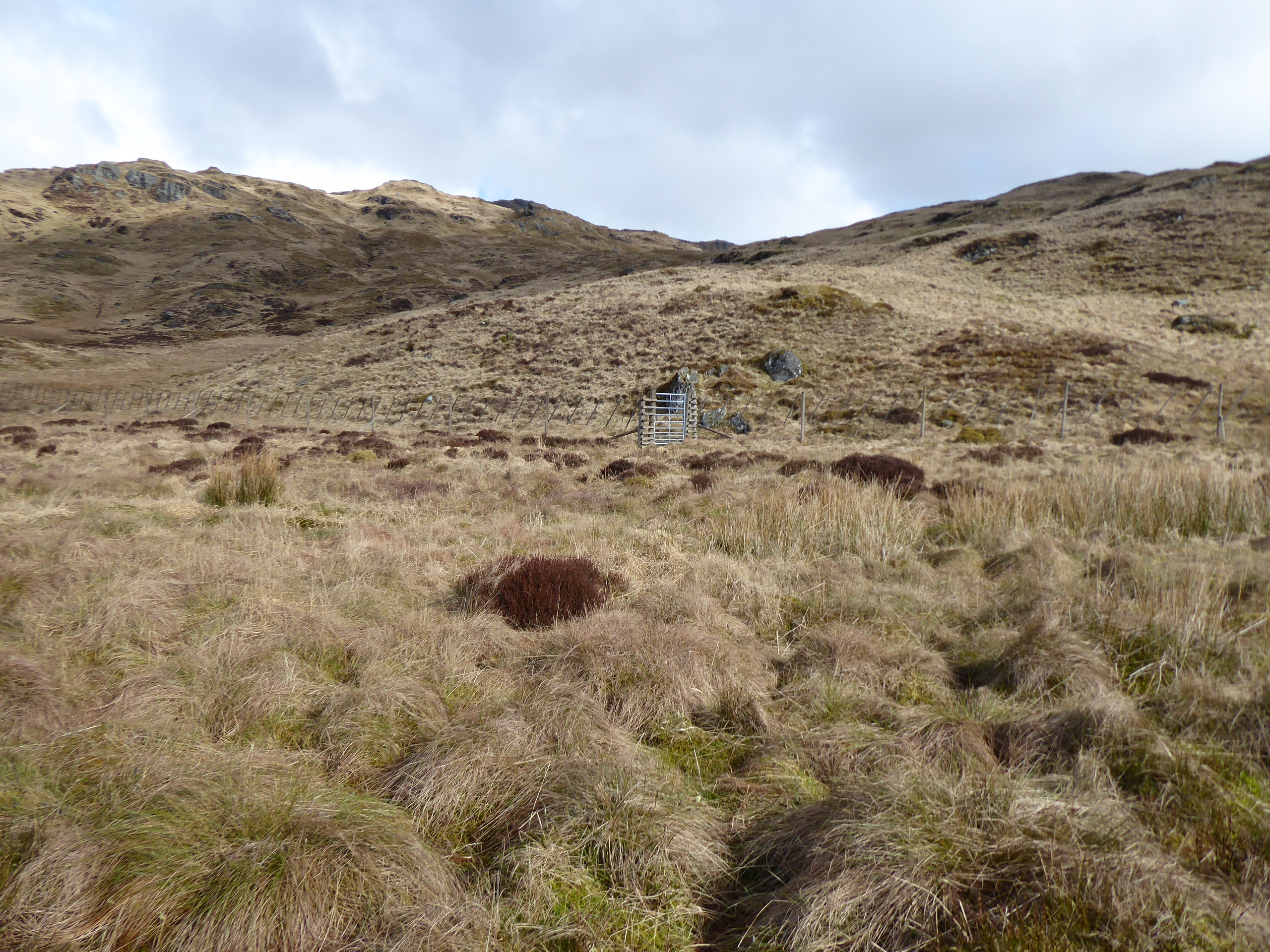
 |
| Finally found the gate in the deer fence |
From
the deer fence gate Walkhighlands takes a steeper route to the left
via some crags but looking at the map the gradient appeared a lot
easier by turning almost immediately right and following the obvious
burn (Allt Trosdain) up towards the Bealach a’ Mheim.
 |
| Now leave the burn and head for the flat area on right |
It does take you away from
the summit target but worth doing. I stayed on the right side of the
burn where some of the deeper gorges appear intimidating to cross but
the good news is if you stay on the right you don't have to cross it.
The bad news is that there are no tracks apart from animal ones which
routinely appear and disappear just as quickly. The going is better
than the plantation but still energy sapping.
 |
| Lots of crags to be wary of if descending this way |
When
I reached the Bealach it was now peat hag ground before the final
ascent. Pick whatever grassy rake between the crags that you fancy
and go for it. After the brutal start my legs were really feeling it
but kept telling myself not far to go now.
 |
| View from false top over Loch Katrine. Note clouds on left which was coming my way and quickly |
Finally
reached the point on my map that I thought was the top but of course
there is a slightly higher point across the way. From my poor eyesight there does not look much of a difference between them but one has a few stones and the other a big cairn so it must be right.
 |
| Was almost jogging to get to the actual cairn summit before cloud got me |
Followed
the old fence past the lochan and there was even a worn path at this bit.
Clouds had been gathering over to my right, the east, and the rain soon came hammering down. On the top, large cairn, but no hanging about as
I had decided to take a more direct route back and I was not ruining
camera or new phone so sorry no snap from here.
 |
| Rain easing. Through 1st line of crags but steep grassy rakes ahead, the deer have just disappeared. |
There are plenty of
potentially dangerous crags so it was a case of finding as much grass
as possible and taking detours to avoid them. Thankfully the rain
eased as I hit the peat hags where I spooked a small herd of 5 stags.
They were big beasts, no youngsters here and as soon as I appeared
they quickly disappeared.
 |
| Deer fence somewhere down there with Loch Lomond fore and Loch Long behind |
After
slowly picking my way down the steep and wet grassy rakes I reached
the deer fence. I was glad I did not ascend this way, much steeper
than my route.
As
said earlier no mistakes this time as I stuck to the ATV track all
the way down, so much easier.
A
good ramble but my legs were gubbed from all the early efforts and to
be fair I did not have a lot of hills in my legs. Typical rough
terrain as befits the Loch Lomond hills. At least the majority of it was in the dry with good visibility.
Ascent:
741m
Distance:
9.3km
Time:
4.29
Wildlife:
Red Deer stags; Meadow Pipits; Caterpillar


No comments:
Post a Comment