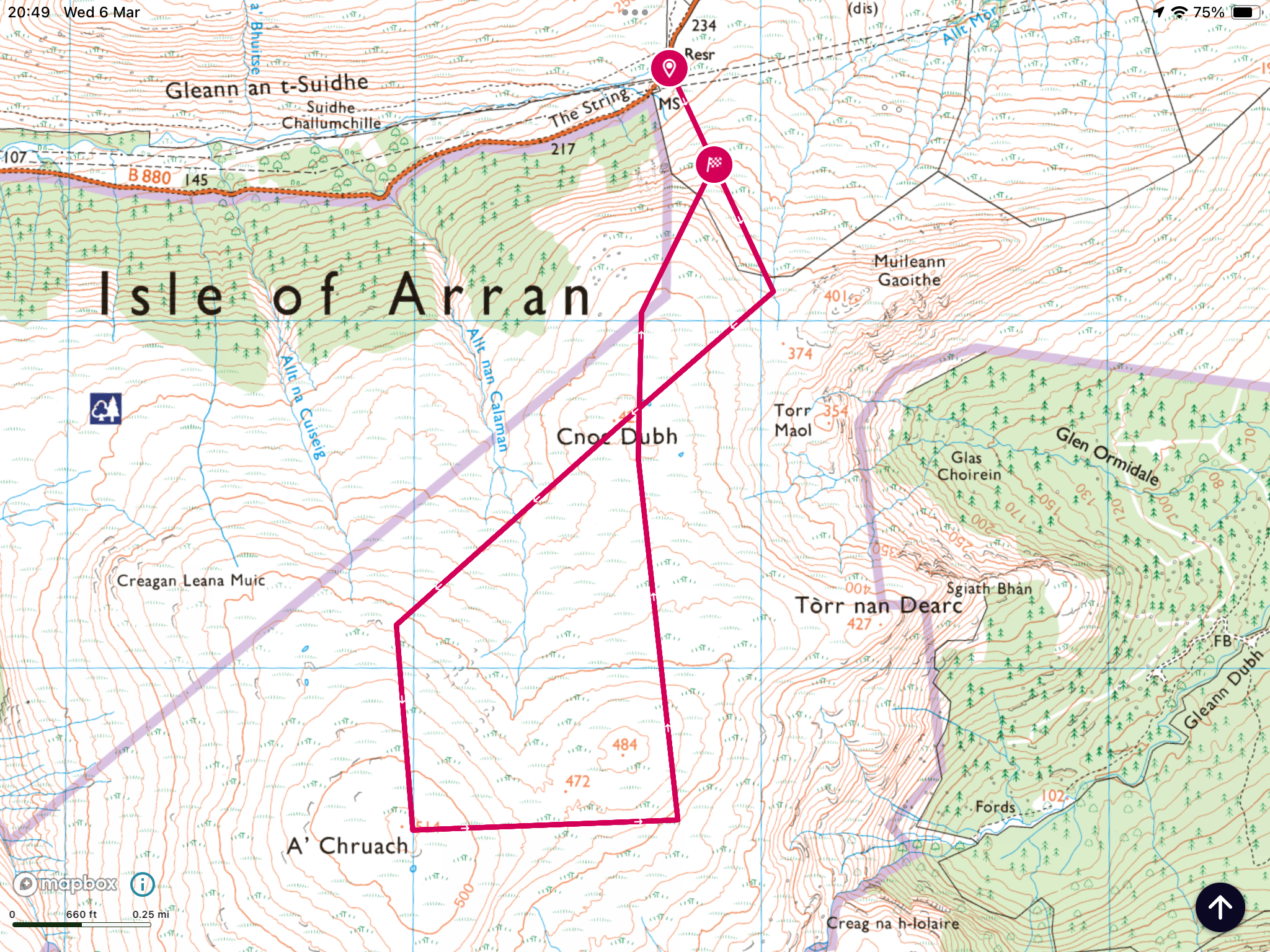
Hill: A’Chruach
Type: Sub2k
Height: 514m
When I woke up this morning I had no plan for the day. Opened the curtains and a nice morning. Checked the weather forecast, winds building but clear. Checked CalMac status, no issues showing. Decision made, a quick preparation and out the door heading for Arran. Luckily my rucksack is almost permanently ready to go.
A’Cruach was my second last Sub2k to do on Arran but I knew that it had a not so positive reputation. Only 64 people have ticked it off on Walkhighlands, that tells its own story. From whichever direction you approach it is said to be a totally pathless boggy moorland walk. Walkhighlands describes it as ‘ quite dreary by the standards of Arran’. But in its favour it is the highest point on the south of the island, as split by the String road, so it deserves to be bagged.
The terrain is not quite the best as I can testify to but possibly because of the time of year it was not as bad as I feared. In saying that it is not a hill to do with snow lying as the bogs and hags are many and deep and could be very dangerous terrain. It is also not a walk to do in high season as the bracken and deep heather, tussocks would make it very difficult.
Lastly, unless you are very sure of navigation it is not one to be done in poor visibility. It is a large featureless moor and although the top is a volcanic plug you would be hard pushed to imagine you are on one. Cruach means an upthrust of rock/stack, appropriate for a volcanic plug.
Now that all the warnings are out of the way here is the trip report as told mainly through the narration of the pictures.
To get to the walk start I got the bus to the top of the String Road, the driver was happy to let me tell him where I wanted dropped off, no formal bus stops up here.
 |
| It is behind the high lump centre right |
 |
| Starting point |
 |
| Headed for the low point but came back descending the heather |
 |
| Rough moorland to get to the high point |
 |
| Wooden narrow walkways required |
 |
| Summit looking over Glen Rosa |
 |
| Descent initially heading towards Holy Isle |
 |
| Hidden building |
 |
| Thats the descent |
 |
| Aiming for the white post, safe route for ATV's |
 |
| Zoomed into Glen Rosa |
 |
| Cairn appears much larger than summit one |
 |
| String Road below |
 |
| Lovely view from Brodick |
The downside of the walk at this time of the year was CalMac's fault. There is only one ferry operational which meant a long delay between finishing the hill and getting on a ferry, no buses this time. This meant a walk back down the road. Not a hardship as it was a nice day and on this section I saw my red deer munching away on the slopes and a solitary golden eagle coming from Glen Rosa direction, flying over me towards A’Chruach before gliding down the ridge and heading back to Glen Rosa.
Also the hanging about meant time for a visit to the Douglas Hotel whilst waiting for the ferry, such hardship.
Ascent: 319m
Distance: 6.3km
Time: 2.29
Wildlife: Red Deer; Golden Eagle; Buzzard; Kestrel; Grey Heron; Carrion Crow; Coal Tit; Goldfinch; Wren; Robin; Mallard; Chaffinch; Black Backed Gull;
No comments:
Post a Comment