Showing posts with label Donald bagging. Show all posts

Thursday, 27 March 2025

At last the end of my Donald journey.....Carrifran Gans

Hill: Carrifran Gans

Other Hills: White Coomb

Type: New Donald: Donald/Corbett


When I started out on my Donalds adventure I never envisaged that this would be my completion summit.

At the start of my journey the objective was based on the 89 blue ticks required for Walkhighlands completion but much as I admire and use this website they are not the decision makers for what is or is not required for Donald completion. That responsibility sits with the Scottish Mountaineering Council and in 2018 they made the decision that to be a Donald compleator the list was extended to include the New Donald/Donald tops taking the required number up to 141. So another journey began and today was to be the climax.

Once again I chose a route which took me over another previously climbed Donald to get to the final summit of Carrifran Gans. There are a couple of alternative routes but they appear to be either stupidly steep or through deforestation so I decided to stick with the tried and tested.


In fairness it is no hardship to start from the Grey Mares Tail waterfall car park, a stunning location at any time of the year.

The forecast was again for winter conditions, very cold winds, feel like -5 at best up top, but thankfully only a 5% chance of winter showers. Nevertheless fully layered and geared.
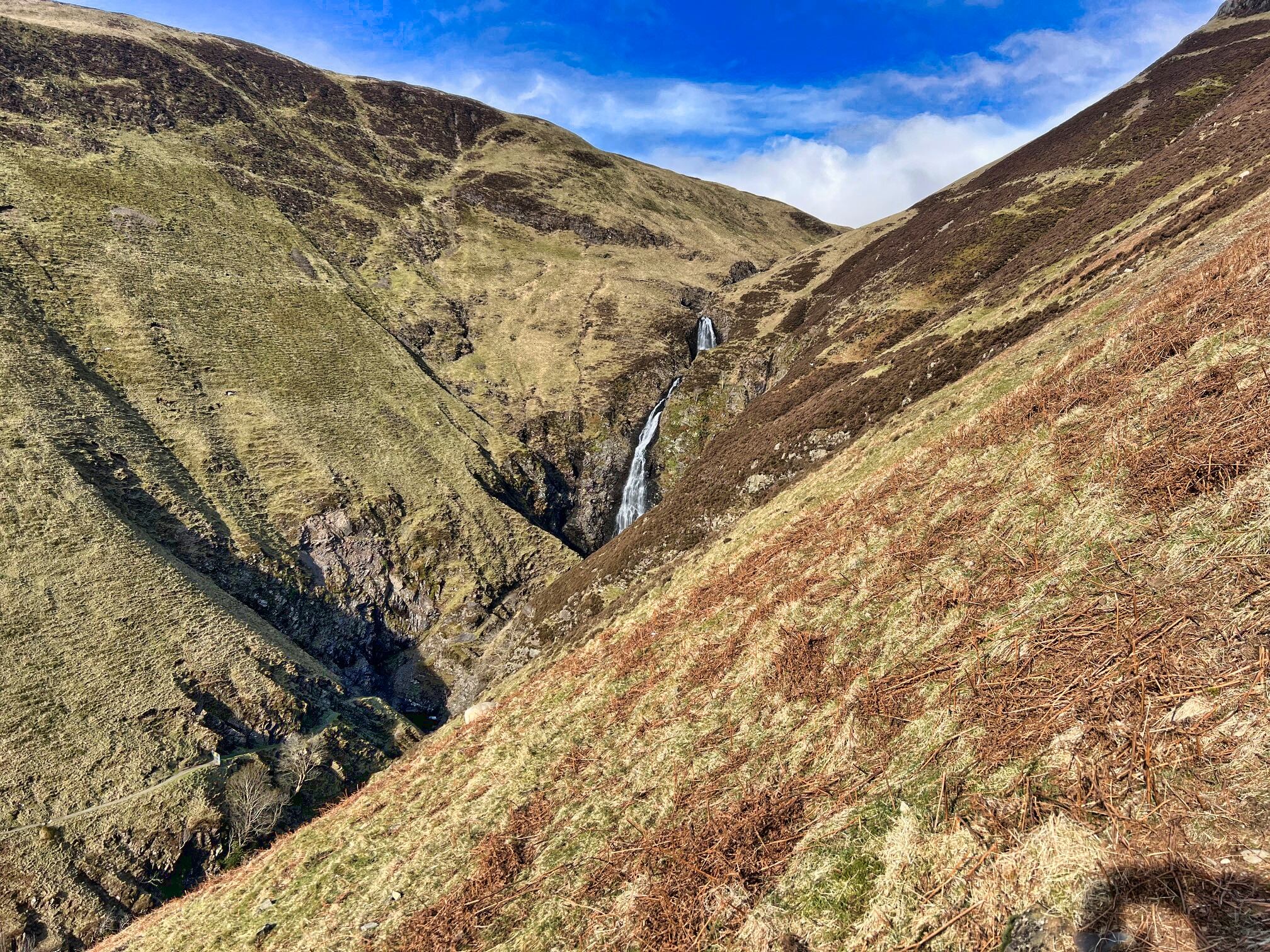

I was the only car at the parking area but to be fair it was early. The trek up the excellent stone staircase never gets any easier, I was well and truly huffing and puffing. But as I looked up a Golden Eagle was circling, could there be a better omen for my completion? Not as far as I was concerned.


My main worry about the route was getting across the Tail Burn without having to make it a much longer ramble. But once again the gods were with me and the burn was running low. It was still calf deep for a few steps but the water was running slower and shallower than previous visits so across without wet feet.

Carrifran Gans on the left as I go up White Coomb

Donald's Cleugh Head & Lochcraig Head

A straightforward walk ensued mainly following the ruined dyke all the way to the top with a few minor detours. I was still affected by a chestiness which meant frequent short breaks but I was not giving up today. All the ‘not far now/getting there’ mantras were in constant use.

The frozen temperatures meant that the boggy sections, and they were plentiful, had a crust of ice on them. So until my foot stood on them I had no idea whether it was solid going or sinking into the gloop. Mainly solid but I was glad I had put on gaiters for those sinking moments.
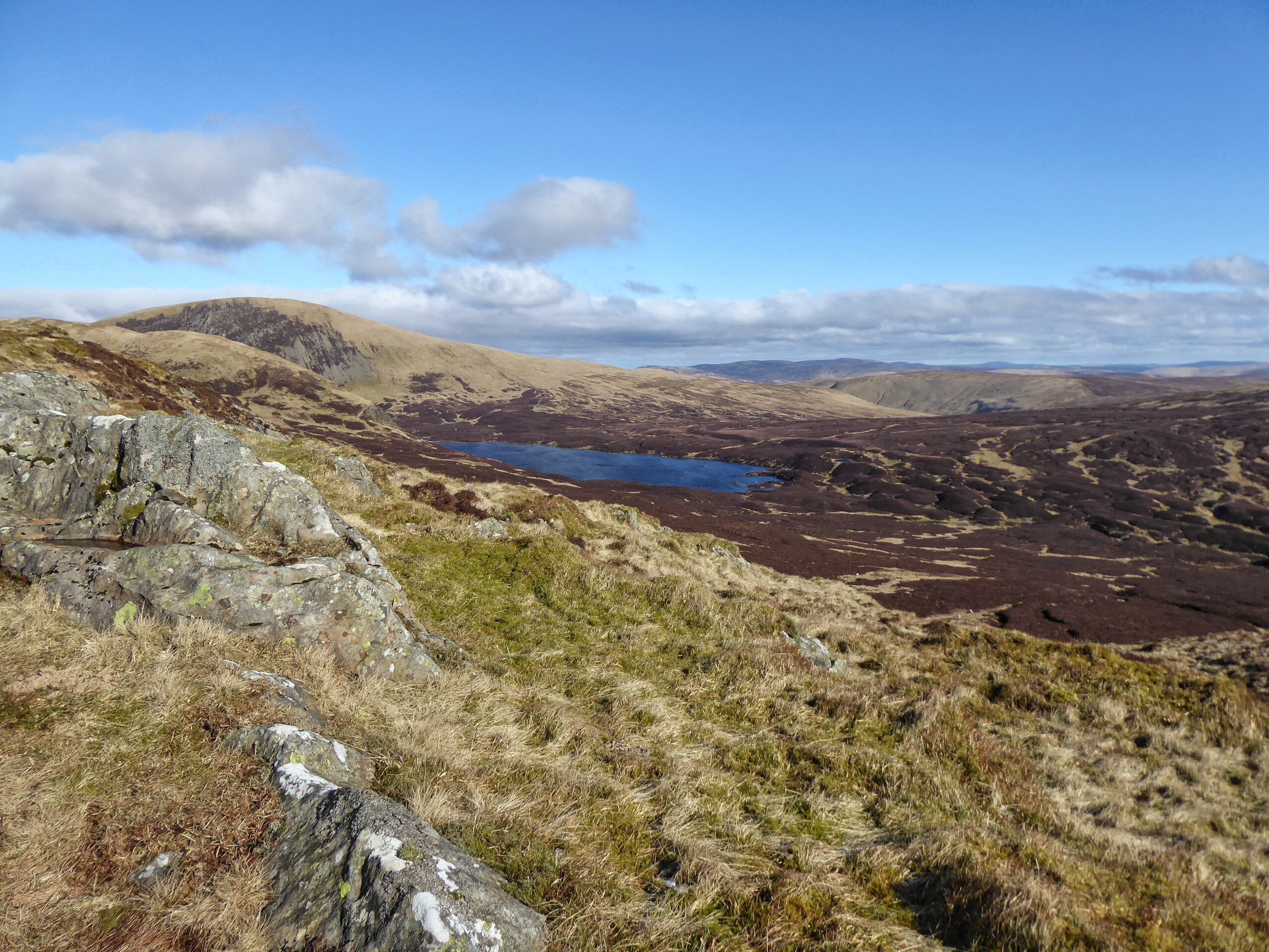
Lochcraig head & Loch Skene

Dusting of snow on White Coomb

Just before the staircase I had one of my frequent pauses for breath where a rather large raven landed on a rock just ahead of me. Some eyeballing took place as it sized me up whilst it wondered if I was to be breakfast, but thankfully not today.

Up the winding but icy staircase to find the wall again and then the final tramp to the top but of course there was at least 4 false summits to get me sighing and trying and dishearten me. But that wasn’t going to happen today.

View north from White Coomb

View over to Hart Fell

White Coomb summit was reached, tramping in light snow with excellent views apart from the wind turbines. I was shocked at just how many could be seen from here.

Some of the New Donalds are no more than a seemingly level tramp from the parent Donald but fitting for my last one there was a proper descent and re-ascent, it could even be a Donald in its own right.

Descent to Carrifran Gans

The views on the descent to Carrifran Gans were stunning with the huge craggy drops of Saddle Yoke and Hart Fell right in my face. When I looked further south the glacier ridges that created these Donalds are evident on the other side of the road Capel Fell etc.

View to Saddle Yoke & Hart Fell from Carrifran

The summit of Carrifran Gans actually has a few stones to mark the top, I was glad as I did not want an unmarked summit for my journeys end. Despite making many stops to get my breath I was surprised and delighted with my time so far, 2hours and 4minutes.

View back to White Coomb

Even though I was driving I regretted not bringing a small nip to mark the occasion so the alternative celebration was stuffing a small pork pie in my gob. I need Washed down with very cold water lol. At least it provided me with a needed energy boost. I took a few moments enjoying the superb views and reminiscing. The strong cold winds meant it would not be too long at the top.

ATV track all the way

All that was left was to repeat the outward journey back to the car. The time flew past with much reflection and memories of previous rambles on this adventure.

Start of descent follow the dyke

The ridge of Andrewhinney Hill just behind

After I crossed the burn I met the only other walker out today. We had a great chat. He was an ex Royal Marine, not too old, from the east end of Glasgow. At weekends he said he would take disadvantaged local kids to the hills and get them swimming in gorge pools as well as to meditate in cold water. He said he needed to do it not just for the kids but for his own mental health after some of the sights he had seen and probably been involved in. He was certainly not an old disillusioned guy, instead a positive talking early 40’s something. What a fitting and inspirational end to my journey this was. He was genuinely as happy at me fulfilling my journey as I was, humbling. I will forgive him being a Celtic fan as his cousin was the recent Hearts player Liam Boyce.

I had a superb day out and it was a fitting ramble to bring this particular adventure to its conclusion. These Border hills hold a lot of special memories for me.

Definitely time for a celebratory beer.

Ascent: 837m

Distance: 9.6km

Time: 3.59

Wildlife: Raven; Golden Eagle; Meadow Pipit;

Sunday, 23 March 2025

Taking the long way.....Clockmore

Hill: Clockmore (641m)

Other Hills: Cramalt Craig

Type: Donald Top; Donald


If taken in isolation Clockmore could be a short, straightforward but steep climb over mainly heather clad terrain. Probably an hour or so up and down.

Researching the route and looking at the map I worked out a longer circuit which had more appeal as I wanted to ramble for longer than an hour.

On the day the weather forecast was not the most promising, consistent strong winds blowing in from the north bringing with them rain and snow. Throw in feel like temperatures of -10deg up top it was definitely still the season for full winter gear.

As I geared up the wind was howling, the reservoirs waves looked good for wind surfing, wow, was this a mistake?


My ramble started from the Megget reservoir parking area and headed up the track beside Cramalt Farm following the Cramalt Burn.

Clockmore as viewed from the track at the start

It was a good track rising in the direction of Dollar Law, much more ascent than I needed today to bag Clockmore but hey ho be positive, it is building my walking strength.

I had been suffering from a heavy cold/Covid so there was a bit of huffing and puffing as well as some stops to take in the landscape and recover. The wind and rain showers were lighter than expected so it the going was easier than I expected.

Good track winding all the way to the high point

My chestiness was apparent and I was really blowing towards the high point of the track.

Turned now, looking back to Dollar Law

Looking down on the start/finish point at the trees

Track winding round to Cramalt Craig, Broad Law behind

Up top the main track changed to a grassy ATV track as it headed towards Dun Law where I now had decent views over to Broad Law. There was a short descent where I was hit by the heaviest storm shower of the day, hail not snow, short but intense and I was glad that I had completed the first half of the circuit so the battering was more from the side and behind.

Cramalt Craig looking back

Another snow shower just about to hit me

Broad Law

My goggles were steaming up (they shouldn’t!) as I climbed up to the highest point of the ramble, Cramalt Craig, almost a Corbett, once was until re measurement. As I climbed I recalled first doing Cramalt as part of a longer ramble in conjunction with Broad Law. That was a tough up and down and back again on a very warm day as I recall.


Pykestone Knowe ahead

Leaving Cramalt Craig it was rough high moorland crossing to Pykestone Knowe but still with a partial ATV track.

Finally Clockmore with the shaft of light hitting the reservoir

Looking down from Pykestone I could see that the worst of terrain was now ahead. I knew from my planning this was going to be rough going but it is always different when you see it for real, not a map. It also became worse going than I expected. Looking down I could see a lot of heather, tussocks and peat hags and no tracks but there was no choice but to go for it, this hill was my objective after all.

High point looking back to my route

It was certainly not very pleasant and quite hard going so it was with a lot of relief that I reached the summit of Clockmore. Not that it is recognised in any way but this was the top.

The worst is to come as I head back to Megget reservoir

The descent back to the farm was by far the worst going. Quite steep and surprised with heather that was waist deep at times. Step by step, pole prod by pole trod, as I had no idea what was underfoot, slow going but I got there.

A long way for a short cut as my granny used to say but despite the mixed weather and mixed terrain it was a good day out and one bagged top closer to my full Donald completion.

Ascent: 704m

Distance: 11.5km

Time: 3.35

Wildlife: Raven: Snipe: Redwing: Pheasant: Great Tit.

A recce that became the real ramble.....Deer Law Circuit

Hill: Deer Law & Conscleugh Head

Type: New Donald & Donald Top

Height: 629m & 624m


I had missed out on these two when I did Blackhouse Heights. However, I did not fancy another trip to Black Law first. When I was returning from Blackhouse I could see a new estate track running along the bottom of these hills but where did it come from? I drove down to the Megget Reservoir and beside a cottage there appeared to be the start of a track over the other side of a field. Time to explore.

The weather was grey and damp and there was fresh snow on the hills so I decided to do a recce to see where this track went to.

A very cold wind was blowing down from the Megget water so it was a quick change well clad.

It's a track is it the one I wanted?

I was going to knock at the cottage to check the route was okay but it appeared that nobody was at home. The gate to the field was a simple hook so no climbing required before I crossed the mole hill studded grass to the track.


The track seemed more substantially built than that required for sheep. Not wide enough for a windfarm, maybe some tree planting going to take place.

Deer Law now in sight

The track winds around Broomy Law following the Glengaber Burn and after about 15 minutes Deer Law is directly in view. Rough hill ground and plenty of sheep.

Start of ATV track

Straight on I could see the track ahead going between Deer Law and Black Rig. But on the right my eye was caught by the quad bike trail going up the easier gradients of Deer Law before continuing into the snowline then into the clouds. That looked a lot better than the unknown terrain, so recce abandoned, Decision made to do at least Deer Law so off I went and followed the hill track upwards.

Looking across to Greenside Law another Donald

Nice and steady, gently plodding on, I was surprised how well I was going. Good gradients maybe but it was still a steep climb. The quad bike track was obviously well used and had compacted the ground. Certainly easier than heather and tussocks. A bit tougher underfoot when I hit the snow line which deepened as I got higher. I was also into the clouds along brought poor visibility. The wind was gusting, short sharp snow showers. Really glad I had full winter gear on along with Ski Goggles, vital.

Lower stone pillar

Summit stone

Out of the gloom a tall pointed stone appeared which I knew this was what I was looking for. Problem was that although the ground had flattened out there was still a higher point behind it. So on I went until another pointed stone appeared, this time surely.

Conscleugh Head this way, track soon to disappear

I was relieved to discover this was also a quad track junction which would helped make my decision to bag the other hill. As I headed off towards Conscleugh I reflected. I am not sure that I would have continued across peat hagged boggy moorland in these conditions on my own, but with the track off I went.


This was all moorland up here and of course the track disappeared into the heather, what! The ground had started to rise so I continued and was happy to see through the gloom a fence on my right. That would do nicely.


The solitary Iron rod

I kept as close to the fence as I could until the ground flattened. I had no idea how the top was marked if at all. According to my GPS and OS Maps this was the high point at 624m. A bit further on I spotted a thin solitary iron rod on the other side of the fence. I was comfortable that I was on the high point flat area Of Conscleugh Law so that would do it for me.

Back that way

I had no intention of going across the moor in these conditions to make a circular route so it was a case of following my footsteps back to Deer Law and then back down the quad bike track.

Glimpse of reservoir plus the burn and the track back

About half way down I came out of the clouds and was able to enjoy the views. At the high point I could just see some of the Megget Reservoir. I also took some time to grab some food and drink, well deserved.

The number of these beautiful sheep pens indicate how many sheep there were on these hills

There were grouse, deer and hare tracks in the snow but apart from the sheep not a bird or animal was seen.

Cottage and my car

Still an unexpected bag of a pair of hills on what was just to be a recce. Still don't know where that track went to and somehow I doubt if I ever will, although could be an opportunity for the good lady to stretch her legs without doing the hills..

A wild day for a ramble but a good one nevertheless.


Ascent: 536m

Distance: 8.1km

Time: 2.37

Wildlife: None

Monday, 24 June 2024

A misty Donald Tops Circuit down Ettrick way

Hill: White Shank (DT); Smidhope Heights (DT); West Knowe (DT); Capel Fell (D); Loch Fell (D)

Type: Donald: Donald Tops


Another day to push and test my walking fitness but when I opened the curtains expecting a nice view it was a full on shade of grey.

My plan was to pick off the two Donald Tops associated with Capel Fell.

An interesting single track drive with minimal visibility praying that I would not meet anything coming my way, luckily I didn't.

Start of walk

I knew the route up to Capel Fell so the weather was not an issue just hoping it would clear. Looking at the snaps it is amazing how a modern lens makes everything so much brighter and clearer, not quite how my eyes saw it.

Phawhope Bothy


An hours trek from the car via Phawhope Bothy, utilising the Southern Upland Way, got me to the base of Capel Fell.

Fence to Capel Fell thought it would clear but not for a while

The mist was lifting with flashes of blue sky but the top was not in sight from here. Having been up Capel Fell before I knew it was a straightforward 20-25 minute grassy slog. I was following an ATV track and a fence so no difficulty. It took the 25 minutes!!

Right turn still following the fence to Smidhope Hill

On the top of Capel I was still in the mist and much colder it was, jacket on. I followed the fence as it made a right turn heading for Smidhope. This was new territory and I had not realised how much I had descended from Capel Fell until out of the gloom a steep ascent loomed into view. As we know mist and fog exaggerates everything.

Top of Smidhope

Despite my initial misgivings it actually was not too bad and beside me the fence had changed to an impressive dry stone dyke. However on reaching the top of Smidhope there was no marker to designate the summit, not unusual for Donalds.

Top of White Shank

On return mist cleared enough to look back to Smidhope

Onward in the gloom again, once more the dyke beside me reassured that I was still on track until I reached a high point and the cloud briefly lifted, there was nothing higher ahead. So final point reached and confirmed.

View from Smidhope to Capel

In terms of distance I had walked back almost level with the bothy and it would have been straightforward to make a circular walk out of it. But I wanted the longer exercise and made my way back to Capel and back down the hill.

Snap flattens out the climb had to go left then follow fence West Knowe high point on right

This was now my dilemma. I was feeling good but legs were tiring and I knew I had one other Donald top nearby. It was a question of do I return another day or do I put in a bigger shift today? As I descended from Capel the mist lifted and I could see across to West Knowe. Decision was made. I knew I would have to ascend via the Donald of Loch Fell first which was a bit of a pain and more effort but that is the price to be paid for not bagging West Knowe first time around.

West Knowe ahead on way back I cut across once over the peat hags

Whilst descending from Capel I spotted an ATV track across the way which I was able to ascend to the fence line which then took me to Loch Fell. After that it was a case of another right turn and followed the fence to West Knowe. It was no hardship as the views were excellent despite the cold wind.

Croft Head from West Knowe

Green Lowther radar ball high point in the back centre of snap

From the summit I enjoyed the scenery even spotting the golf ball on Green Lowther on the horizon. A small flock of birds suddenly appeared on the ground and the fence. At first I thought Chaffinch but no way up here until I looked closer through the zoom of the camera and they were Common Redpoll, never seen a group so high up before. I had read that there were good numbers being spotted in Scotland this winter so delighted with that.

En route I decided I would return cross country through the gorge. A bit of a descent and reascent but worth it as saved time and distance.

Into the forest for the tramp back to the car

Back to the SUW and then an hours trek back to the car. Not another person met or even spotted in the distance and on the moors next to no birdlife.

Ascent: 801m

Distance: 18.6km

Time: 5.08

Wildlife: Chaffinch; Blue Tit; Coal Tit; Meadow Pipit; Buzzard; Curlew (heard); Common Redpoll;