Showing posts with label Trossachs. Show all posts

Thursday, 6 October 2022

Very, very steep ascent and the flies!!!.....The Stob

 Hill: The Stob aka Meall na Frean, (The Stub)

Type: Graham

Height: 753m

For various reasons it has been a month without a hill so I knew my pick would bring pain to the leg muscles. I decided on a plan A and B, both near Balquidder but determined by parking. Plan A would be the toughest of the two and according to reports had only one parking space.

With some trepidation I made my way along the single track road alongside Loch Voil. The last time I used this road was a late autumn day where you could see oncoming traffic. Today with the heavy foliage growth I had umpteen close encounters, frantic reversing, stressful.

Finally I reached the start to find another car already there. There is easily room for 2 cars and maybe 3 but numpty had parked without any consideration. Thankfully after much manoeuvring I got parked, should have blocked it.

1st firebreak ahead
Looking at the map there seemed an early firebreak that I fancied but I had not read any reports of its use. When I reached the break it was a no go as the bracken was deep and long, probably ok at another season but not today. The Braes of Balquidder is a rough landscape.

Opening out

Turn here
So on I plodded up and down the track until I reached the big boulder that was my cue to head uphill.

Doesn't look too steep from this angle

But it sure does from this one
This firebreak was without deep bracken but was very steep. The day was very humid and half way up a swarm of flies surrounded my head and stayed with me for much of the walk which spoiled the ramble.

Height gained quickly as a shower blows through
Once clear of trees the ascent just keeps coming and coming. This is a trackless slog that really never gives up until the top is reached. So steep all you get is false optimism, the skyline you see is never ever the top, haha said my accompanying escort of flies. I was feeling quite good fitness wise but my motivation was struggling, a slog without views not a lot of fun.

Finally onto the open moor

Pimple in the middle is the top
Once past a broken fence it is undulating over peat hag moors until the insignificant top of The Stob is reached. Although windier the flies were determined to stay so it was brief food break. This really is a remote wild area, no tracks, just moorland.


Stob Binnein & Ben More tops in the cloud
There is an option to do a circular but for me it was back down the same way, it was a painful descent on the legs.

Common frog hiding

On the descent track can be seen back at the start

Chimney Sweeper moth with damaged wing
So glad to reach the track where only a few hardy flies continued to follow me. Just reached the car as the heavens opened, boots changed in the car.

Glad I did it but it will go into the ticked the box category and won’t be seeing you again. Numpty’s car has gone never got a glimpse of him/her. M&S Turkish delight bar will lift my spirits.

Ascent: 700m

Distance: 12.7km

Time: 3.59

Wildlife: Common Frog; Small Heath; Undertaker moth: Small White; Meadow Pipit; Great Tit; Red Squirrel;

Friday, 24 June 2022

Surprisingly snowy up top.....Beinn Stacath

Hill: Beinn Stacath

Type: Corbett

Height: 771m

The forecast was good for a ramble but the recent snow made the choice a little easier, opting for a grassy slope that did not have a long peat bog crossing.

As we drove towards the hill we were surprised at just how much snow was on Ben Ledi this could prove more interesting.

Snowy top peaking straight ahead
Managed to squeeze into the small parking area and off we went along the boggy right of way to Brig o'Turk. It would certainly be more straightforward to use the estate track on the other side but out of bounds.

Fully in sight
It does not take too long before the lower slopes are in view but still a few kilometres to go before we reach it.

We crossed the river and headed for the whaleback
Finally time to cross the river which was straightforward but on the other side at the farm buildings were a herd of cattle with calves. Some of the calves were pretty lively so a detour away from them towards the base of the climb.

Now all that remained was a long slow climb up the grassy slopes with many, many false promises. Still the gradient was kind. The views around us were improving as we climbed along with a significant drop in temperature thanks to a strong north wind. Although the weather was fine it was not the expected blue sky and sunshine.

Snow line in sight

Superb light
We reached the snow line but compared to Ben Ledi this was patchy soft snow. Slippy to walk on at times but not an issue. 

Summit ridge finally spotted

Still very cold up here
After we crossed the small patch of peat hags it was surprising to see the summit still quite a bit away. Although we were in no hurry it would be around 30 minutes more than I predicted to summit.

More ups and downs and then the flat top was reached beside the rotting iron fence posts.

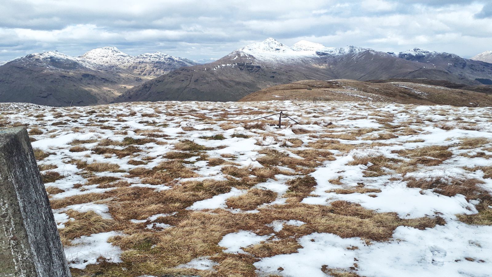
To be fair this top has pretty stunning views, far better than I expected. The Inverlochlarig tops dominated by Ben More. All the way down the ridge to Ben Lomond. Lawers Hills and all the nearby Trossachs stuff. On a day like this with snow topping most of them pretty dammed special.


Where's the Coos?
We descended on a more direct route but nearing the river we noticed the coos had moved to  now be in our way. So another version via the cow poo covered buildings. We had been spotted but they did not come our way. Using the humps to hide us we got back to our river crossing and then an uneventful trek back to the car.

Final stretch dominated by Beinn an t-Sidhein
A very pleasant relaxed ramble in fine surroundings, what's not to like.

Ascent: 705m

Distance: 13.5km

Time: 5.39

Wildlife: Meadow Pipit; Skylark; Raven; Common Lizard; Red Squirell,

Thursday, 24 June 2021

Third time lucky....Meall Buidhe.....Glen Ogle

Hill: Meall Buidhe, Glen Ogle ( Yellow Hill)

Type: Graham

Height: 719m

On my way to a planned trip I was looking for a quick up and down hill and decided to travel via Glen Ogle to tackle this hill at the 3rd attempt. On the previous two occasions I was intending to stop off on my way home but the weather was awful both times. Not a walk to bother about without the views unless you are a don't care less bagger and to be fair there are a few of them around. This time the forecast looked good for everywhere in Scotland apart from this section which was forecast for showers and yes they arrived. The annoying thing was that 10 miles down the road Tyndrum had no rain at all, that's showers for you.

Although this is categorised as a Graham the starting point is at the top of Glen Ogle thus giving a head start so an easy walk. 

Ferns here had grown to head height
At the start the track starts beside the car park and the ferns had grown much taller here than recent hills but luckily I was not wading through them. Food for thought for planning future walks.

There is an aerial mast about two thirds of the way up the hill so unless you are a masochist and want to go cross country the service road is the one to take. This zig zags its way up the hillside making progress even easier. 

1st view of the crags at the mast
Initially the track meanders through trees but then opens up to give you a view of the mast. 

Almost out of the plantation
Further on the track escapes the trees giving good views which become better as you ascend. The clouds were rolling over but no rain yet.

High point Meall Buidhe from the mast just pick a route
From the mast the cairn can be seen but the terrain in between is full on moorland, not D&G tussocks but not far off. The walking was awkward but not difficult. There was the occasional very deep hole to keep me wary but mainly it was heather and sphagnum bogs. 

Typical peat hag moor
After about a kilometre the ridge was reached and surprise, surprise on came the rain. I had swapped to my light rucksack and had put in a waterproof jacket but not the trousers, so wet shorts!!

The big cairn as a shower passes
Once on top there are two of cairns, oddly the smallest being the high point. 

Looking down Glen Ogle towards Lochearnhead
Slightly further west there is a more substantial cairn which would normally give good views down into Glen Ogle but for me atmospheric would be a better description as the clouds prevented downwards looking, still not bad.

It had been a short walk and I was feeling good so rather than return the same way I decided to head along the ridge to the north top of Beinn Leabhainn. Strongly recommended as even in these conditions the views are so much better and on a good day would be quite stunning.

The traverse is not all ridge, there is a descent into more very wet bog but thankfully short lived before heading up the ridge again, once on top the cairn is in sight. Fresh deer and grouse droppings around but no live ones spotted.

Killin with Lawers range behind

Loch Tay
As you head towards the cairn good views of the Lawers hills directly ahead and to the east Loch Tay opening out more and more. 

Looking West up Glen Dochart to Tyndrum
From the cairn the full vista also covers the Tyndrum hills and closer the Munros along Glen Dochart. Pretty dammed good but would be fabulous with the air clarity I had on Dun Rig.

Mast ahead
From here the top of the aerial can just be seen peaking over the horizon. Easy navigation and an easy descent albeit along more poor walking terrain but the aerial mast is soon reached.

Winding track back to the start
To finish just follow the track back to the car. A young couple passed me heading up, the only people seen on the hill all day. 

Back at the car the humidity had brought out the midgies and they were having a feast with me on the menu. I had midge spray in the main rucksack but I was getting so many bites that I abandoned trying to find it. Simply jumped into the car and drove away with the windows open hoping they would be blown out. Maybe some did but others lived to continue the feast.

An enjoyable walk and definitely a small hill to return to when the weather allows the views to be enjoyed in full.

Annoyingly when I got to my digs and checked the weather forecast for tomorrow it had changed and was very poor indeed. I had planned to kickstart my Munro count with a Dalmally double but the forecast was predicting heavy rain and very poor visibility by lunchtime, so a rethink required. Next blog will tell what happened.

Ascent: 474m

Distance: 9.1km

Time: 2.28

Wildlife: Chaffinch; Blue Tit; Meadow Pipit; Small Heath


Monday, 21 September 2020

Hopefully not in vain on Benvane

Hill: Benvane (White Hill)

Type: Corbett

Height: 821m

I had a choice of two Corbetts from the same start point but on arrival one route had a lot of cows well spread over my walking territory so no choice after all. Benvane has been on my to-do list for too long so it was time to visit and up my Corbett number. It is a good looking hill from the farm side a high point on the ridge from Ben Ledi to Glen Buckie.

The view of Benvane ridge from drive to the start
There are quite a few route options for Benvane but it will be no surprise that I opted for the straight forward ascent from Ballimore farm. Actually both hills had could start from here. I had delayed my start as the poor weather was forecast to improve by lunchtime. As I got prepared the rain came on so did the waterproofs. Low lying cloud made for an atmospheric start but hopefully that will disappear.

Not the best start but at least the cloud hides the gradient
I had not overly prepped the route beforehand so got a shock at how steep the initial stages were, huffing and puffing never a good way to start a walk, body too hot. 350m of sharp steep ascent, welcome to an easy Corbett!

After the recent horrible weather I expected this grassy route to be a very wet bog fest and I was not disappointed, very wet from start to finish.

There is not a lot too say about the initial stages other than it was a plod up steep grassy slopes mainly following a clear track which sometimes became an ATV track. At times it was lost but soon found again. The few times I looked up the cloud was still there.

After the initial steep section it became a rugged moorland walk which certainly could be very challenging in poor visibility. 

Looking to the Munros of Ben Vorlich, Chroin & the Corbett Each
There were good views on my left of Vorlich, Chroin and Each. At least the cloud is slowly lifting.

There are a some large peat hags which the WH description says can be easily avoided. Really, not in these conditions. Ankle deep sphagnum bog water patches at least cleaned the black peat mud from the boots.

Benvane my 1st view
After just under an hour finally there are views of the main hill. It looks further away and more daunting than it really was. 

Route to the summit now clear
A fence is met where I note there is a faint grassy track coming up, presumably from Glen Finglas. My track stays fairly close to the fence only moving away to avoid the hags.

I was glad to reach the summit where you are greeted by a smaller than expected cairn. 

Ben Ledi
Ben Ledi can be added to this walk, if transport has been sorted, and from here it looks to be much larger than the 50m actual height difference. Superb views down to Loch Lubnaig and the village of Strathyre. 

Looking north Lawers hills can just be seen through the haze
The spectacular views are enhanced by the low clouds still clinging to the lower layers of the lochs and glens.

Rugged terrain but the track is clear from here.
The descent lays out the rugged moorland terrain. Even in winter no big drop offs to worry about but potentially easy to get lost in low cloud.

Sheep enjoying the views
At this time of year the light quality is normally excellent so as I descended there were more excellent long distance views to take in including Ben Lomond; Arrochar Alps; Crianlarich Munros and the Lawers range, just super.

Heat brings up the clouds will I get lost?
About half way down the temperature rose sharply which brought the clouds rising from the floor level, more atmosphere and even though I was on the descent the humidity meant a lot more sweat.

Overall a good walk, it was an expected wet walk but the views were unexpectedly better. The timing was good, probably too fast at the start but that's a lesson I don't seem to learn.

Despite the midgies attacking me, changing was a long cleansing and drying affair, it was humid but the clouds were already reclaiming the hill tops. Looking at the forecast this day might be as good as it gets for a few days! Maybe no more walks for a while within my opportunities, sad.

Wildlife: Raven; Buzzard; Meadow Pipit; 

Ascent: 693m 

Distance: 9.3k 

Time: 3.12


Sunday, 26 January 2020

Muddy, boggy, wet that's Ben Venue from Ledard Farm

Hill: Ben Venue
Category: Graham
Height: 729m
I decided to break my journey home and join the group from Ayr & District for this walk. I had been to the top of Ben Venue before but not from this side so apart from a small section at the top to all intents a new hill for me.
Start
Walkhighlands describe this approach as very muddy and then boggy further up. It was not wrong as this has to be the longest wettest mud fest I have walked for some time.
Lumpy formations
This gloop started quickly through the wooded section which could be very pleasant under other conditions, interesting moss covered formations.
Leaving the woods
Out of the woods and we were soon on the cloud line. Thankfully we were able to cross the Ledard burn without difficulty. The fence is broken at the stile which led us to take the ankle deep gloop, the wet and slippy stile would have been better option.
Now the rain and wind joined in, nae views just a trek to the point the tracks merged.
After the junction there were other people around from the tourist route so we were not the only foolish ones out today.
Not much to see up here
The last section is fairly steep and rocky so care required as wet rock means very slippy conditions, only one minor accident. 
The flat sections in between were just awful wide expanses of deep mud, difficult to avoid at times.
Summit
Got to the top, nothing to see so did not hang around, time to get lower out of the wind and get some food.
Clouds lift briefly heading for the low point of the ridge
On the descent we took the same route. The clouds did lift for a short section and it was nice to see the views. It felt so weird, as if we were in the wrong spot, on the way up in the cloud you did not get the feel for the landscape. A nice bowl of a glen and the slopes of Beinn Bhreac.
Ledard burn safe to cross up and down
Still not for long, clouds back down low, rain back on so just plod through the mud back to the car. How I didn’t heel slip is one of the mysteries for today.
The walk was a lot longer than my Graham the other day and I was feeling a bit achy by the end. But a good outing with good chat as always.

Wildlife: Blue Tit; Long Tailed Tit; Blackbird; Greylag Geese; Hooded Crow; Pied Wagtail.
Time: 5.05
Ascent: 2590ft 
Distance: 6.92m