Friday, 26 May 2023

An lonely walk to an isolated Fiona.....Meall nan Eagan

Hill: Meall nan Eagan (Mountain of the notches)

Type: Fiona

Height: 658m

The forecast was pretty grim but the drive had not been too bad at all, although the cloud was very low covering most tops. There was the possibility of a weather window early afternoon and as I had my brekkie roll at the Snack Shack in Dalwhinnie it was at least dry outside.

Parked at the quarry entrance and walked the right of way to Laggan. I had read that the space could take 3-4 cars but sign says operational quarry including Saturdays so only room for one, road verge parking, maybe?

Track on left to The Fara

At this stage it is a hard packed road to the estate houses which are private and should be bypassed.


One of many

I could of went back up to a grass track behind the houses but there was another low level track alongside the burn. There are at least 4 fords where the ATV track criss crosses the burn. But for some reason all the footbridges have been moved onto the banking. They didn't look damaged and the ATV’s would not be using them so not sure why this has happened.

Nevertheless there is a faint track on this side of the burn although a rockfall meant I had to scramble upto the higher track. As I headed along the valley it was silent apart from the male Cuckoo calling constantly. Many meadow pipits and the odd Skylark. Delighted to see and hear a male stonechat on the other side of the burn.

Alongside the burn I came across this wooden frame. Uncertain of its function, maybe to hang deer and do some outside butchery?

Will be leaving the burn soon

I could see the target ahead and I decided I was going to head right and head up the more gradual ridge. The ground was wet marshland and heather. Plenty of that but never saw or heard a red grouse. As I neared the crags the ground was now wet peat hags, walking around not through these.

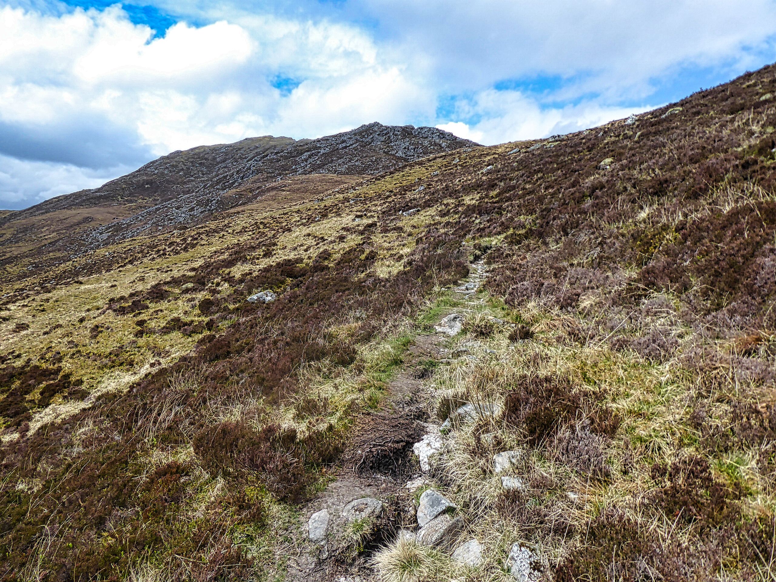
Finally the climb begins in earnest as I was well aware that I had not gained much height, if any, since the start. The ground was rough and at times steep but meandering on the grassy sections, good progress was made.

The next section was by far the steepest. I spotted an old fence line on my right and decided to follow it to the top. Maybe not the best idea as the ground was really rough, an ankle twist always a possibility.

View towards Laggan

View back to track for my return route

Then the final pull and a couple of iron boundary posts marked the top. Looking around all the big hills were under cloud so my attention was focused on the broader landscape. This is very rough terrain as far as the eye can see. Apart from the pylons only the deer stalkers and the odd walker will be out here, not a place to come to harm.

It was only on the descent I realised I had forgot to look for the local landmark, Dirc Mhor, a narrow passage through some cliffs, but I wasn't going back up again.

I opted to take a more direct descent route. Once I had gently zig zagged down the steep top section I could see the hags to miss and then found a grassy rake which took me back down to the valley floor. From up there I had spotted a faint ATV track so headed across the boggy ground to find it.

On my way I could smell death and not long after came across the remains of a red deer hind. It had been stripped almost to its bones so surprising how strong the smell was.

Found the ATV track and followed it back to the burn and the same route back. There seemed to be more than one cuckoo calling and the pipits were extremely agitated so I assume there was at least one female cuckoo nest invading.

Going through the final tree section birds were calling constantly and great to hear the willow warblers amongst the others.

A good ramble. Like most Fionas it is mainly pathless with some grotty terrain but that goes with the territory.

Ascent: 378m

Distance: 9.6km

Time: 2.54

Wildlife: Chaffinch; Siskin; Willow Warbler (heard); Meadow Pipit; Skylark; Common Lizard; Stonechat; Cuckoo;


Arran's wild west.....Sail Chalmadale

 Hill: Sail Chalmadale

Type: Sub2k

Height: 480m


Sail Chalmadale is small Arran hill that I had been meaning to get around to and an opportunity arose when I spotted it on the Arran Mountain Festival programme. This was way back in January and I had totally forgotten about it until it popped up as a calendar reminder the day before I was due to go on it. Wow, quick decision time.

Forecast looked good and the ferry was operational so yes a day trip was on.

On the quiet 7am ferry in good time for my brekkie roll and time to catch up on my sleep as we sailed.

As the group gathered my fears about the ability of a couple of the group to maintain the required pace were rising. More about that as this ramble evolves.

The walk is a rough but fine route on the west of Arran starting at Catacol and finishing at Dougrie, ascending Sail Chamadale en route.

Start of walk 'eagle crags' on left but none spotted

Beinn Tarsuinn (the smaller one) directly ahead
The walk begins by heading up Glen Catacol which I recognised as the final section of my 3 Glens walk. The water on the Abhainn Mor was very low but crystal clear, I would drink out of that if required. Sand Martins flew in and out of an eroded sandy riverbank and a lone sand piper called and flew away near by. Not long before the Cuckoos began calling, we reckoned 2 on our right and at least one on the left. And superbly a female on our left started calling and we then spotted a pair flying, great start. Although the walk started with many heavy grey clouds it improved and we had no rain.

The track at this point is narrow, alternatively boggy and stony.

Heading up the glen Ben Bhreac slopes on left

Example of track with enclosure ahead

Uniquie Arran Whitebeam tree
At a ford the left turn becomes Gleann Diomhan but we crossed the burn and continued south up Glen Catacol, starting to be hemmed in on our right by the flanks of Beinn Bhreac. There are a few fenced off plantations presumably protecting the rare to Arran Whitebeam tree. These are restricted to the northern part of the island and are numbered in their hundreds.

Waterslide

The track was now rising and the broad waterfall bringing down the Allt nan Calman was a spectacular rolling slab of stone. A cairn is reached at point 336m and here the terrain changes. The walk leaders had been concerned about the slow pace of the group, the most concern being me getting back for the last ferry. The slower ones were offered the opportunity to go back at this point with a guide but nope they wanted to continue. The guides knew I was capable so offered me the option of going solo, something I said I might take up later.

Enter the bog of Loch Tanna


From L-R Castail Abhail, Cir Mhor, A Chrois, Beinn Tarsuinn & Beinn Nuis

Cnoc Breac on left Sail Chalmadale top on right
We were now walking on the west side of Loch Tanna, a really remote spot but scenic on a day like this, not much chance of meeting anyone else out here. It was really wet, I suppose it never dries out. So much so we were heading higher to get better walking which for the most part was good.

However one of the tail enders slipped on the muddy slopes and was well covered in gloop. Not hurt and I was not alone in having a smirk but then it took another 15 minutes before they could get going again.

Now I was getting more concerned. The pick up was for 5pm but at our rate of progress the group were going to need to put that back, problem at this stage, no phone signal, oh dear. The views over the eastern hills were fantastic as the light kept changing with passing clouds.

Chalmadale from Cnoc
Down into peat hag terrain then up the boulder strewn nose of Cnoc Breac. By this time the stragglers were well behind and the guide was just as concerned as I was and luckily we got a signal. Decision made I was going solo to try and meet the pick up at 5 where they would wait 15 minutes or it had to be a pick up with the main group, no pressure then. It was now 3.30.

A short descent and reascent and I was on top of Sail Chalmadale. A quick look round then along the ridge knowing there were crags on the nose so decision time when I reached them about which flank to take. A rugged little mountain but as always with a stand alone hill superb views.

View from cairn on Sail

Loch Sail in snap along with track to Dougarie
Standing at the top I could see Loch Sail Chalmadale where I knew and atv track would be picked up. It looked a long way down.

I decided to turn right/west, down the steep grassy rakes, adjusting my route as required.

With relief I was down but the terrain between me and the loch might have been flattish but it was the worst of the walking. Tussocks abounded but they were islands in marshy terrain so the going was slower than I wanted. Further relief when I found the atv track but it was so slippery that it was easier walking to the sides. Still pace picked up.

Looking back from Sail loch to Sail hill
I could now see the Iorsa Water and its hard packed track which would lead me to Dougarie. The bracken here was the highest I have seen this year, will soon be obscuring the track. Another ford to cross, no stepping stones, this could be interesting with higher water levels. 

Looking back along Iorsa Water
Just the river section left which was scenic, maybe just my relief at being off the hill.

The land owner has put in a separate track in for walkers to keep them away from his house but it is still a decent track.

At 4.40 I reached the water and 10 minutes later my transport arrived. So good that I even made the relief catamaran rather than the last boat. On the ferry I got a text from the guide, around 6.40 pm, saying that was them at the parking area. Getting to the last ferry would have been extremely tight so I made the right call.

As a ramble I thoroughly recommend it if you want to see Arran from a different perspective and want the feeling of real isolation. Naismith rule suggested 4 hours 30 and 6 hours would be more than ample. I have finally learned my lesson re group walking with strangers lol.

Ascent: 552m

Distance: 15.5km

Time: 6.45

Wildlife: Stonechat; Cuckoo; Sand piper; Golden plover; Sand Martin; Meadow Pipit; Skylark; Raven,
Monday, 22 May 2023

An OAP's very long walk to..... Meall Dubh

Hill: Meall Dubh (Black Hill)

Type: Corbett

Height: 788m


This hill and its route were specifically chosen to make the most of an opportunity and also to kill some time so no regrets about its length or tediousness at times.

This Corbett is the highest point between Glen Garry and Glen Moriston and does contain a large wind farm, the tops of a couple of these can be seen from the road.

This was another hill on my ebike list but today I only had my normal MTB and I wasn't fit enough or motivated to do a long constant pull up a wind farm track.

Start, Dubh cannot be seen from here

You can follow the Walkhighlands route which goes over a lot of rough and boggy terrain. Or you can just walk up the track to the end of the turbines and go cross country from there. That was my choice. There are two windfarm entrances I opted for the easterly one.

At least the birds were singing

Other entrance meets up here

The initial section through the trees was actually quite pleasant with the sound of early morning birdsong all around.


Think the workies set this stone in place

Looking at the route the track goes a long way eastwards away from the hill before coming back on itself. On the way up this was not an issue as this was new territory full of new sights. Not quite the same on the descent.

The weather forecast was poor but I stayed dry all the way up to the beginning of the turbines around 500m.

About to enter the clouds

At about 600m I entered the clouds and stayed in the gloom for about 2 hours of the walk. It seemed a long way from the first to the last turbines particularly when the view is severely restricted.

Turbine number 1 looms out of the gloom

Indeed by the time I reached turbine number 1 it was drizzly, windy and cold. It was weird hearing these massive blades turning above my head but not actually seeing the turbine bodies until just feet away.

Golden Plover

At one point I could hear some birds calling very loudly. It was a pair of Golden Plovers and they were so close until I got my camera out.

Off onto the rough stuff which actually wasn't too bad, a lot of dry grass and moss.

I knew about the old fence structure for guidance and quickly found an isolated iron post which further on became more numerous. Spotting the odd individual ones was more difficult.

Falsie

Grey lumps would suddenly appear, was this it? Of course not. I came across the false cairn mentioned in a report. He said the real top was a few minutes walking, more like 15.

Dropped into a peat bog area, up the other side and then the top appeared in the murk.

Big cairn on right

I went left of the outcrop and found a track leading to the top cairn, at least triple the size of false one the track continued to the rock that Walkhighlands claims is the real summit but not mentioned in SMC Corbetts book. However the rain was horizontal so no snaps, along with the wind trying to blow me off my feet so an immediate about turn and retraced my route back to turbine 1.

Anyway another top with nae views.

Cold but not cold enough for this

Heading for the trees and long walk out

The descent was by the same route but felt twice as long. The cloud had lowered to around the 400m level which did not help. Neither did the stronger wind and the constant drizzle. If I had had this on the ascent I might have turned back. Lots of Wheatear around, the 1st I have seen this year. Of course the walk was accompanied by calling Cuckoos, I have heard so many over the last two weeks.

So a long walk to bag another Corbett. At least it was an easy ascent gradient, no huffing and puffing. As said I knew it would be a bit of a trudge at times but minimal mud on the boots. No doubt the ebike would have knocked off at least a couple of hours but as said time was not a factor today.

Ascent: 749m

Distance: 24.2km

Time: 5.14

Wildlife: Red Grouse; Wheatear; Mallard; Cuckoo (heard); Meadow Pipit; Skylark; Carrion Crow; Red deer (hind); Golden Plover; Robin (heard); Siskin (heard); Willow Warbler; Chaffinch; Great Tit; Coal Tit (heard); Song Thrush;

All praise the stalkers path.....Sgor an Airgid

Hill: Sgurr an Airgid (Silver peak)

Type: Corbett

Height: 841m


A last minute change of plan which for once was a good idea. I had originally intended to do this tomorrow but the forecast for then was for rain and low cloud, nae views. Today was an unexpected bright day with the rain not due until later so change made.

As this Corbett rises from sea level it was going to be a full on walk.

You could go straight up from the start, if mad

Due to the change of hill, sorry forgot to say I was at 1st choice before changing my mind, the car park was almost full but I squeezed in.

Don't fall off the narrow track!

Initially nice green zig zag path

A positive about this ascent is that it uses a stalkers path for about 80% of its ascent. Whatever your views on deer culling I guarantee that you will use the track rather than go full frontal directly up the hill on rough ground.

Heading to the top of the gouge


Path got rougher

It is steep but has many zig zags so the ascent is done at a good gradient and a reasonable walking pace. Surprisingly I wasn't blowing too badly. The path is stony at times, definitely narrow in places but it feels right. The constant calling of Cuckoos and the views over the nearby Munros keep ones interest. I only had on a base layer but the heat was unfamiliar and I was sweating away.

The stalkers tracks only negative is that it mainly took me away from the summit leaving a longish walk once I reached the plateau. A huge gouge in the hill looked far away and is getting increasingly closer but thankfully that gorge does not have to be crossed.

The steep ascent is right of middle

A small cairn on the moor/plateau gives a good view of the final steep section. There appears to be a track going steeply up to the right, surely not, surely yes as I found out.

The wind was blowing strongly and pretty cold as I crossed the moor so jacket on. I was climbing the steep section when I noticed a figure coming down towards me. I had expected to see descenders sooner bearing in mind how full the car park was. Brief chat where he said there was only one other person behind him. The car park must be for Munro baggers as well.

The final climb was good to start with but my legs were beginning to run out of steam on the final third. A Ptarmigan called nearby but unless it moved there was no chance of spotting it. Its grey/white colour scheme was an immaculate match with the rocks.

Lots of rocky tops to explore, where is the summit?

Got to the top and had a look along the ridge. Yip quite a bit away were a few lumps but the furthest away, of course, looked like a sizable beehive cairn.

View to Skye

Torridon jagged hills

Kintail Munros

So on I plodded, descending and reascending via rocky, grassy ground until I reached it and yes that was it. Excellent views but the disappointment was that it was too far back to have a proper look down at Loch Duich below. How many tops can you see? Rather a lot actually. Loch Duich can be seen heading out to the Atlantic. Skye looks monochrome, rather like the forecast for the OIR groups few days on the Isle.

Closer to hand the eastern view much better. The Five Sisters so close. The Saddle and the Forcan ridge holding small amounts of snow. The Affric-Kintail trail heading up Glen Croe looks worth a visit. There was a huge black cloud heading in from the west which seemed to be pushing the strengthening cold wind so not exploring the other tops.

Heading to rocky high point to descend on the left

Descent line just above the crack

Back down the same way and although I have to descend more carefully than once did the views are terrific. It is only on the descent that I realised how much climbing there had been.

Sgurr a Choire Ghairb on right

Beautiful view to the start and Loch Duich

About half way down back into the heat and sweating again. Cuckoos are calling everywhere how many are there? Views are still spectacular.

At the end the short tree section is full of birdsong and butterflies, a lovely way to finish the ramble.

Ascent: 932m

Distance: 10.7km

Time: 4.02

Wildlife: Meadow Pipit; Tree Pipit; Lesser Redpoll (heard); Skylark; Wren; Blackbird; Robin; Long Tailed Tit (heard); Orange Tip (m); Speckled Wood; Ptarmign (heard); Cuckoo (heard)